Showing posts with label Lake Mead National Recreation Area. Show all posts

Tuesday

Ireteba Peaks Wilderness Area - 04/16/2019 Trip Notes

{Click on any image to view full size, then use the back button on your browser to return to this page}
This page last updated on 04/20/2019
(Fig. 01) 
(Fig. 02)
04/16/2019 Trip Notes: Even though today's weather predicted rain, it turned out pretty good. We spent about 4 hours driving along Rockefeller Road on our way to the Rockefeller Mine (Fig. 02). We made a few stops along the way for some scenic picture taking and exploration of some old abandoned mines. This entire area has the most jumping cholla cacti you have ever encountered. There are literally tens of thousands of these plants. Jumping Cholla (Cylindropuntia fulgida) The view in (Fig. 01) is of Copper Mountain. A little further along we spotted a large cave (Fig.03) on the side of a mountain side and decided to stop and climb up to it. As we climbed up this rough, rocky, jagged hillside, there were hundreds of small wildflowers and cactus. Howard Saxon, in (Fig. 04), and I hung behind the rest of the group taking our time as we tried to get pictures of the many small wildflowers and cacti we found along the way (Fig. 05). Eventually the rest of the group reached the cave. Jim was the first one to reach it and took this picture looking out and back down the hill and the road we traveled to get there (Fig. 07). After the three of them all entered the cave they ended up confronting the following. (Notes Continued below)

(Fig. 03)
(Fig. 04)
(Fig. 05)
(Fig. 06)
(Fig. 07)
Notes Continued: They found a large snake. It was a California Snake that was up on a ledge that finally came out and slithered its way to the ground (Fig. 08). For additional pictures and info about this snake click here ... California Kingsnake (Lampropeltis getula californiae). Bob Croke also captured this picture of a colorful Blister beetle (Fig. 09). Click here for more info ... Master Blister Beetle (Lytta magister). Climbing up the hill we came across a couple of caterpillars (Fig. 10). Click here for more pictures and information ...White Lined Sphinx Moth Catepiller. The view in (Fig. 11) was taken about halfway up the hillside looking north toward the Ireteba Wilderness Area. From here we continued driving up the road toward the Rockefeller Mine stopping at various mines along the way (Figs. 13 thru 18). Eventually we came to a barricade in the road and had to turn back. After this trip we drove to Boulder City and had lunch at a barbecue restaurant before turning home.

(Fig. 08) picture by Jim Herring
(Fig. 09)
(Fig. 10)
(Fig. 11)
(Fig. 12)
(Fig. 13) 

(Fig. 14) 
(Fig. 15)

(Fig. 16)
(Fig. 17)
(Fig. 18)

___________________________________________________

Note: Every attempt is made to provide accurate information, but occasionally depictions are inaccurate by error of mapping, navigation or cataloging. The information on this site is provided without any warranty, express or implied, and is for informational and historical purposes only.

Go Back to the previous page ... (Ireteba Peaks Wilderness Area - Summary Page). 

Kingman Wash Road & Mine

{Click on any image to view full size, then use the back button on your browser to return to this page}
This page last updated on 02/06/2020
(Fig. 01)
Directions: This road is located in Lake Mead National Recreation Area, about 40 minutes southeast of Las Vegas. From town, drive out towards Hoover Dam, then continue south on Hwy 93 into Arizona for about 2 miles to Exit 2, Kingman Wash Road. Exit the highway, turn left and drive under the highway. Kingman Wash Road starts on the east side of the interchange.

Description of AreaKingman Wash Road, National Park Service (NPS Road 70) is a maintained backcountry road off Highway 93 south of Hoover Dam in Arizona. The road runs for about 3.6 miles over hills and down washes through the wild backcountry of Lake Mead National Recreation Area to the colorful Paint Pots area at the shore of Lake Mead. Many people use the small cove to launch small boats, picnic and camp in the surrounding area.

(Fig. 02)


01/29/2020 Trip Notes: Today Jim Herring, Bob Croke,Ron Ziance and I went back to this area to find and drive Fortification Hill Road. Click here for a description of this trip and pictures ... Fortification Hill Road.

03/23/2019 Trip Notes: Today Jim Herring and I decided to go looking for some wildflowers. A site I looked at said that there were some off Kingman Wash Road in Arizona. There is also a unknown mine in the area, so we headed there. The elevation at the TH (Trail Head) at exit 2 off I-93 is around 1,340 feet. The entire length of this road to the lake's edge is only about 3.2 miles. The relatively maintained dirt road from here runs uphill about 300 feet till it reaches the intersection of South Mine Road (NPS-70A) at about .9 miles out. Driving this road runs roughly a mile atop a winding up and down ridgeline for about 1.2 miles till it comes to the intersection of the North Mine Road (NPS-70B) on the map in (Fig. 02). The elevation at the intersection is 2,168 feet. Looking north provides a great view of Lake Mead and the Paint Pots area (Fig. 01). Looking back, somewhat southwest you can see the dirt road (Fig. 03) you just traveled getting here and in the distance and the bridges you cross over just south of the dam. From the intersection, the less maintained dirt road runs ahead due east for about a mile to the mine itself (Fig. 05). This quite rough road ends at an elevation of 2,431 feet, for a total climb from the TH of nearly 1,100 feet. I would not attempt this portion of the road without a 4WD vehicle (Fig. 06). The end looked so rough we actually parked and hiked the last several hundred feet. When you reach the top you see some old water tanks on the left (Fig. 07) that had some piping that lead down to the mine site sitting above a large wash just below. In front of the two openings here had debris scattered about (Figs. 08, 09 & 10). We hiked down the wash for a several hundred feet and found the remains of yet another digging, Even though we didn't hike to the top of it, There were two steel rails sticking out over the edge of the overage pile (Figs. 11 & 12). (Notes continued below)

(Fig. 03)
(Fig. 04)
(Fig. 05)
(Fig. 06)
(Fig .07)

(Fig. 08) Click to Enlarge
(Fig. 09) Click to Enlarge
(Fig. 10) Click to Enlarge

(Fig. 11) Click to Enlarge
(Fig. 12) Click to Enlarge
(Fig. 13) Click to Enlarge

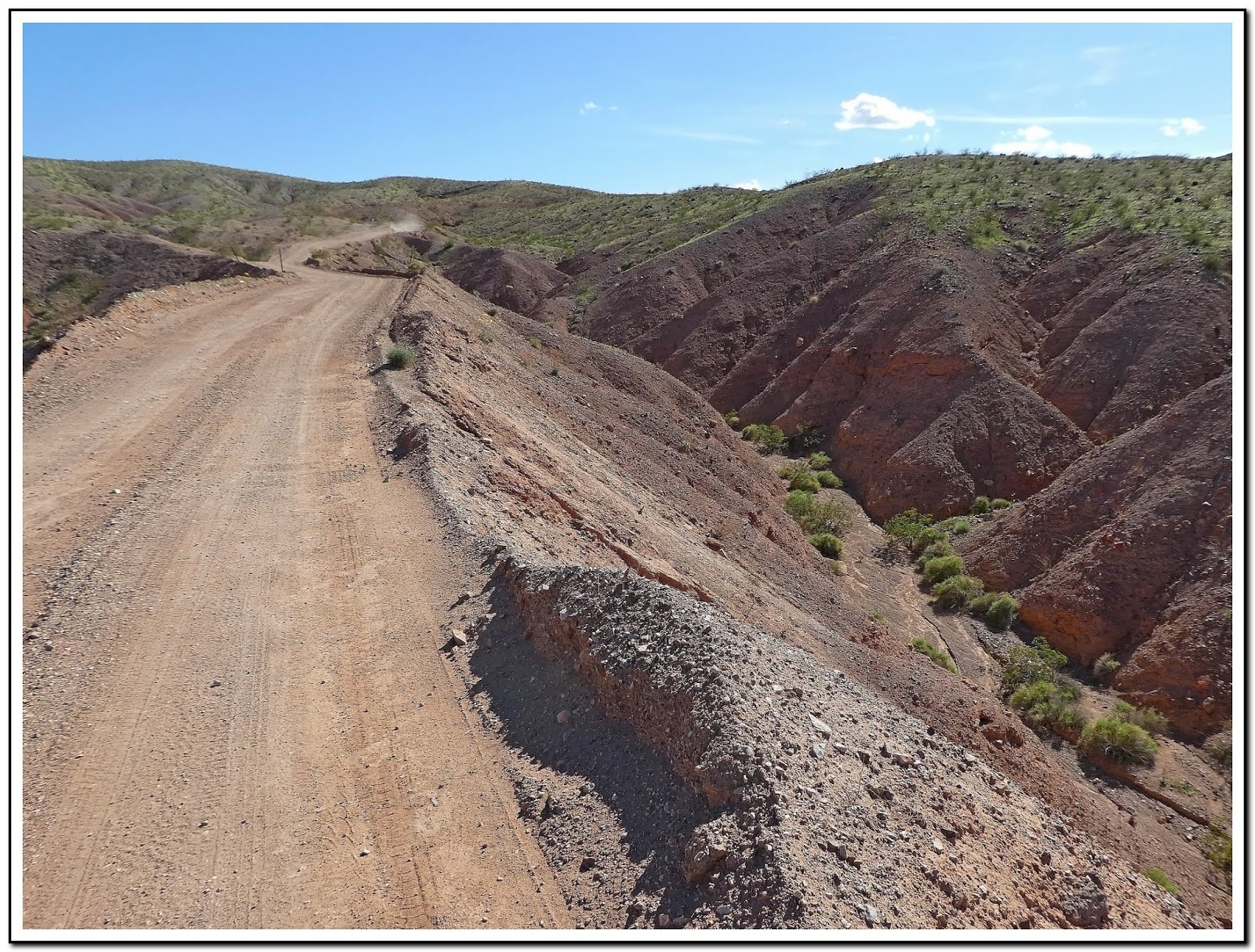
Trip Notes Continued: After hiking back to the jeep (Fig. 13), we then backtracked to the intersection. It was then 1.16 miles still on the top of a another ridge back to the main road. Driving this ridge felt like you were riding along the great wall of China. From there it was another 1.7 miles to the shoreline of Lake Mead. As we drove along the main road down to the Paint Pots Cove, the road has deep washes on both sides of the road (Fig. 14). Near the end of the road you got some great views of the Paint Pots areas (Figs. 15 & 16). The large flat butte behind the colorful Paint Pots is Fortification Hill. At the very end of the road is the small cove and beach line of Lake Mead (Fig. 17). The picture in (Fig. 18) shows "bath tub ring" around Lake Mead. From this vantage point where we were parked, and the land below us, would have been under water years ago. (Figs. 19 thru 24) are pictures of several wildflowers that we spotted along the side of the road on our way down to the lake. Taking our time, stopping for pictures of wildflowers, scenic views and hiking around the mine site made for a pleasurable afternoon. On the return home we stopped in Boulder City at the Southwest Diner, one of our favorite restaurants for dinner.

Side Note - Paint Pots: Thirteen million years ago, the crust around the Lake Mead area was stretched and thinned so iron and magnesium-rich magma and basalt, poured out of the ground and covered the landscape. The darker lava produced many of the black volcanic flow-capped mesas, such as Fortification Hill and Callville Mesa, seen in many parts of Lake Mead National Recreation Area. Mineral-rich fluids trapped in older rock were mobilized when hot magma was injected into them. These hot, hydrothermal fluids percolated up through some of the igneous rock formations, including the Paint Pots pluton at the base of Fortification Hill, imparting their beautiful coloration!
Definition - pluton: A pluton (pronounced "PLOO-tonn") is a deep-seated intrusion of igneous rock, a body that made its way into pre-existing rocks in a melted form (magma) several kilometers underground in the Earth's crust and then solidified. At that depth, the magma cooled and crystallized very slowly, allowing the mineral grains to grow large and tightly interlocked — typical of plutonic rocks. Shallower intrusions may be called subvolcanic or hypabyssal intrusions. There are a slew of partial synonyms based on a pluton's size and shape, including batholith, diapir, intrusion, laccolith, and stock.
 

(Fig. 14)

(Fig.15)
(Fig. 16)
(Fig. 17)
(Fig. 18)


(Fig. 19) Click to Enlarge
(Fig. 20) Click to Enlarge
(Fig. 21) Click to Enlarge

(Fig. 22) Click to Enlarge
(Fig. 23) Click to Enlarge
(Fig. 24) Click to Enlarge
___________________________________________________

Note: Every attempt is made to provide accurate information, but occasionally depictions are inaccurate by error of mapping, navigation or cataloging. The information on this site is provided without any warranty, express or implied, and is for informational and historical purposes only.


33-Hole Overlook (LMNRA)

             {Click on an image to enlarge, then use the back button to return to this page}
Last Updated on 01/17/2019  

EFP-Lakeshore Scenic Drive - 33-hole Overlook
(Fig. 01)
09/23/2015 Trip Notes: My friend Jim Herring, Connie and I took a trip out to Lake Mead for a picnic lunch at the 33-Hole Overlook (Figs. 01-03). Even though a little overcast, it was very hot and so windy, it was trying to blow our lunch off of the picnic table. I’ve certainly had better days out here. Jim and I tried to hike down to the water’s edge, but before reaching it we decided it was too hot to be out here hiking. Most impressive was how low the water line was as compared to my first visit here more than 10 years ago. The exposed landscape is quickly becoming a surreal landscape turning into more and more desert with every passing day.

As a result of the roughly 15-year drought, today's water level is at 1,079-feet, down another 40 feet from just two years ago and more than 135 feet from the 2000 level of 1214-feet. At the present time, lake Mead is only at 38% full and hasn't been this low since they were filling it in the 1930s. Every day it is drawing closer to the 1,075-foot level, below which officials would declare a water emergency and begin rationing water allotments to Nevada and Arizona. The more the water level drops, the greater the chances that Hoover Dam's hydroelectric output might be seriously affected. Federal forecasters originally predicted that the Colorado River would flow at 71% capacity this summer, but they now say the figure could fall to 50% or lower. This summer, officials will make their projection for Lake Mead water in January 2016. If the estimate is below 1,075 feet, rationing kicks in: Southern Nevada would lose 13,000 acre-feet per year and Arizona would lose 320,000 acre-feet. California's portion would not be affected. The U.S. Bureau of Reclamation officials say there is a 21% chance of Lake Mead plunging below 1,075 feet by January. The odds increase to 54% for 2017.
                                 
EFP-Lakeshore Scenic Drive - 33-hole Overlook-2
(Fig. 02)
EFP-Lakeshore Scenic Drive - 33-hole Overlook-3
(Fig. 03)
Paragraph divider

Wednesday

05/07/2013 Update – Irebeta Peaks Wilderness Area

{Click on any image to view full size, then use the back button on your browser to return to this page}
This page last updated on 04/20/2019
EFP-P1080432-2
MAP-Ireteba Peak Mines
(Fig. 01) Click to Enlarge
05/07/2013 Trip Notes: After a disappointing trip to this location last week, Harvey Smith and I decided to visit this area again to see if we could drive to the Rockefeller Mine that is located on the edge of the Ireteba Peaks Wilderness Area deep into this wild and remote part of the Lake Mead National Recreation Area. After passing Copper Mountain Cove Road (#34) the drive up Rockefeller Mine Road towards Copper Mountain (Fig. 02) and the Ireteba range provides you with some very unique geology (Fig. 03). Beginning about 8 miles out on Rockefeller Mine Road (NPS Road 32) from Cottonwood Cove Road (NV-164), the hills on the west side of the road are filled with dozens of abandoned mine adits, shafts and tunnels. We must have hiked to and explored nearly a half dozen of these abandoned prospects (Fig. 04). At the base of a small hill just north of Dupont Mountain, there is a played-out adit that was used by miners as living quarters (Fig. 05). I find these old sites fascinating. The miners came here under ridiculous hardships from the elements, hostile locals, hostile animals, very little local sources of water or food and dug these tunnels out of hard rock mostly using hand tools. They also didn’t mind littering as evidenced by the hundreds of cans (Fig. 06) and other trash items strewn about the area. This area also contained what looked like malachite (Fig. 07) tailings from several additional adits (Fig. 08) in the area.


EFP-P1000748-P1000749
(Fig. 02)
EFP-P1000744
(Fig. 03)
EFP-P1000838
(Fig. 04)
EFP-P1000783
(Fig. 05)
EFP-P1000778
(Fig. 06)
EFP-P1000781
(Fig. 07)
EFP-P1000788
(Fig. 08)
At about 9.7 miles out there is a four-way intersection with the Dupont Mine Road (NPS Road 34A) heading west and Opal Mountain Road (#33) heading east towards Lake Mojave. Taking the Dupont Mine Road, we drove about .75-miles northwest into the Rockefeller Mine area, just north and west of Dupont Mountain (refer to Fig. 01). At an elevation of 1,886 feet, the road ends in a wash, about a third of a mile short of the Dupont Mines (Fig. 08). From what I have read, it appears that the Dupont Mines mainly produced copper ore. We spent nearly an hour here hiking up to and around three mine shafts (Figs. 09 thru 12) on the north side of the road. We also had some fun putting together some pieces of an old pickup truck (Fig. 13 & 14) that were strewn about the area. Loaded with hundreds of Jumping Cholula and Red Barrel Cactus (Fig. 15), hiking the area along this road provided some excellent sightseeing opportunities (Fig. 16).
EFP-P1000875
(Fig. 09)
EFP-P1000857
(Fig. 10)
EFP-P1000874
(Fig. 11)
EFP-P1000856
(Fig. 12)
EFP-P1000859
(Fig. 13)
EFP-P1000878
(Fig. 14)


EFP-P1000780
(Fig. 15)
EFP-P1000772
(Fig. 16)
Continuing up Rockefeller Mine Road, about 10.47 miles out, an old white travel trailer (Fig. 17) can be seen up ahead on a hill. At an elevation of 2,067 feet, this trailer marks the edge of the Rockefeller Mine claim. The main production of this mine was gold, along with some silver and copper. At a fork in the road the road to the left runs past two "no trespassing" signs to the trailer, while the Rockefeller Mine Road curves hard to the right and ends shortly at some wooden barricades in the bottom of a wash. This is the edge of the Ireteba Peaks Wilderness Area. From this point, the Ireteba Wash Hike runs north into the wilderness area. At this point we turned around and headed back. Because it had clouded over and was threatening rain, we decided to skip Opal Mountain Road (NPS Road 33) (refer to Fig. 01) which follows along the southern edge of the Ireteba Peaks Wilderness Area, running 5.8 miles to the western shore of Lake Mojave. Farther out, Opal Mountain, a large ridge of dark volcanic rock, dominates the landscape ahead and left of the road while the deep blue waters of Lake Mojave dominate the view straight ahead. We decided to bypass this road, saving its exploration for another day.
   
EFP-P1000793-P1000796
(Fig. 17)