{Click on any image to view full size, then use the back button on your browser to return to this page}
This page last updated on 02/06/2020
 |
| (Fig. 01) |
Directions: This road is located in Lake Mead National Recreation Area, about 40 minutes southeast of Las Vegas. From town, drive out towards Hoover Dam, then continue south on Hwy 93 into Arizona for about 2 miles to Exit 2, Kingman Wash Road. Exit the highway, turn left and drive under the highway. Kingman Wash Road starts on the east side of the interchange.
Description of Area: Kingman Wash Road, National Park Service (NPS Road 70) is a maintained backcountry road off Highway 93 south of Hoover Dam in Arizona. The road runs for about 3.6 miles over hills and down washes through the wild backcountry of Lake Mead National Recreation Area to the colorful Paint Pots area at the shore of Lake Mead. Many people use the small cove to launch small boats, picnic and camp in the surrounding area.
 |
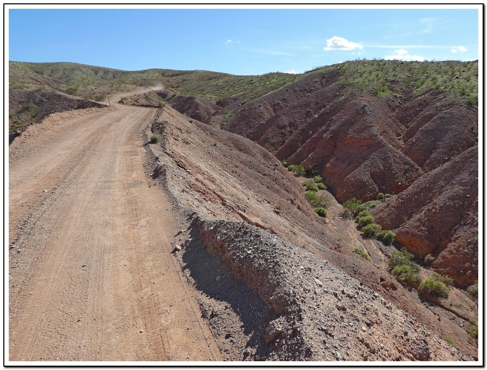
| (Fig. 02) |
01/29/2020 Trip Notes: Today Jim Herring, Bob Croke,Ron Ziance and I went back to this area to find and drive Fortification Hill Road. Click here for a description of this trip and pictures ...
Fortification Hill Road.
03/23/2019 Trip Notes: Today Jim Herring and I decided to go looking for some wildflowers. A site I looked at said that there were some off Kingman Wash Road in Arizona. There is also a unknown mine in the area, so we headed there. The elevation at the TH (Trail Head) at exit 2 off I-93 is around 1,340 feet. The entire length of this road to the lake's edge is only about 3.2 miles. The relatively maintained dirt road from here runs uphill about 300 feet till it reaches the intersection of South Mine Road (NPS-70A) at about .9 miles out. Driving this road runs roughly a mile atop a winding up and down ridgeline for about 1.2 miles till it comes to the intersection of the North Mine Road (NPS-70B) on the map in (Fig. 02). The elevation at the intersection is 2,168 feet. Looking north provides a great view of Lake Mead and the Paint Pots area (Fig. 01). Looking back, somewhat southwest you can see the dirt road (Fig. 03) you just traveled getting here and in the distance and the bridges you cross over just south of the dam. From the intersection, the less maintained dirt road runs ahead due east for about a mile to the mine itself (Fig. 05). This quite rough road ends at an elevation of 2,431 feet, for a total climb from the TH of nearly 1,100 feet. I would not attempt this portion of the road without a 4WD vehicle (Fig. 06). The end looked so rough we actually parked and hiked the last several hundred feet. When you reach the top you see some old water tanks on the left (Fig. 07) that had some piping that lead down to the mine site sitting above a large wash just below. In front of the two openings here had debris scattered about (Figs. 08, 09 & 10). We hiked down the wash for a several hundred feet and found the remains of yet another digging, Even though we didn't hike to the top of it, There were two steel rails sticking out over the edge of the overage pile (Figs. 11 & 12). (Notes continued below)
 |
| (Fig. 03) |
 |
| (Fig. 04) |
 |
| (Fig. 05) |
 |
| (Fig. 06) |
 |
| (Fig .07) |
 |
| (Fig. 08) Click to Enlarge |
|
 |
| (Fig. 09) Click to Enlarge |
|
 |
| (Fig. 10) Click to Enlarge |
|
 |
| (Fig. 11) Click to Enlarge |
|
 |
| (Fig. 12) Click to Enlarge |
|
 |
| (Fig. 13) Click to Enlarge |
|
Trip Notes Continued: After hiking back to the jeep (Fig. 13), we then backtracked to the intersection. It was then 1.16 miles still on the top of a another ridge back to the main road. Driving this ridge felt like you were riding along the great wall of China. From there it was another 1.7 miles to the shoreline of Lake Mead. As we drove along the main road down to the Paint Pots Cove, the road has deep washes on both sides of the road (Fig. 14). Near the end of the road you got some great views of the Paint Pots areas (Figs. 15 & 16). The large flat butte behind the colorful Paint Pots is Fortification Hill. At the very end of the road is the small cove and beach line of Lake Mead (Fig. 17). The picture in (Fig. 18) shows "bath tub ring" around Lake Mead. From this vantage point where we were parked, and the land below us, would have been under water years ago. (Figs. 19 thru 24) are pictures of several wildflowers that we spotted along the side of the road on our way down to the lake. Taking our time, stopping for pictures of wildflowers, scenic views and hiking around the mine site made for a pleasurable afternoon. On the return home we stopped in Boulder City at the Southwest Diner, one of our favorite restaurants for dinner.
Side Note - Paint Pots: Thirteen million years ago, the crust around the Lake Mead area was stretched and thinned so iron and magnesium-rich magma and basalt, poured out of the ground and covered the landscape. The darker lava produced many of the black volcanic flow-capped mesas, such as Fortification Hill and Callville Mesa, seen in many parts of Lake Mead National Recreation Area. Mineral-rich fluids trapped in older rock were mobilized when hot magma was injected into them. These hot, hydrothermal fluids percolated up through some of the igneous rock formations, including the Paint Pots pluton at the base of Fortification Hill, imparting their beautiful coloration!
Definition - pluton: A pluton (pronounced "PLOO-tonn") is a deep-seated intrusion of igneous rock, a body that made its way into pre-existing rocks in a melted form (magma) several kilometers underground in the Earth's crust and then solidified. At that depth, the magma cooled and crystallized very slowly, allowing the mineral grains to grow large and tightly interlocked — typical of plutonic rocks. Shallower intrusions may be called subvolcanic or hypabyssal intrusions. There are a slew of partial synonyms based on a pluton's size and shape, including batholith, diapir, intrusion, laccolith, and stock.
 |
| (Fig. 14) |
 |
| (Fig.15) |
 |
| (Fig. 16) |
 |
| (Fig. 17) |
 |
| (Fig. 18) |
 |
| (Fig. 19) Click to Enlarge |
|
 |
| (Fig. 20) Click to Enlarge |
|
 |
| (Fig. 21) Click to Enlarge |
|
 |
| (Fig. 22) Click to Enlarge |
|
 |
| (Fig. 23) Click to Enlarge |
|
 |
| (Fig. 24) Click to Enlarge |
|
___________________________________________________
Note: Every attempt is made to provide accurate information, but occasionally depictions are inaccurate by error of mapping, navigation or cataloging. The information on this site is provided without any warranty, express or implied, and is for informational and historical purposes only.