Friday

Roadtrip – Albuquerque, NM – 2009 Balloon Festival

EFP-IMG_1430-2
(Fig. 01)
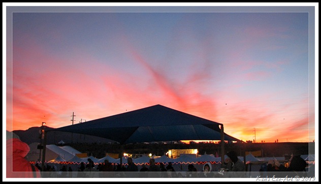
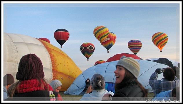
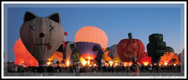
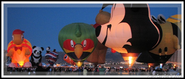
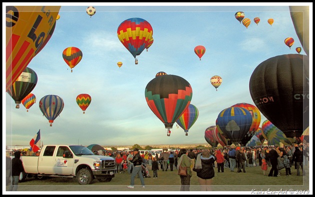
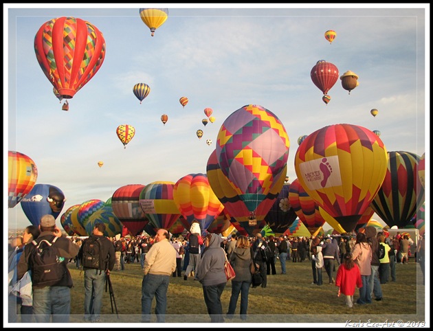
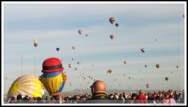
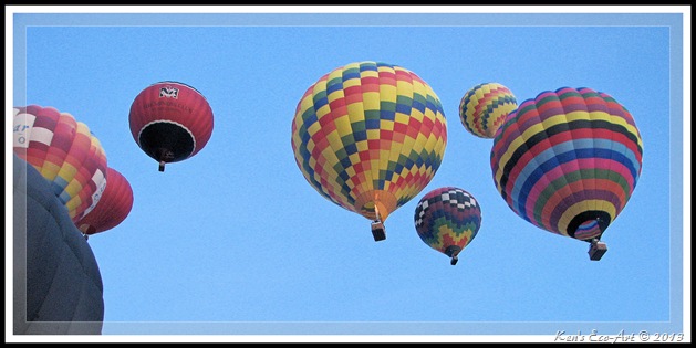
10/15/2009 Trip Notes: This was the goal of an eight day roadtrip through Utah, Arizona and New Mexico that Connie and I made with our neighbor Marc Resnic back in 2009. We spent two full days at this event and took in several of the main events, including the 5:00 AM Dawn Patrol, the evening Special Shape Balloon Glow, and the final days’ Mass Ascension. The early morning Dawn Patrol brought a beautiful sunrise (Fig. 02) with temperatures near the freezing mark. Not quite as prepared as most (Fig. 03), we ended up buying gloves and hats. My hands were so cold I could hardly operate my camera. On our second day we attended the evening Night Glow, where they light off various tethered groups (Figs. 04 & 05) scattered throughout the grounds. On the day of the Mass Ascension (Figs. 01, 06, 07, 08) there were more than 200 balloons in the air all at once.

Be sure to check out the special slide show that I created that shows the lengthy process of getting one of the large balloons into the air. It is much more work than one would think. Check it out here … Anatomy of a Balloon Flight.
EFP-IMG_1155
(Fig. 02) Dawn Patrol
EFP-IMG_1209
(Fig. 03) Dawn Patrol
EFP-IMG_1035-2
(Fig. 04) Balloon Glow
EFP-IMG_1034-2
(Fig. 05) Balloon Glow
EFP-IMG_1290
(Fig. 06) Mass Ascension 
EFP- IMG_1302
(Fig. 07) Mass Ascension
EFP-IMG_1446
(Fig. 08) Mass Ascension

One of the things that surprised us the most was the vast number of balloons shaped like cartoon characters, animals, or other recognizable subjects. The two collages (Figs. 09 & 10) below provide a small representation of the many different subjects we saw. These unique balloons actually created a wonderful “fun” factor that was enjoyed by children and adults alike.

EPC-IMG_1300 EPC-IMG_1310 EPC-IMG_1278 EPC-IMG_1427-2 EPC-IMG_1280
(Fig. 09) 
  
Balloons 02
(Fig. 10)
 The 2-page PDF file below provides information and pictures from a road trip back in 2009 that took us to Allbuquerque, NM and the 2009 Balloon Festival. Use the “scroll bar” on the right to scroll down to the next page. To view for reading, click on the “Full Screen” Full Page Icon icon located at the very right of the Scribd menu bar at the bottom of the page. Directly below this file I have included a slideshow with some additional pictures of our visit.
(Fig. 11)


The slideshow below is designed to run automatically in place. Clicking anywhere in the black background area that surrounds the picture being shown will PAUSE the show and bring up the Pause, Forward and Back menu at the bottom of the slideshow window, allowing you to start, stop or manually forward pictures one at a time.

To view the slideshow full-screen, click in the middle of the running show. When the new browser window appears, click on the left side of the menu where it says "slideshow".


Slideshow Description:
The slideshow above contains 100 pictures that were taken at the 2009 Albuquerque Balloon Festival.

Thursday

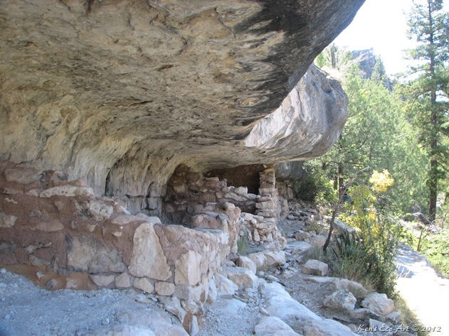
Title – “The Guardian”

IMG_1500 (B&W)(Framed)
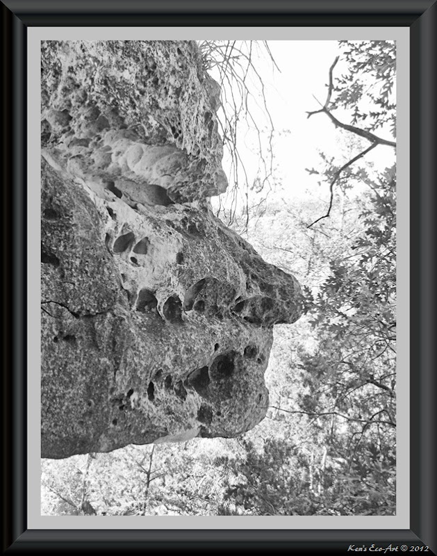
Even though I had previously published this image as a color photo, I was never happy with the blue cast that was present in the upper half of the image. I thought that converting it to a black and white not only solved this problem, but accentuated the rock face as well as making it look older.

On 10/15/2009 we visited the Walnut Canyon National Park. This 600-foot deep canyon, located on a densely-wooded plateau just 8 miles southeast of Flagstaff in the Coconio National Forest, was carved by the small seasonal stream called Walnut Creek as it flowed east, eventually joining the Little Colorado Rover en route to the Grand Canyon. The exposed Kaibab limestone that forms the upper third of the canyon walls occurs in various layers of slightly differing hardness, some of which have eroded more rapidly forming shallow alcoves; during the 12th to 13th centuries they were used by the local Sinagua Indians who constructed cave-dwellings along the steep well-protected ledges, high above the canyon floor.

Just to get down to the level containing the dozens of cliff houses in this river canyon, one must first descend more than 225 feet. As I was taking the picture below, just off the pathway that passes in front of these ancient cliff houses, I looked up at the natural overhang that was part of the “ceiling” of the cliff house and the composition above came into view. By backing up just a few steps, I caught this angle which looked like the profile of a face, staring down into the canyon.this image. Worn by hundreds of years of natural erosion, it could only be seen by standing in just the right spot, at just the right angle; I was the only one who visualized it. Most people walked by just beneath it without ever noticing its unique beauty. 
IMG_1502

Roadtrip–Albuquerque, NM - Anatomy of a Balloon Ride

 EFP-IMG_1216-2

I created this slideshow from a series of pictures captured at the 2009 Balloon Festival that we attended  in Albuquerque, NM. There's more work to getting one of these into the air than one imagines. Click anywhere in the black background area that surrounds the current picture being shown to PAUSE the show and then use the Back button to rewind to the beginning with slide #01, then press the Play button. 

The slideshow below is designed to run automatically in place, however, the slides move too fast to read the captions.. Clicking anywhere in the black background area that surrounds the picture being shown will PAUSE the show and bring up the Pause, Forward and Back menu at the bottom of the slideshow window, allowing you to start, stop and manually forward pictures one at a time.

To view the slideshow full-screen, click in the middle of the running show. When the new browser window appears, click on the left side of the menu where it says "slideshow".
Slideshow Description: The slideshow above contains 21 pictures that were taken at the 2009 Balloon Festival held in Albuquerque, NM.

Monday

Bryce Canyon National Park

E-Bryce Canyon 3 - Copy
Destination: Bryce Canyon National Park
Distance from Point of Origin: 255 miles.
Estimated (One Way) Travel Time: 4 hours and 30 minutes.
Directions: From the Stratosphere, turn right onto Las Vegas Blvd south. Go a little over a mile and turn right again onto W. Sahara Ave. Go 1.2 miles and reverse direction by making a U-Turn to head back east on W. Sahara Ave. Go .5 miles and turn left to merge onto I-15 N via the ramp on the left toward Salt Lake City. Go 169 miles passing through Arizona and into Utah. Take exit 57 toward Cedar City/I-15/UT-14 and go .4 miles. Merge onto S. Main St and travel 2.2 miles. Turn right onto UT-14 E/E Center St and continue to follow UT-14 E for 40.4 miles. Turn left onto US-89 N and follow for 20.6 miles and turn right onto UT-12 E. Go 13.5 miles and turn right toward UT-63 S and go 5.5 miles and turn left onto Bryce Point Rd and take a slight right to Bryce Canyon National Park, Tropic, Utah

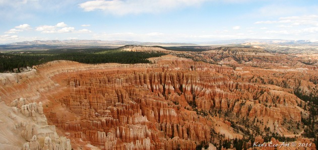
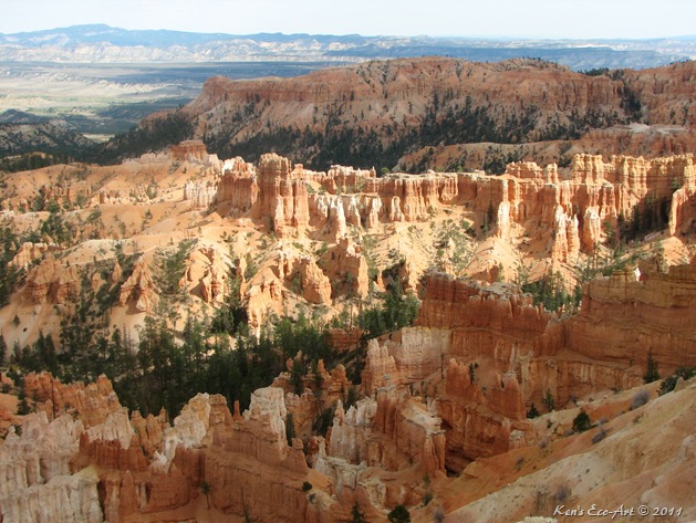
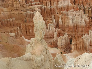
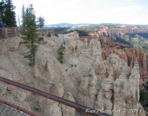
General Description: Named after the Mormon Pioneer Ebenezer Bryce, Bryce Canyon became a national park in 1924. With a rim elevation between 8,000 to 9,100 feet, it is famous for its worldly unique geology, consisting of a series of horseshoe-shaped amphitheaters carved along the eastern edge of the Paunsaugunt Plateau. Bryce Canyon National Park is mostly know for its large groups of hoodoos. Encompassing 35,835 acres of land, a good share of it is covered with eroded shale that forms the mystical limestone hoodoos.  These geological curiosities of claron limestone, sandstone and mudstone have an ancient history that dates back to the same time as the disappearance of the dinosaurs.  Slowly over vast periods of time the landscape changed until it finally resulted in  what you see in Bryce today. Although the parks name implies that it is a canyon, it is not.  The hoodoos and amphitheaters are the edge of the Paunsaugunt Plateau.  The edge has been embattled and sculpted by the Paria River's tributaries as well as wind and ice.
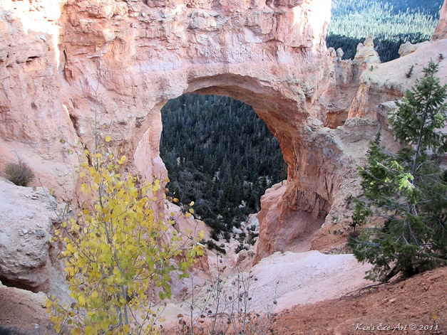
Special Attraction or Points of Interest: In addition to dozens of hiking trails classified as easy, moderate, and strenerous, one can also take horseback rides down into the base of the canyon-like bowl. Getting to the “natural bridge” is a must picture taking moment.
Primary Activity: Photographing.
Secondary Activities: Hiking.

Elevation: 8,000 feet to 9,100 feet.
Best Time To Visit: Bryce is open year round. Spring and fall when the temps are lower would be the ideal times to visit. However, due to its elevation, there is plenty of snow in the winter and sometimes one can capture some very nice pictures of “snow-capped” hoodoos.
Difficulty: Walks and hikes along the most common trails are easy to moderate.
Facilities: Some portable facilities.
Estimated Round-trip Time: Nine hours driving time leaves little time for exploring and picture taking without an overnight stay somewhere.
More Info On Bryce Canyon: http://www.nps.gov/brca/index.htm


10/12/2009 Trip Notes:  We visited Bryce Canyon National Park while on a 10 road trip with our neighbor Marc Resnic. Of all our stops, this was Connie’s favorite. The ever changing colors and formations were just amazing. One can wait hours trying to get good sunset and sunrise pictures. We made two visits to the canyon and still wish we had more time.

E-IMG_0088

Read more about Bryce's Hoodoo's here ... Bryce Canyon Hoodoo's

IMG_0094 IMG_0149
IMG_0129
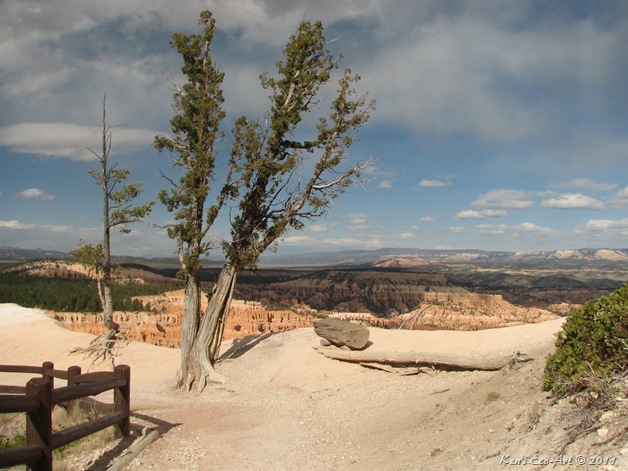
Bristlecone Pines (Pinus longaeva and Pinus aristata) are among the oldest living organisms on earth. Bristlecones are only found in six states, Utah included. Some have been dated to more than 4,900 years old. They often grow on exposed dry rocky slopes and ridges between 6500-11,000 feet, such as those shown above. Bristlecones have 5 needles per fascicle, and can grow to be 40-60 feet in height (under most favorable conditions.) Often they will die in portions. As the roots become exposed they will dry out and die. The tree directly connected above those roots will eventually die as well. The remainder of the tree will continue to live. This is among the causes that create the twisted tortured look of the trees.


The Natural Bridge, shown below, is located 1.7 miles past  Fairview Point and is visible from the Natural Bridge turn-out, it is the largest and most beautiful of the park’s many arches. Even on an overcast day such as the one we had, it still makes for a beautiful picture. The naming of Natural Bridge in Bryce Canyon caused a slight uproar in the geology circles. Even though the natural-made structure looks like a bridge, it is in fact an arch. What is the difference between a bridge and an arch? The difference between a bridge and an arch is in how the rocks were molded and formed. A true natural bridge is formed by stream erosion or some sort of water force, but Bryce Canyon's Natural Bridge is thought to be formed by weathering, rain and freezing. Run-off enlarged the hole in the center of Natural Bridge, forming the structure seen today.
E-IMG_0172


The slideshow below is designed to run automatically in place. Clicking anywhere in the black background area that surrounds the picture being shown will PAUSE the show and bring up the Pause, Forward and Back menu at the bottom of the slideshow window, allowing you to start, stop or manually forward pictures one at a time.

To view the slideshow full-screen, click in the middle of the running show. When the new browser window appears, click on the left side of the menu where it says "slideshow".


Slideshow Description: The slideshow above contains 33 pictures that were taken during my visit to Bryce Canyon National Park.

PDF Collage: In 2009 I produced a series of PDF collages for the creation of "Our Travel & Entertainment Diary" blog. Click here to view a two page PDF collage of our trip to Bryce Canyon National Park in Tropic, UT ... Bryce Canyon.

Sunday

Red Canyon Dixie National Forest

E-IMG_0390-2
Destination: Red Canyon Dixie National Forest
Distance from Point of Origin: 240 miles.
Estimated (One Way) Travel Time: 4 hours and 10 minutes.
Directions: From the Stratosphere, turn right onto Las Vegas Blvd south. Go a little over a mile and turn right again onto W. Sahara Ave. Go 1.2 miles and reverse direction by making a U-Turn to head back east on W. Sahara Ave. Go .5 miles and turn left to merge onto I-15 N via the ramp on the left toward Salt Lake City. Go 169 miles passing through Arizona and into Utah. Take exit 57 toward Cedar City/I-15/UT-14 and go .4 miles. Merge onto S. Main St and travel 2.2 miles. Turn right onto UT-14 E/E Center St and continue to follow UT-14 E for 40.4 miles. Turn left onto US-89 N and follow for 20.6 miles and turn right onto UT-12 E. Follow UT-12 for about 4 miles and you will begin driving through Red Canyon.

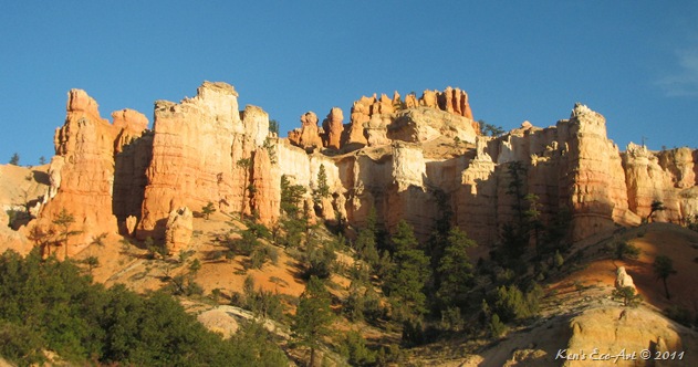
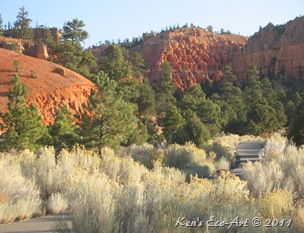
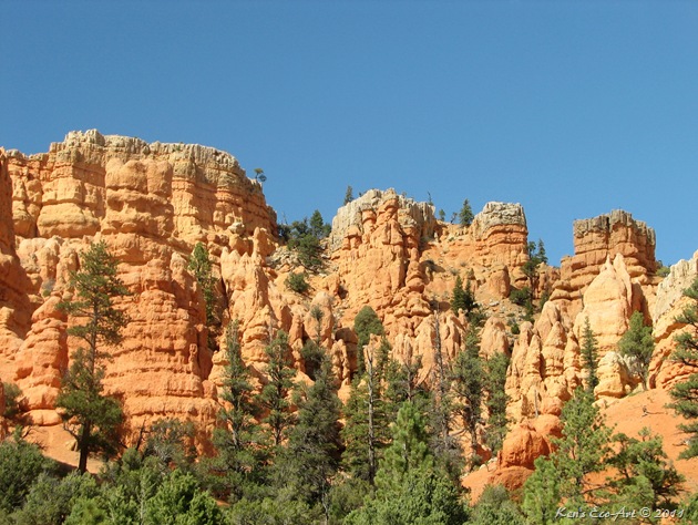
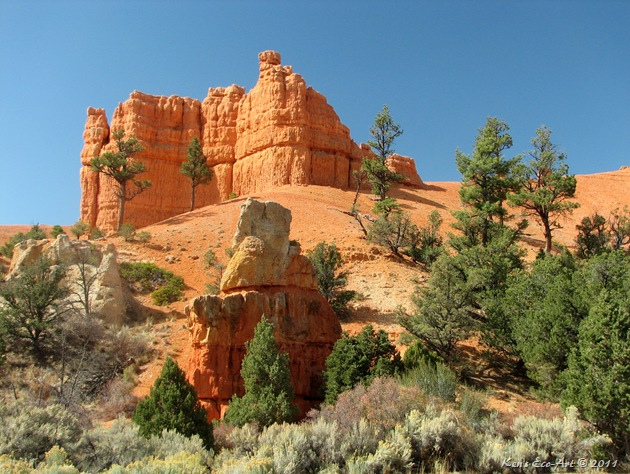
General Description: The numerous red hoodoos here are unique in appearance and organization, and quite different from those of nearby Bryce Canyon and Cedar Breaks. In addition, they appear to be more ‘open’ as they line the road instead of being concentrated in an amphitheater. The base of these hoodoo cliffs are surrounded by ponderosa pines, junipers and Douglas firs. For a closer look at the unique scenery, there are at least five well-maintained trails of varying difficulty that provide something for everyone.
Special Attraction or Points of Interest: Because this area is a part of the Dixie National Forest rather than the National Park System, it is regulated by the Forest Service and thus allows ATV's, horses and bicycles on the trails. It has a 34 miles of paved and unpaved biking trails, the most popular being the paved trail along Scenic Byway 12 that takes you through 5 miles of towering pines and red rocks . If you are a bike rider then this is something you do not want to miss. In addition, there are more than a half dozen hiking trails that range from .7 to 3 miles classified as easy to moderate. There are no entry fees for this area, so come and enjoy.
Primary Activity: Biking and Hiking.
Secondary Activities: Photographing.

Elevation:  7,200 to 7,811 feet.
Best Time To Visit: Due to its elevation, even summertime hiking and biking here can be relatively cool.
Difficulty: Walks and hikes along the five well-maintained trails range from easy to moderate. 
Facilities: The Red Canyon Visitor Center is located just off Highway 12 amid the spectacular red sandstone spires and formations. There is an interpretive site, picnic tables, Flush toilets, drinking water and parking
Estimated Round-trip Time: Just over eight hours driving time leaves little time for exploring, hiking and picture taking without an overnight stay somewhere.
More Info On Red Canyonhttp://www.zionnational-park.com/red-canyon-utah.htm

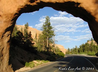
10/11/2009 Trip Notes:  We entered Red Canyon on our way to Bryce Canyon. This 4-mile stretch of highway is a heavily forested area with what appear to be 60 million year old red rock castles protruding up from crimson sand. Its spiraling red rock hoodoos line the edge of a long escarpment called theSunset Cliffs.Though one might think that this would not be a single destination for a roadtrip, it’s overall beauty, combined with its many walking and biking trails make it a great place to bring a picnic lunch and spend an entire day., This area was so gorgeous that we actually went back to it a second time.
Red Canyon Arch E-IMG_0412
E-IMG_0083
E-IMG_0082

Thursday

Walnut Canyon National Monument, AZ

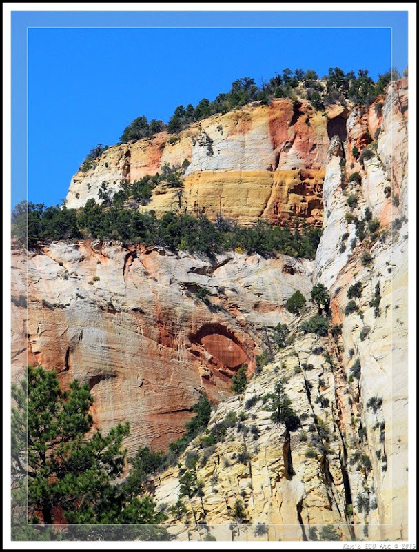
I am always looking for some feature in a natural setting that resembles something familiar or reminds me of something. The section of ledge above, resembling a face is a prime example of what I mean.  This picture is of a natural overhang that was captured while walking past one of the hundreds of cliff houses I found on a visit to Walnut Canyon National Park in October 2009. This natural cliff outcrop, worn by hundreds of years of natural erosion could only be seen at just the right angle. Hiking just below it, most people walked right on by and never noticed its natural beauty. Click here to view some of the cave dwellings located along the Island Trail [Cave Dwellings].

Area Description: Walnut Canyon National Monument is easily reached from Flagstaff, being just 7 miles east along I-40 and another 3 miles south on a spur road starting at exit 204. During the 12th to 13th centuries, the local Sinagua Indians constructed cave-dwellings along the steep well-protected ledges, high above the canyon floor. Today, the appearance of the canyon and ruins is quite reminiscent of the more well known Mesa Verde National Park in Colorado, just on a smaller scale. At an elevation of nearly 7,000 feet, the 0.9 mile Island Trail is a loop path that descends steeply (by 185 feet) via a series of 240 steps, that then circles an island carved by the river in the middle of the canyon.  The trail passes alongside the remains of about 20 separate dwellings, a few of which are quite intact, including front walls with rectangular doorways. The trail also has good views of the cliffs opposite, which have other ruins clearly visible, since the reddish stones used by the Sinagua contrast well with the white striated limestone layers of the canyon.

Antelope Canyon – Rivers of Taffy

E-IMG_0825-3
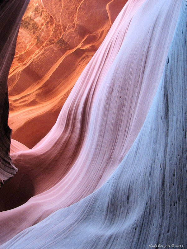
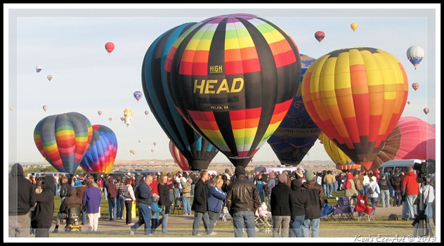
When I was a kid back in the early 60’s, I worked in Junkin’s Candy & Ice Cream shop at Hampton Beach, N.H. Their main claim to fame was making pure salt water taffies right in front of the customers. These water and wind honed sandstone ledges located inside the Lower Antelope (slot) canyon near Page Arizona look almost exactly like the salt water taffy we used to make back then, hence the title. Click here to see my most unusual photo of Antelope Canyon ... Lava Man.
Pulled Taffy

Monday

Roadtrip – Zion National Park

{Click on an image to enlarge, then use the back button to return to this page}
EFP-IMG_1550
(Fig. 01)
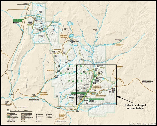
MAP-Zion National Park-2
(Fig. 02)
Directions: From Las Vegas, travel I-15 north to Utah and St. George. It is 128 miles to I-15 exit 16 on the other side of St. George. Follow SR-9 and travel through Hurricane to LaVerkin, bottom left of (Fig. 02). In LaVerkin, continue turning right (East) on SR-9 to the south entrance of the park. This road goes by Utah Scenic Byway-9; Zion-Mt. Carmel Highway and the Mt. Carmel Scenic Byway. All three names are correct. Following the Mount Carmel Hyway 14 miles through the park to its eastern entrance boundary makes for a total driving distant of about 170 miles for a total time of 3-3.5 hours, without stops and pictures taking. 
                                  
MAP-Zion National Park Detail-2
(Fig. 03
Park Description: Zion National Park is located situated in the southwestern corner of Utah near the Nevada and Arizona borders near Springdale, Utah. The map in (Fig. 02) shows the extent of the park’s boundaries. The park is 229-square-miles as it surrounds Zion Canyon, which is 15 miles long and up to half a mile deep as it cuts through the reddish and tan-colored Navajo Sandstone by the North Fork of the Virgin River. The lowest elevation is 3,666 feet at Coalpits Wash and the highest elevation is 8,726 feet at Horse Ranch Mountain. At Canyon Junction (Fig. 03), the road into Zion Canyon is called the Zion Canyon Scenic Drive. Refer to the enlarged map section in (Fig. 03).  It is 6 miles long and ends at the Temple of Sinawava ("Sinawava" refers to the Coyote God of the Paiute Indians). At the Temple the canyon narrows and a foot-trail continues to the mouth of the Zion Narrows, a gorge as narrow as 20 feet wide and up to 2,000 feet tall. This road is served by a free shuttle bus from early April to late October and by private vehicles the other months of the year. Other roads in Zion are open to private vehicles year-round.
EFP-IMG_1538
(Fig.04)
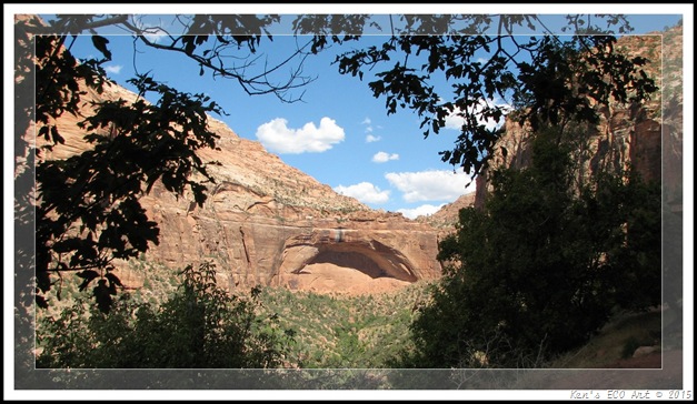
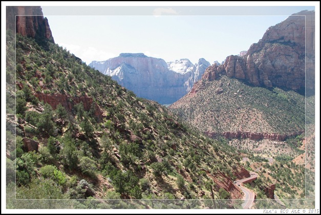
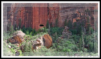
At Canyon Junction (Fig. 03), SR-9, called the Zion-Mount Carmel Highway (Figs. 01 & 04), heads east to service the east side of the park. This seven mile stretch passes the Zion–Mount Carmel Tunnel and ends at Mount Carmel Junction, Utah. When opened in 1930, the Zion-Mt. Carmel highway was an engineering marvel of its time and was the longest tunnel in the United States. Providing access to Zion from the park's east entrance, the highway leads to the famous Pine Creek Tunnel, which is 1.1 mile long and has six large windows cut into the rock (Figs. 05 & 06). I have to admit that when I first looked up and saw the opening in the side of the sheer cliff, I thought it was an Indian cave or dwelling. It was only as I got closer and then drove through the tunnel that I realized that it was one of several "tunnel vents" that provided several outstooding "window views" onto the valley below.
East Tunnel Entrance
The notable features on the eastern portion of the park include Checkerboard Mesa and the East Temple. On the west side of the park, west of Zion Canyon, is the Kolob Terrace. This area features The Subway, a slot canyon hike, and Lava Point, with a panoramic view of the entire area. The Kolob Canyons section, further west near Cedar City, features the world's second longest arch, Kolob Arch. Other stone arches at Zion include Crawford, Double Pine, Jughandle, Chinle Trail, and Hidden Arch.
EFP-IMG_1545
(Fig. 05)
EFP-IMG_1546
(Fig. 06)
EFP-IMG_0261-2
(Fig. 07)
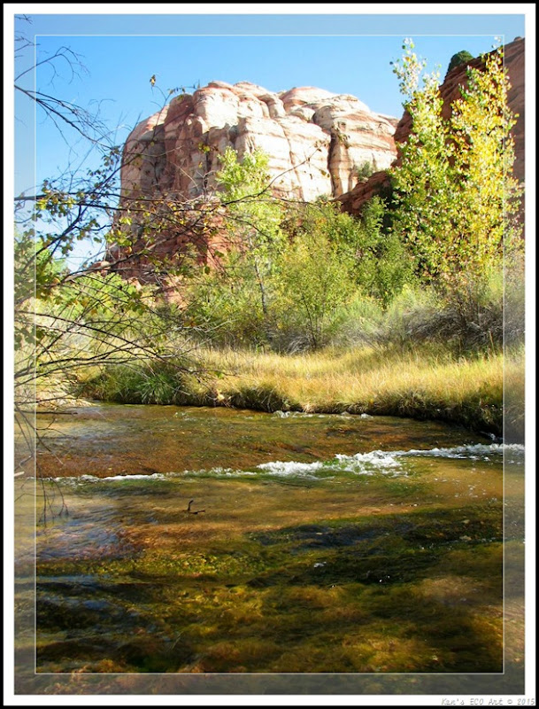
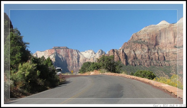
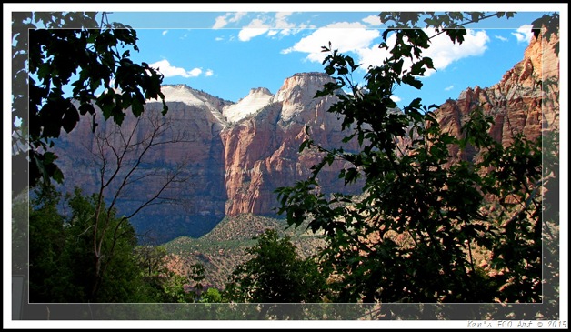
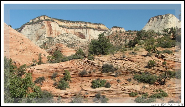
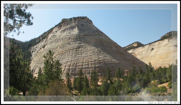
10/05/2009 Trip Notes: This stop was the beginning of a week long trip Connie and I took with a neighbor through Utah, Arizona and New Mexico on our way to the annual 2009 Albuquerque Balloon Festival. As you turn onto SR-9, headed to Zion, the road travels alongside the Virgin River (Fig. 07), with some of the parks’ peaks in the distance (Fig. 08). The closer you get to the park, the more you begin to find yourself surrounded by the many colored layers of the sandstone mesas and mountains (Figs. 08 & 09). The soaring towers and massive monoliths offer a spectacular grandeur. The peak show in (Fig. 10) is called Mountain of the Sun. After entering the park we decided we didn’t have enough time to take the shuttles up through the Zion Canyon Scenic Drive (see Fig. 03), and chose to take the Zion-Mount Carmel Highway to the park’s east entrance. This road switchbacks (Figs 04 & 11) its way up the mountain on the eastern side of the valley towards the tunnel near the top. As you climb higher and higher, the views of the surrounding mountains and the valley below provide staggering views (Figs 01, 12 & 13). After passing through the mile long tunnel near the top of the mountain, the sandstone landscape begins to change from shades of reddish-orange to more tan, white and shades of grey (Fig. 14). I just love the varying colors of the sandstone in (Fig. 16). A little further on you begin to encounter what is called "Checkerboard Mesa or Mountain" due to its strange vertically and horizontally striated surface. The left to right deep scratches are due to a north to south wind direction while the vertical cracks are a result of weathering, a cycle of freezing and thawing (Fig. 15). I can’t wait to go back and spend a couple of days hiking some of the trails along the Zion Canyon Scenic Drive. Note: I have converted some of the pictures taken here into "Black & White". Check out some of these pictures by going to ... Black & White Index.
                                             
EFP3-IMG_0014
(Fig. 08)
EFP2-IMG_0010
(Fig. 09)
EFP2-IMG_0030
(Fig. 10)
EFP-IMG_0046
(Fig.11)
EFP2-IMG_0040
(Fig.12)
EFP-IMG_1551
(Fig.13)
EFP-IMG_0064
(Fig.14)

EFP2-IMG_0068
(Fig.15)

EFP-IMG_0072
                                                                          (Fig.16)

Paragraph divider
Brief History: During the Archaic Period, the first human presence in the region dates to 8,000 years ago when family groups camped where they could hunt or collect plants and seeds. About 2,000 years ago, some groups began growing corn and other crops, leading to an increasingly sedentary lifestyle. Later groups in this period built permanent villages called pueblos. Archaeologists call this the Archaic period and it lasted until about 500 CE. Baskets, cordage nets, and yucca fiber sandals have been found and dated to this period. By 300 CE some of the archaic groups developed into an early branch of seminomadic Anasazi, the Basketmakers. Basketmaker sites have grass- or stone-lined storage cists and shallow, partially underground dwellings called pithouses. They were hunters and gatherers who supplemented their diet with limited agriculture. Locally collected pine nuts were important for food and trade.
                                     
During the Protohistoric Period, both the Virgin Anasazi and the Parowan Fremont disappear from the archaeological record of southwestern Utah by about 1300. Extended droughts in the 11th and 12th centuries, interspersed with catastrophic flooding, may have made horticulture impossible in this arid region. Tradition and archaeological evidence hold that their replacements were Numic-speaking cousins of the Virgin Anasazi, such as the Southern Paiute and Ute. The newcomers migrated on a seasonal basis up and down valleys in search of wild seeds and game animals. Some, particularly the Southern Paiute, also planted fields of corn, sunflowers, and squash to supplement their diet. These more sedentary groups made brownware vessels that were used for storage and cooking.
                                   
The Historic period began in the late 18th century with the exploration of southern Utah by Padres Silvestre Vélez de Escalante and Francisco Atanasio Domínguez. The padres passed near what is now the Kolob Canyons Visitor Center on October 13, 1776, becoming the first people of European descent known to visit the area. In 1825, trapper and trader Jedediah Smith explored some of the downstream areas while under contract with the American Fur Company. Mormons started settling and farming the Virgin River region in 1847. Their search for farmland led them to Zion Canyon in 1858, about 75 miles up the Virgin River from the confluence of the Colorado and Virgin Rivers, below the Grand Canyon. Public attention of this area led to President Theodore Roosevelt proclaiming the area a national monument in 1909 (called Mukuntuweap at the time). The U.S. Congress established Zion National Park in 1919; additional areas were included in the park in 1937 and 1956. 
The slideshow below is designed to run automatically in place. Place the cursor anywhere on the picture being shown to bring up the Pause, Forward and Back menu at the bottom of the slideshow window, allowing you to start, stop or manually forward pictures one at a time.

To view the slideshow full-screen, click in the middle of the running show. When the new browser window appears, click on the "Full screen" button on the left side of the menu bar.
When the full screen window appears, use the menu bar to play and control the slide show.

Slideshow Description:
The slideshow above contains 44 pictures that were taken on my visit to Zion National Park on 10/05/2009.