{Click on an image to enlarge, then use the back button to return to this page}
This page last updated on 10/02/2017
 |
| (Fig. 01) |
 |
| (Fig. 02 |
Physical Description of the Area: The 57,442 acre
Mt. Charleston Wilderness Area located inside the boundaries of the 316,000 acre
Spring Mountains National Recreation Area (see Fig. 02). North to south, four peaks, Willow, Bonanza, Charleston and Griffith are all located inside the
Mt. Charleston Wilderness Area. At 11,918 feet, Mount Charleston is the highest peak and the fourth highest in the entire state of Nevada. As you can see from (Fig. 03 below), there are some 40 miles of trails located within the
Mount Charleston Wilderness Area, all of which can be accessed from the
Spring Mountains National Recreation Area, commonly referred to by locals as Mount Charleston. Referring to the map in (Fig. 02), the boundary of the
Spring Mountains National Recreation area stretches nearly 60 miles from Mount Sterling and Wheeler Peak in the north to Potosi Mountain in the south. Officially a part of the
Humboldt-Toiyabe National Forest (see Footnote (#1), bottom), SMNR and the Mt Charleston Wilderness Area is home to the bristlecone pine (Pinus longavea), which are some of the world's longest-living plants--the oldest are thousands of years old. The east and south are bordered by the Red Rock Canyon National Conservation Area (Fig. 02).
 |
| (Fig. 03) |
09/30/2017 Trip Notes: Located less than 45 minutes from downtown Las Vegas, Jim Herring,
Connie and I made a day trip of driving around the 57,442 acre
Mt. Charleston Wilderness Area.
The purpose of our trip was to locate and photograph some Quaking Aspen (Populus tremuloides) trees and have a picnic lunch. Click here for more information about these aspens ...
Quaking Aspen (Populus tremuloides). Due to recent drops in temperatures, we guessed that it was about time for the broad trembling leaves of these white-barked deciduous trees to be turning. As you can see from these pictures, we guessed right. We drove up SR-157 (Kyle Canyon Road) to the end and the
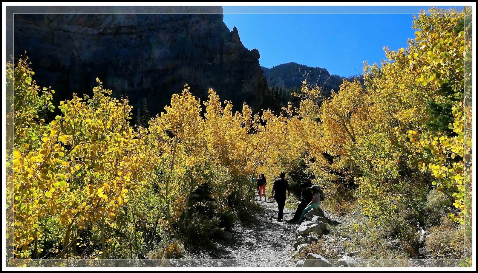
Cathedral Rock Picnic Area at the top (see Footnote (#2), bottom). After paying the $18 entrance fee we secured a nice table right next to one of their flush toilets facilities. While Connie sat in the sun reading one of her books, Jim and I headed out on the trail to Cathedral Dome. After about a third of a mile we reached the avalanche area of the trail that is filled with hundreds of Quaking Aspens (Fig. 01). The lower portion of this trail not only provides great views of the dome (Figs. 04 & 05), as well as looking down Kyle Canyon and to the desert valley below (Fig. 06). (notes con't below)
 |
| (Fig. 04) |
 |
| (Fig. 05) |
 |
| (Fig. 06) |
Trip Notes Continued: Along the way we had great views of the surrounding mountains (Fig. 07), fallen trees and stumps (Fig. 08), and occasional plants and flowers (Figs. 09 & 10). After we hiked back down, we built a charcoal fire at our site and enjoyed a picnic lunch of grilled hot dogs and hamburgers (Fig. 12). The flowers in (Figs. 13 thru 15) were right around our picnic area. (more notes con't below)
 |
| (Fig. 07) |
 |
| (Fig. 08) |
 |
| (Fig. 09) |
 |
| (Fig. 10) |
 |
| (Fig. 11) |
 |
| (Fig. 12) |
 |
| (Fig. 13) |
 |
| (Fig. 14) |
 |
| (Fig. 15) |
Trip Notes Continued: After lunch we packed up and headed down to the parking area for the Mary Jane Falls hike (refer to map in Fig. 03). The entrance to this trailhead area is bordered on one side by dozens of Quacking Aspens (Figs. 16 thru 18). After spending some time in this area we drove across NV-158 (Deer Creek Road) to the Las Vegas Ski and Snowboard Resort at the end of NV-156. The views in (Figs. 19 & 20) were taken along the route. The shot of the ski resort in (Fig. 21) was taken from the upper trailhead of the Bristlecone Trail (refer to map in Fig. 03).
 |
| (Fig. 16) |
 |
| (Fig. 17) |
 |
| (Fig.18) |
 |
| (Fig. 19) |
 |
| (Fig. 20) |
 |
| (Fig. 21) |
 |
| (Fig. 22) |
 |
| Click to Enlarge |
Footnote (#1): The
Humboldt-Toiyabe National Forest (HTNF), right, is the principal U.S. National Forest in the state of Nevada, and a smaller portion in Eastern California. With an area of 6,289,821 acres, it is the largest National Forest of the United States outside of Alaska. HTNF does not resemble most other National Forests in that it has numerous fairly large but
non-contiguous sections scattered about most of the state of Nevada and a portion of eastern California. Its 10 ranger districts are scattered across the many mountain ranges in Nevada, from the Santa Rosa Range in the north to the Spring Mountains near Las Vegas in the south. A part of the forest (about 11%) is in eastern California, in the areas around Bridgeport and Markleeville, and other areas east of the Sierra Nevada.
 |
| Click to Enlarge |
Footnote (#2): The
Cathedral Rock Picnic Area is opposite the scenic restaurant & lounge of the historic Mount Charleston Lodges' 23 log cabins located at the end of Kyle Canyon Rd. We paid a fee of $18 to use this facility. The view to the right is a picture of our site. Picnic areas have drinking water from Memorial Day to Labor Day unless otherwise noted. Day-use picnic areas are open from sunrise to sunset. Picnicking is also available in campgrounds from 8:00 am to 2:00 pm (excluding holidays). Each site has pedestal grills, a picnic table and vault & flush toilets. We found the area to be very clean and well maintained. If you don't plan on picnicking and want access to the Cathedral Rock trail, turn right a few hundred yards before this picnic area, opposite the log cabins. This is the parking and trailhead for Cathedral Rock.