{Click on an image to enlarge, then use the back button to return to this page}
This page last updated on 08/20/2019
 |
| (Fig. 01) |
 |
| (Fig. 02) |
Over the course of the past several years, I have visited the town of Pioche and the surrounding area six times. Because information about the town has been scattered over several previous pages, I decided to redo them and combine information about the town onto a single page. Pictures and information from previous visits have been combined for the creation of this new page.
08/20/2019 Trip Notes: Today was probably my sixth visit to the area of Pioche. Today, Bob Croke, Jim Herring, Ron Ziance and I made the trip to visit our old friend Harvey Smith. It was just to visit with Harvey and have lunch. Click her for pictures and a description of this visit ...
Pioche Nevada - 08/20/2019 Trip Notes.
05/03/2016 Trip Notes: Today was probably my fifth visit to the area of Pioche. Today, Bob Croke and I made the trip to visit Harvey Smith and a local resident, "P. Rob". The main objective of today's visit was to do some 4-wheeling around the valley and Highland Range located behind the town in search of some of the areas' old silver mines (Fig. 02). Click here for info and pictures of today's visit ...
Highland Mining District near Pioche NV. After riding around the mountains, we drove up to Pioche for lunch and a brief tour of town's more well known points of interest. Refer to the Section below titled "Pioche Today".
09/02/2014 Trip Notes: Harvey Smith and I made a day trip to Pioche to bring back some of the equipment he had stored there during his summer camping trips, however, ended up spending the day riding his quads throughout the valley east of town. Click here for info and pictures ...
Trip Notes for 09/02/2014.
Pioche Today: Far from its glory days as a lawless mining camp, today this small town of less than 1,000 is as tranquil as the desert that surrounds it. It is situated on a turnoff of US-93, about halfway between Ely and Glendale, 190 miles northeast of Las Vegas.With its picturesque mountainside setting, you can spend hours wandering up and down its curving streets, looking at many deserted buildings and the dark holes and tailing piles of the now silent mines that stare down on the town from “Treasure Hill” (Fig. 01).
On the approach to the town, the first thing you see is a portion of the aerial tramway running overhead that still supports a few of the original steel ore-carts (Fig. 03) that carried the ores from Treasure Hill behind the town down to the Godbe smelter mill that still stands today in the valley northeast of the town (Fig. 04). The tramway ran during the 1920's and 1930's and was used for the transportation of silver and nickel ore. It was built by the Pioche Mines Company and used mainly gravity, powered with the aid of a five horse motor. The ore in the full buckets rolled down hill to the mill with enough momentum to return the empty buckets back to the loading bin. This led to a cheap cost of six cents a ton delivery, much to their liking.
When glancing southwest toward the town proper, the picturesque Pioche Hills behind the town are dotted with dozens of holes fronted by the tailings, the result of long silent mine operations (Fig. 01). The hillside is still dotted with many deteriorating buildings (Figs. 05 &06) in various stages of decay reminiscent of the ore processing operations that were once the lifeblood of the mining that went on here. Some of the mine heads, buildings and other workings here are quite extensive, though many are quickly disintegrating (Fig. 07). One of the largest mine shafts located beneath the tall steel mine head/hoist shows evidence that it may have been 1,200 feet deep. The upper level of mines on the hillside provide some great views of the town below (Fig. 08). (con't below)
 |
| (Fig. 03) |
 |
| (Fig. 04) |
 |
| (Fig. 05) |
 |
| (Fig. 06) |
 |
| (Fig. 07) |
 |
| (Fig. 08) |
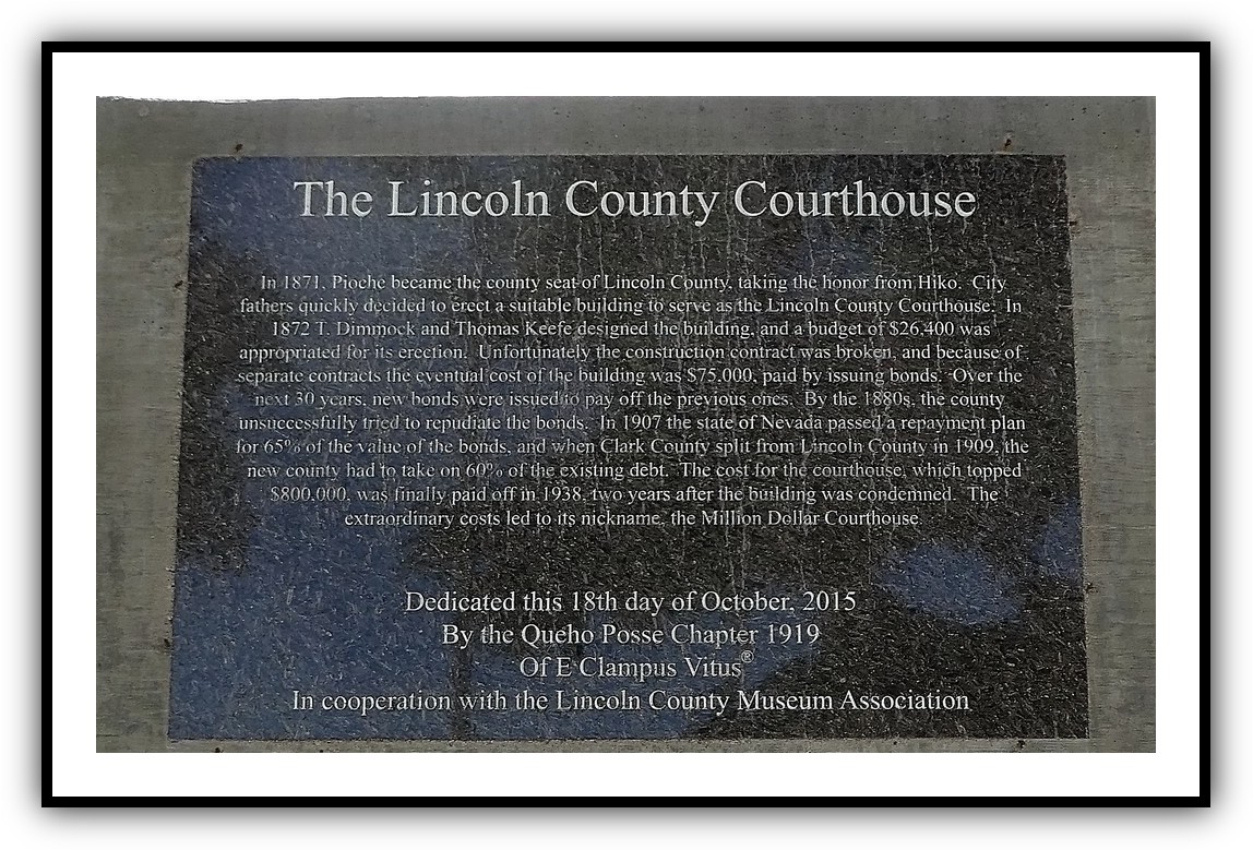
Pioche Notes Continued: After touring the mine area, we then drove back down to the town and visited one of the town's most famous attractions, the "Million Dollar Courthouse" (Fig. 09). Construction was started in 1871. It was designed by Edward Danahue. It was constructed of brick and stone, and borders on the 'Classic Revival' style of architecture. The town's heavily fortified jailhouse was built directly behind the top floor courtroom. Today, the courtroom is filled with nearly a dozen manicans to simulate an actual trial (Fig. 10). It has been recorded that no one ever escaped from the jail. On the hill next to the jail is a substantial, three-stall outhouse (Fig. 11). When originally contracted it was budgeted to cost $16,000. The cost quickly zoomed to $88,000. The courthouse politicians produced 'cost over runs' from the git-go. With delayed payments and mounting interest, it was financed, and refinanced with bonds that quickly ballooned into a million dollar price. It didn't take long to known there after as the "Million-Dollar Courthouse". The cost of the building wasn't paid off until 1936. It was condemed four years after it was paid off. Before lunch we passed by the Mountain View Hotel (Fig. 12), a building in much need of restoration. It was built in 1895 by the Ely Valley Mines to house their guests. Over the years its many overnight guests included president Herbert C. Hoover (1930), Nel Murbarger (author of "The Old West") as well as many U.S. Senators, Nevada Governors and other notables. In its time, the food, wines, accommodations and the unmatched service was renowned throughout the west. We then visited the Pioche Historical Museum on Main Street and walked the streets, stopping at several of the town’s historic buildings, including two turn of the century mining houses (Fig. 13).
 |
| (Fig. 09) |
 |
| (Fig. 10) |
 |
| (Fig. 11) |
 |
| (Fig. 12) |
 |
| (Fig. 13) |
Town's Mining History: Since the 1860's Pioche was the wickedest mining camp town in Eastern Nevada, worse than Tombstone, Dodge City and all the rest. A William Hamblin made the first discovery of gold and silver in 1863, but no important development took place until 1869 when mines were opened and the town of Pioche appeared. The town, however, was developed by a Frenchman by the name of F. L. A. Pioche, a banker from San Francisco, to whom Hamblen sold his claims. Pioche's major mining activity began in earnest in 1868 and increased dramatically when the county seat was moved there from Hiko in 1871. The population quickly grew to more than 7,000 by 1872 supported by 72 saloons and a large red light district that added to the chaos. Along with its 72 saloons, there were 3 hurdy-gurdy houses, 32 maisons de joie, two theaters, two breweries, two gravity fed water systems with street mains and fire plugs, two fire companies and a livery stable maintaining 300 horses. It has been said that there were 75 deaths of violence before anyone died a natural death. Over five million dollars in ore was taken out by 1872.
Over the course of the towns history, it burnt up and flooded several times. One of the major fires, 15th of September 1871, was just after a day of glorifying the occasion of the Mexican Independence. Shortly after midnight flames were seen to issue from the rear of a restaurant on Main Street. However, the fire was not the worst of it. Stored in the cellar of a leading mercantile store were 300 pounds of powder. When the powder went off it gave a shock that shook the surrounding mountains to the core. Some historians say there were thirteen killed and forty-seven injured, though that may be exaggerated. Any way the reports were that some 200 to 300 people remembered what it was like to sleep out under the stars again. Damaged was estimated at a cost of $500,000. As if this was not bad enough, again on the 5th of May 1872, the town lost twelve buildings at a cost of $50,000. This was followed by the twenty-second of August 1873, when a flood occurred after receiving 3.4 inches of rain within two hours, with damage at around $10,000. On the morning of May 3rd, 1876 another destructive fire ripped through the town, causing the loss of twenty-one buildings and an estimated $40,000 in damages.
When the mine shafts hit water at the 1,200 foot level, the mining companies met with insurmountable problems and eventually had to suspend operations. It has been said that more than $40,000,000 had been taken out of the town's surrounding mines, above the 1,200 foot water level. Is there still another $40,000,000 below the water level. By 1900 Pioche was nearly a ghost town. In later years, notably during World War II, profitable lead-zinc deposits were developed. The town's population was 1,002 at the 2010 census.