{Click on an image to enlarge, then use the back button to return to this page}
This page last updated on 10/22/2018
 |
| (Fig. 01) |
Directions: From Henderson, we drove the I-15 south towards Jean NV. At Jean we took exit 12 and headed west on route 161 towards Goodsprings. Just before the town of Goodsprings we turned left onto Sandy Valley Road. After driving about 3-4 miles we turned left onto the unmarked Table Mountain Road. This rough dirt road requires a 4WD vehicle in several places. It is about 1-3/4 mile in to the road that takes you to the top of the ridge that overlooks the Argentina Mine (Refer to Fig. 01). It is then about 2-3/4 miles to the peak of Table Mountain (elevation 5,140 feet) (see Fig 01).
Area Description: Sandy Valley Road winds its way through a series of mountain ranges. As it leaves Route 161, Sandy Valley Rd heads west, following along an area that is known as the Columbia Pass, between the southern end of the Spring Mountain range to the north and the Table Mountain range to the south, on its way towards the town of Sandy Valley. All of the many mines along this road fall within the Goodsprings Mining District. Click here to learn more ... Goodsprings Mining District. There are literally dozens of old mines, adits and starter shafts along this 10 mile stretch of road. Just to name a few, there's the Argentina, Hermosa, Bill Nye, and Hoosier mines to the south; and the Belle, Keystone, Cosmopolitian, Shenandoah, Mobile, Whale and Smithsonite mines to the north. The Lookout & Mountain Top Mines are along the crest of the same spur on which the Argentena mine is located, southeast of the Argentena mines. The Mountain Top claim was located before 1893 and was followed several years later by the Lookout claim. The smaller of the two, the Lookout Mine has two digging sites. Both are located north northwest of the Mountain Top mines. The Mountain Top Mine is surrounded by three additional digging sites. Zinc and Lead were the most common ore mined here. Calamine and hydrozincite are the most common zinc minerals, and galena is the source of most of the lead. Material screened from dumps at the Mountain Top mine in 1944 contained 19 percent zinc and 11.5 percent lead. At the Mountain Top No. 2, droppings of malachite and greenish descloizite were found.
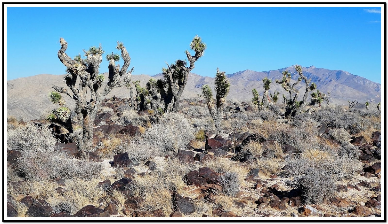
10/17/2018 Trip Notes: Only a short distance in from Sandy Valley Road we explored a mine on the right (Figs.02 - 04). I think this is the Fredrickson Mine. There were two openings that we were able to enter and explore. After continuing up the road for about 1.5 miles we came to a T-intersection (Refer to Fig. 01). We decided to turn right and follow this road up to the top of Table Mountain. The road comes to a dead end at a steep cliff with a beautiful view overlooking the town of Sandy Valley in the distance (Fig. 05). At the top there is a relatively flat plateau area will with Yucca Trees (Figs 06 & 07). The view in (Fig. 07 is looking north towards Mount Potosi in the background. The view in (Fig. 08) is looking northeast to the Rainbow Quarry located behind the town of Goodsprings. (Notes con't below)
 |
| (Fig.02) |
 |
| (Fig. 03) |
 |
| (Fig.04) |
 |
| (Fig. 05) |
 |
| (Fig. 06) |
 |
| (Fig. 07) |
 |
| (Fig. 08) |
Trip Notes Continued: From here we backtracked to the intersection, turned slightly left and then right to follow the road up to the the eastern ridgeline and the Argentena mines. The drive up this section of road was rough and needed 4WD in places. At the top (Fig. 09) we got out and walked around the half dozen of pilings of overage or tailings (Fig. 10). We got out and walked around the area. If you look carefully you can see Jim and Harvey in the middle of (Fig. 10). If you look towards the northwest you can see a portion of the road down in the valley that we drove in on (Figs. 11 & 12). At the end of the road, you actually have to hike the rest of the way, up and over the ridge and then down to the Argentena mines on the back side. We decided not to hike down to the mines due to the strong winds. However, as you round the corner at the top, there is a nice view of Goodsprings in the distance (Fig. 13). After back tracking down to the main road we made to left turns and head up the road that leads to the Lookout and Mountain Top mines (Refer to Fig. 01). After reaching the highest point of this quite rough rough we found a Coast & Geological Survey marker noting the following: "Table Mt #3 - 1934" (Fig. 14). Near the top, someone had erected a partial stone structure. Harvey climbed into it to protect him the the 30-35 mile per hour wind gusts (Fig. 15). From this vantage point there was a good view of the town of Jean and the dry lake bed behind it (Fig. 16). After driving about another mile on this rough road we came upon the remains of a quite long structure (Figs. 17 & 18) on the right side of the road, opposite the road that went down to the Lookout mine (Refer to the map in Fig. 01). As you can see from (Fig. 18) there were three heavy steel cables, the ends embedded into the cliff rock behind the structure. The only thing we could imagine was that at one time they might have been placed over the roof of the original structure to help secure it in the heavy winds up here. About a quarter mile past this location we came to a spot that looked down onto the Mountain Top (Figs. 19 & 20) mine (Refer to the map in Fig 01). On the opposite side of the road a road led down to a pile of debris at the end of the road that looked down onto two mine openings (Figs. 21 & 22). After this we decide to head back and go to the Pioneer Saloon in Goodsprings for a couple of beers and lunch. Pioneer Saloon - Synonymous with Goodsprings, NV
 |
| (Fig. 09) |
 |
| (Fig. 10) |
 |
| (Fig. 11) |
 |
| (Fig. 12) |
 |
| (Fig.13) |
 |
| (Fig. 14) |
 |
| (Fig. 15) |
 |
| (Fig. 16) |
 |
| (Fig. 17) |
 |
| (Fig. 18) |
 |
| (Fig. 19) |
 |
| (Fig. 20) |
 |
| (Fig. 21) |