{Click on an image to enlarge, then use the back button to return to this page}
 |
| (Fig. 01) |
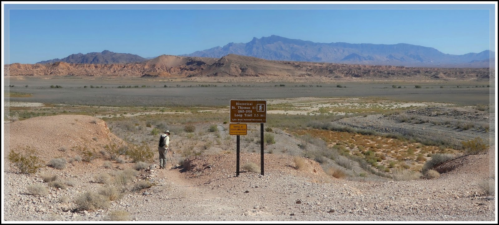
Directions: St. Thomas is located approximately 82 miles NE of Las Vegas. From the Stratosphere Casino head northeast on Las Vegas Blvd about 3 miles and turn right to merge onto US-93/95. Go 12.5 miles and Merge onto NV-564 E/W Lake Mead Pkwy via Exit 61B. Heading east on NV-564 (Lake Mead Blvd) go over the mountains (passing between Frenchman Mountain to the south and Sunrise Mountain to the north) to the park entrance station. Pay the entrance fee ($5 per car or an annual pass), and proceed to the T-intersection with Northshore Road (NV Rt 167) and Lakeshore Road (NV Rt 166). Bear left and drive north on Northshore Road (NV 167) towards Overton, NV. Turn right opposite the Valley of Fire Road onto Old St. Thomas Road and travel 3.3 miles to the parking area and trailhead at the end. The picture in (Fig. 01 above) is of Blake Smith heading out from the parking and trailhead area.
 |
| (Fig. 02) |
 |
| (Fig.03) |
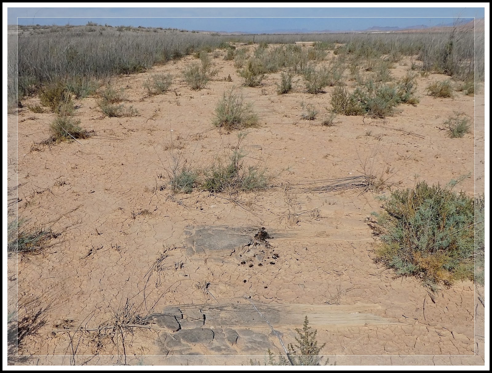
10/13/2016 Trip Notes: Today was Jim Herring's first visit to visit to St. Thomas, though both Blake and I had both been there on two or more occasions. As a result, I didn't take very many pictures, however, I did hike to a section of town that I had not visited before. The map in (Fig. 02 above) is a pre-flooding reconstruction showing the lay out of St. Thomas. The path we hiked today is shown on the map in yellow. After hiking down from the trailhead, the path to the town is a somewhat downhill easy hike across the level valley floor as seen in (Figs. 01 & 03). Once we reached the are of the towns' "main drag" (Fig. 04), we turned right and headed west (see Fig. 02) in search of the original train tracks that once serviced the town (see Note below). Along the way we were buzzed overhead by an ultralight (Fig. 05). When we reached the end of this short walk we came to a foundation that was the old packing shed (#4) (Fig. 06). From here we turned left and headed southeast (refer to Fig. 02). Even though none of the old rails exist, all along this clear path we found several railroad ties that showed where the RR track once existed (Figs. 07-09). As we toured this area and the rest of the town, we found several examples of remaining remnants that haven't been scavenged over the years (Figs. 10 & 11). When we finished hiking around the town, we headed back down Northshore Drive to Roger's Spring, where we enjoyed a relaxing picnic lunch (Fig. 12).
 |
| (Fig. 04) |
 |
| (Fig. 05) |
 |
| (Fig. 06) |
 |
| (Fig. 07) |
 |
| (Fig. 08) |
 |
| (Fig. 09) |
 |
| (Fig. 10) |
 |
| (Fig. 11) |
 |
| (Fig. 12) |
Note: The Union Pacific railroad built a branch down to the valley and used St Thomas as a terminus, between 1910 and 1918. In 1912, the San Pedro, Los Angeles & Salt Lake Railroad built a spur to St. Thomas to haul produce from local farms and ore from the gold and copper mines in the surrounding hills. A large salt mine was located just south of St. Thomas. It was a busy frontier town. The farmers there grew a wide variety of crops, including peaches, melons, grapes, figs, wheat, barley, corn, almonds and asparagus. Then during the First World War the price of copper rose and with thousands of head of stock being freighted from St Thomas to Grand Gulch mine things really got lively. It was at this same time that the Arrowhead Trail was built through the Valley of Fire to St Thomas, which caused the tourist business to grow for the Gentry Hotel.