Saturday

Golden Canyon - Death Valley National Park

{Click on an image to enlarge, then use the back button to return to this page}
This page last updated on 02/09/2018
EFP-P1060212
(Fig.01)
MAP-Death Valley National Park-2
(Fig. 02)
Directions: From the Stratosphere Casino head southwest on S Las Vegas Blvd toward W Baltimore Ave. Travel 1.7 miles and turn right onto Spring Mountain Rd. Go .7 miles and turn left to merge onto I-15 South. Follow for 5.4 miles and take exit 33 to merge onto NV-160 W/Blue Diamond Rd/State Route 160 W toward Pahrump. Continue to follow NV-160 W/State Route 160 West for 55 miles  In Pahrump, continue straight on Hwy. 160 through three stoplights then drive 3.1 miles. Turn left at Bell Vista Road and continue 25.5 miles to Death Valley Junction. Turn right and then immediately left on CA Hwy 190 and drive 31 miles to Furnace Creek Junction.  Turn left onto CA 178 (Badwater Road) and travel about 1.7 miles and turn left to the turnoff for Golden Canyon.
                         
Area Description: The rocks along Golden Canyon tell tales of ancient times when a lake once covered this land, and when violent flash floods raced down the canyon. It is a fascinating showcase of the effects of water in an arid land. As you enter the canyon, there are segments of what was once a road. In February 1976, a four-day storm dropped 2.3 inches of rain at Furnace Creek. On the last day of the storm, a violent downpour caused a surge of water, mud, and rock to flow through these narrows, washing away the road. Flash floods like these have been shaping the canyons of Death Valley for millions of years. The walls of the canyon are covered with conglomerate rock. Estimated to be about five million years old, these rocks tell of a former alluvial fan. Burial and cementation transformed the loose material into a solid conglomerate. Subsequent uplift and erosion have exposed these deposits. As you continue to walk up the canyon, the conglomerate layers have given way to light-colored deposits of silt and clay. Such fine-grained sediment typifies debris deposited at the bottom of a calm lake. In crossing the boundary between these different rock layers, you have walked across an alluvial fan and into a lake! At the end, it changes from the relatively gentle yellow slopes in the foreground to steep red cliffs beyond. More resistant to erosion than the soft yellow mudstone, the rocks of Red Cathedral form steep cliffs. These cliffs are composed of conglomerate similar to that  near the mouth of the canyon. Oxidation of iron creates the red color, like rust.
                                     
01/27/2014 Trip Notes: On a recent daytrip to Death Valley National Park with my friend Jim Herring, we decided to hike a spot known as the Golden Canyon Interpretive Trail. I have driven by this spot several times on earlier visits to the park, but this is the first time I decided to stop and check it out. As we entered the canyon, there were segments of what was once a paved road. This road was washed away in a flash flood in 1976. During the early part of this 2 mile R/T hike, the walls of the canyon are a conglomerate rock (Fig. 01). Midway we entered an area of light colored silt and sandstone (Fig. 03). Along the way there are several side canyons with a wide variety of deposits that are millions of years old (Fig. 04). Towards the end you come to an area of barren hills that looks like the badlands of South Dakota. Over time, the intense runoff of water forms the numerous gullies and ravines that characterize the ‘badlands’ look. This ‘badlands’ area leads up to Zabriskie Point, seen in the middle of (Fig. 04). Once you reach the very end of the hike, you are confronted with a large vertical cliff of oxidized conglomerate rock known as Red Cathedral (Fig. 05). From the trailhead to the end of the hike, the gradual, but steady uphill climb provides a 300 foot elevation gain. If you feel real energetic, there is a marked trail at the end that will take you to Zabriskie Point. This will make the hike a total of 2.5 miles one-way from the parking lot with a total elevation gain of 950 feet. We opted to just return the same way we had come. Though a moderately strenuous hike due to the soft sand and elevation gain, the views of the surrounding geology made the hike well worth it.
                                 
EFP-P1060221
(Fig. 03)
EFP-P1060226
(Fig. 04)
EFP-P1060228
(Fig. 05)

Click here to [Return to the Previous Page]

Corn Creek Station (DNWR) – Trip Notes for 02/13/2014

{Click on an image to enlarge, then use the back button to return to this page}
This page last updated on 04/21/2017

EFP-P1060646
(Fig. 01)
EFP-P1010076
(Fig. 02)
Corn Creek Station, more commonly called Corn Creek, is the gateway to the 2.5 million acre Desert National Wildlife Range. After just one year of construction, the new Visitor Center (Fig. 01) opened on December 20, 2013, replacing the primitive, open air display area and restrooms that greeted visitors in the past (Fig. 02). This new 11,000 square foot structure houses exhibits, a gift shop/bookstore, classrooms, and administrative offices for staff personnel. Even though the doors are open now, mostly on the weekends, some exhibits, as well as the exterior landscaping, are still being worked on. A walking path starts at the entrance area and leads around to the back of the building (Fig. 03), under a covered seating area, to a small, spring fed pond and shaded seating and picnic area. This pathway then continues on to the entrance (Fig. 04) of the properties half dozen walking trails (Fig. 05).
                       
EFP-P1060648
(Fig. 03)
EFP-P1060652
(Fig. 04)
2-14-2014 9-18-47 AM
(Fig. 05)
Because we made only a short stop here after our drive to Gass Peak Road and an attempt to hike to the top of Fossil Ridge, I only took a quick walk past the pond (Fig. 06) and around the Coyote Loop Trail (Fig. 05). This northern portion of this trail passes by the “Railroad Tie Cabin” (Fig. 07), built from the ‘ties’ from the Las Vegas and Tonopah Railroad after it ceased operation and was abandoned. This cabin home was occupied until 1939, when the property was taken over by the government. The southern portion of this trail follows the spring fed stream (Fig. 08) that flows through and out of the new pond. (Figs. 09 & 10) are examples of some of the wildlife I spotted while making this short walk.
EFP-P1060685
(Fig. 06)
EFP-P1060668
(Fig. 07)
EFP-P1060677
(Fig. 08)
EFP-P1060669
(Fig. 09)
EFP-P1060683
(Fig. 10)

Blue Diamond Trails – Trip Notes for 02/06/2014 (Muffin Trail)

{Click on an image to enlarge, then use the back button to return to this page}
This page last updated on 04/10/2018
EFP-P1060580
(Fig. 01)
Blue Diamond Muffin Trai-2l
(Fig. 02)
DescriptionThis hike starts at the Cowboy Trail Rides parking area and works its way up and across the northwest face of Blue Diamond Hill to the North Ridge. It then turns south and finishes climbing the ridge until, at about 1.81 miles out, it reaches the Muffin Rocks, about an elevation gain of 815 feet from the trailhead. These rocks are large boulders of conglomerate rock -- much the same as the conglomerate rock layer that underlies the red-and-white sandstone cliffs to the west. However, here atop Blue Diamond Hill, all of the sandstone has eroded away. The Muffin Rocks make a nice destination for which to gaze east over the Las Vegas Valley, or if you prefer, gaze west to the Sandstone Bluffs, or north towards Red Rock Canyon and Calico Basin.

02/06/2014 Trip Notes: This was my second visit to the Blue Diamond Hill Trails with the rock-hounds from the Henderson Senior Facility.  On this visit I hiked the Muffin Trail (Fig. 02) to a grouping of rocks high on the ridge line called the Muffin Rocks; the pointed rocks on top of the ridge in the very center of (Fig. 01). Two of my fellow hiking friends, Mike and Harvey (Figs. 08 & 09), decided to join me in this attempt. Unfortunately, the extremely overcast day severely hampered what would have been some truly outstanding views had it been a sunny day. I must admit, that looking at the steep cliffs from the trailhead at the parking area, we all felt that maybe we had selected something that was going to be too difficult to achieve. Looking back across the desert towards our starting point provided some awesome views of the Wilson Cliffs (Fig. 03) that line the western edge of Red Rock Canon. However, once you cross the desert flats leading to the base of the ridge, there is a  1.8 mile long, well defined trail with dozens of switchbacks that winds its way to the top. The elevation at the top is 4,520 feet, more than 815 feet above our starting point at the parking lot. If you look carefully in (Fig. 04), you can see portions of the trail winding its way along some of the cliff ridges. This picture that was taken from a vantage point that was about half way up the hillside. Once we started up the side of the hillside, we were unable to see the “muffins” (Fig. 05) until we rounded a bend close to the end of the trail. Once at the top, there were great view in every direction. I only wish it had been a sunny day. To the north was Calico Basin (Fig. 06 & 08); to the east was the entire city of Las Vegas (Fig. 07 & 09).
                                    
EFP-P1060584
(Fig. 03)
EFP-P1060616
(Fig. 04)
EFP-P1060594
(Fig. 05)
EFP-P1060601
(Fig. 06)
EFP-P1060615
(Fig. 07)
EFP-P1060608
(Fig. 08)
EFP-P1060613
(Fig. 09)

Return to previous page [Blue Diamond Hill Trails]

Corn Creek Station (DNWR) – Trip Notes for 02/22/2014

{Click on an image to enlarge, then use the back button to return to this page}
This page last updated on 04/21/2017

EFP-P1060646
(Fig. 01)
Today I attended the grand opening of Corn Creek Station’s new Visitor Center (Fig. 01), a 1,000 square-foot building with exhibit space, as well as administrative offices and a new maintenance building. The project also included enlarged parking areas for visitors and employees, new signing for trails and rehabilitation of disturbed landscaping. Funding for the $7 million project came from the Southern Nevada Public Lands Management Act. The picture below (Fig. 02) is a shot of the building’s rear from the sites’ newly constructed cement pond, which also makes water accessible for use in the new building's air-conditioning and fire-suppression systems. Inside, there is a small gift shop and nearly a dozen informative exhibit areas that highlight the offerings of Corn Creek and the uniqueness of the Desert National Wildlife Range and its offerings. I have to admit that I was surprised by how many people this event drew. The place was mobbed. I got there at 12:30 and they had already run out of food. Though I walked three of its main trails, needless to say there were so many people on the trails, that trying to capture pictures of any birds or wildlife was nearly impossible. I was however, able to get a few pictures of some crayfish (Fig. 03 & 04) and other small fish that were in the small spring fed stream that runs along the south side of the Jackrabbit Loop trail. The collage in (Fig. 05) is a compilation of pictures I took while hiking along the .5 mile Birdsong Loop Trail; one of the few remaining trails that still retains its natural effect. While hiking the southern end of the Coyote Loop trail, I capture this picture, titled “Diving Headfirst” (Fig. 06) of a bee gathering nectar from the blossom of a beautiful tree, though I not sure what it is (help anyone?). Finally, on the north end of Coyote Loop trail is the Railroad Tie Cabin. This was the first time I have ever seen it open to the public, allowing me to capture the interior pictures found in the collage in (Fig. 07). More information below.
                                     
EFP-P1130384
(Fig. 02)
EFP-P1130359
(Fig. 03)
EFP-P1130357
(Fig. 04)
2014 Corn Creek Birdsong Trail
(Fig. 05)
EFP-P1060791
(Fig. 06) Title - "Diving Headfirst"
2014 Corn Creek Cabin
(Fig. 07)
Even though ancient cultures left their marks on this land, most evidence found here derives from the pioneers of more recent times. White settlers farmed the area, and a cabin, built with railroad ties, links the area to the rise and fall of local mining and industrialization. When the mines played out, the railroads failed, pulled up the track and moved on. Local ranchers gathered the ties for reuse as buildings, fence posts, and other things. It was built from ‘ties’ from the Las Vegas and Tonopah Railroad after it ceased operation and was abandoned. This cabin home was occupied until 1939, when the property was taken over by the government.

                                    Click her to [Return to the Previous Page]

Searchlight Nevada – Summary Page

 {Click on an image to enlarge, then use the back button to return to this page}
This page last updated on 01/09/2018
EFP-IMG_5333
(Fig. 01)
Searchlight Nevada-2
(Fig. 02)
Directions: Searchlight is situated in the Colorado River Basin in Clark County, Nevada on U.S. 95 and State Route 164, midway between Las Vegas and Laughlin (Fig. 02). From the Stratosphere Casino head northeast on Las Vegas Blvd about 3 miles and bear right to merge onto US-515/93/95 south towards Boulder City. Follow US-93/95 for 17 miles and then merge onto US-95 South (Veterans Memorial Hwy) for 36 miles to Searchlight.
                                           
EFP-IMG_5336
(Fig. 03)
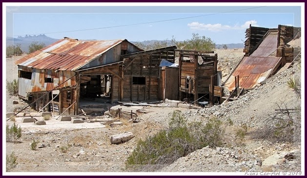
Trip Notes: Probably one of the most recognized landmarks for Searchlight is the dilapidated buildings and mine head frame for the Southern Nevada (Spokane) Mine (Figs. 01 & 03) that is located on the right side of US-95, just before entering the town. Click here for more pictures and information on this mine … Southern Nevada (Spokane) Mine. Because Searchlight is the ‘crossroads’ and jumping off point for several interesting locations, I usually end up making several passes through and or stops here yearly, though I have yet to visit for the purpose of just exploring Searchlight itself. Refer to the “History of Searchlight” section below. Listed below are links to pages and hiking locations that are within 30 miles of Searchlight.


EP-E-IMG_4319Cottonwood Cove: Cottonwood Cove is situated at the banks of Lake Mohave on the Nevada-Arizona border in Clark County, Nevada, just 13.5 miles east from the center of historic Searchlight, NV. Lake Mohave is approximately 67 miles long and is backed by the Davis Dam about 26 miles downstream at Laughlin, NV. This resort area is one of the best Large Mouth Bass fisheries in the West. Its marina has boat rentals, campgrounds, fuel, a cafe', marina store and a motel.


E-P1010865Walking Box Ranch Road: In the center of Searchlight, NV-164 (Nipton Rd.) heads west towards the California town of Nipton and the I-15. About six 6 miles out you come to the graded, yet quite bumpy, Walking Box Ranch Road which turns south towards the Walking Box Ranch. As far back as the 1890s, this section of desert was home to a 400,000 acre working cattle ranch. Besides the ranch site itself, many of these old corrals, water troughs, and other ranch features still remain scattered throughout this desert area. 12-15 miles out the Castle Peaks and the New York Mountain range provide nice views and hiking opportunities.


E-P1020456Wee Thump Joshua Tree Wilderness Area: At first glance, this flat, gently sloped alluvial plain between Searchlight and Nipton appears rather plain and boring; however, it offers a wide variety of plant life and occasionally, for the patient, glimpses of birds, lizards and other desert animals.Wee Thump Joshua Tree is a relatively small (6,050 acres) wilderness area established to protect a forest of dense, old-growth Joshua trees. The wilderness area is relatively flat, sloping gently from west to east at elevations ranging from about 5,000 to 4,100 feet. The area lies on the bajada below the South McCullough Mountains.


E-P1010939Crescent Peak and Crescent Peak Mine: The Crescent Peak mine (aka, Wood mine; Simmons mine, Turquoise mine, Aztec claim, Right Blue claim is located 12 west of the town of Searchlight, along the west flanks of Crescent Peak. At 5,994 feet, Crescent Peak provides views of the Ivanpah Valley, as well as the peaks of McCullough Mountain, Hart Peak, Castle Peak, Clark Mountain, Kingston Peak, and Spirit Mountain.


EP-P1030705Nipton California:Two miles from the Nevada/California border in east San Bernardino County, Nipton is about 10 miles west of Searchlight. Billed as, “The Gateway to the Mojave Desert”, today, Nipton is a privately owned, unincorporated town in San Bernardino County, California, on the northern edge of Mojave National Preserve, with a population of nearly 60 people. It has a historic hotel, eco-lodges, gift shop and a cafe.


   Paragraph divider
History of Searchlight: Searchlight is at an elevation of 3,540 feet. It was established in 1898, after the discovery of Gold in 1897. Initial discoveries of predominately gold ore were first made at this location on May 6, 1897 by G. F. Colton who filed the first claim, later to become the Duplex Mine. The Searchlight Mining District was founded July 20, 1898. The Quartette Mining Company, formed in 1900, became the mainstay of the Searchlight District, producing almost half of the area's total output. By October 1898 a post office and camp were in place roughly 3/4 of a mile from the original mine site. By the winter of 1899 the population increased to a point that one could call it an official town. Searchlight began to boom in 1902 In May, 1902, a 16-mile narrow-gauge railroad was built down the hill to the company's mill on the Colorado River. On March 31, 1907, the Barnwell and Searchlight Railroad connected the town with the then main Santa Fe line from Needles to Mojave. The busiest times for Searchlight were in 1907 thru 1910. There were many gold and silver mines that were excellent producers in the Searchlight Mining District. According to Geological Survey Paper 610, most of the Searchlight District’s gold and silver production came from the Duplex and Quartette Mines. The greatest activity, were between 1902 thru 1916. A reported 246,997 ounces of gold was produced from the lode mines. As a typical mining town, it had a reported population of 1,500 people. In fact, at the time it was larger than Las Vegas. Some reports say that it boomed to a point of 5000 people with over a dozen saloons, a telephone exchange, and 44 working mines. A panic hit between 1907 to 1910 where low grade ores needed more capital for continued mining. By 1919 trains were operating over the B and S Railroad only twice a week, and after a severe washout on September 23, 1923, halted traffic completely. Train service was never restored. When gold and silver mining production cost went up and the grade of the ore went down, people started to move on to the next boomtown. By 1927 the town’s population had dwindled to approximately 50 people. After many years of drifting off a new mill was built in 1934, but ended up shutting down just after 1935 due to lack of ore. Up to 1940, it is reported that total production amounted to $4.5 million.

How it got its name is still a mystery, however there has been much speculation. Some think it came from the name off a box of matches; according to a 1907 Searchlight Bulletin newspaper, there are several stories reported about the naming of our town, but the most popular is the one about Mr. G.F. Colton, while lighting his pipe with a Searchlight brand match (mfg. by the Diamond Match Co.) saw some rocks which contained stringers of gold, staked that claim and named it Searchlight. Another version is that a couple of prospectors, Mr. G.F. Colton and his partner Mr. A.E. Gus Moore, were in the area and one said to the other, “That rock contains gold!” His partner supposedly said, "If there's gold in that rock, you would need a searchlight to find it?" Another is that searchlights were once used to guide patrons into the brothels that were in area. Hence the town was named so Searchlight. I’ll leave it to you, to take your pick on the naming of Searchlight.

Over the past decade the town’s population has continued to decline. Today the Searchlight community has less than 500 residents. With the majority being retired, it struggles to support an eclectic mix of miners, ranchers, small business owners and artists. Its main attraction is the Cottonwood Cove Resort and Marina, located inside the Lake Mead National Recreation Area and administered by the National Park Service. Only fourteen miles down the hill is beautiful Cottonwood Cove, one of the best Large Mouth Bass fisheries in the West. The marina has boat rentals, campgrounds, fuel, a cafe', marina store and a motel. In addition, it is know for a history that includes many famous names: Clara Bow, Rex Bell, Edith Head, Louis Meyer, LT William Nellis, U.S. Senator Harry Reid, John Macready, James Cashman, and an endless list of colorful and fascinating characters that are fodder for the legends of the old west. Scott Joplin, who never lived in Searchlight, was so intrigued by the stories of his composer friend, Tom Turpin - who had spent time in Searchlight in his youth - that he composed a song called the Searchlight Rag.