On 03/18/2016 Harvey Smith, Jim Herring and myself decided to visit the area of the Rainbow Quarry and Aztec Tank after exploring the Contact and Pauline mine sites. This meta-quartzite mine area covers 920 acres and is located about seven miles northwest behind the town of Goodsprings Nevada. This unusual uplifted mound of Aztec sandstone is a very hard, uniquely multi-colored meta-quartzite that can be drilled, cut, and then polished, honed and utilized for a multitude of applications. Click here for pictures and information about this quarry ... Rainbow Quarry Aztec Tank.
Wednesday
Daytrip - Rainbow Quarry and Aztec Tank
On 03/18/2016 Harvey Smith, Jim Herring and myself decided to visit the area of the Rainbow Quarry and Aztec Tank after exploring the Contact and Pauline mine sites. This meta-quartzite mine area covers 920 acres and is located about seven miles northwest behind the town of Goodsprings Nevada. This unusual uplifted mound of Aztec sandstone is a very hard, uniquely multi-colored meta-quartzite that can be drilled, cut, and then polished, honed and utilized for a multitude of applications. Click here for pictures and information about this quarry ... Rainbow Quarry Aztec Tank.
Daytrip - Contact and Pauline Mines
On 03/18/2016 Harvey Smith, Jim Herring and myself decided to explore the Contact and Pauline mines out behind the town of Goodsprings, NV. Once we reached the Contacts' mine site we spent more than a half hour exploring the area. We were disappointed to learn that the BLM had seen fit to either fill-in or place steel bars all of the site's audits. After exploring this site we then continued up the road in search of the Pauline Mine. Click here for pictures and information about these mines ... Contact Mine & Pauline Mine.
Monday
Daytrip - Pauline Mine Road Rock Art Site
 |
| Click Picture to Enlarge |
My New Camera
Camera: In early 2016 I upgraded my everyday carry around (hiking) camera to the black Lumix DMC-ZS60 Digital Camera from Panasonic. Measuring only 4.4" wide x 2.5" high x 1.5" deep and weighing only 10 oz, this versatile, high-quality compact digital travel camera has a 18 MP, 1/2.3-inch High Sensitivity MOS sensor, a powerful Leica DC Vario-Elmar-branded 30x optical zoom lens (720mm-equivalent telephoto.), a five-axis image stabilization system, electronic viewfinder and a rear-panel LCD monitor, and a ring around the camera's lens for adjusting certain controls (such as shutter speed in shutter priority) are altered by it, but you can customize it to adjust something else if you prefer. Check it out here ... My Equipment.
Friday
Daytrip - Ash Spring at Calico Basin
On 03/08/2016, Harvey Smith, Robert Croke, Blake Smith and myself decided to hike to Sloan Canyon. Unfortunately, the road was closed until late May. We then mad a decision to take a trip out to Calico Basin to hike the Ash Spring trail. Click the following link for pictures and a description of this hike ... Ash Spring @ Calico Basin - 03/08/2016 Trip Notes.
Saturday
Daytrip - First Creek Canyon Hike - RRNCA
On 03/03/2016, Robert Croke, Blake Smith and myself decided to return to First Creek Canyon in the Red Rock National Conservation Area in hopes of seeing water at the location of the creek's waterfall. Unfortunately, even though there was considerable water flowing down First Creek, and the "plunge pool" below the area of the creek's "pour-over"/waterfall contained much more water than on our previous visit, there was no water flowing over the pour-over area. This was still a great morning hike, and provided many more additional picture taking opportunities. Click the following link for pictures and a description of this hike ... First Creek Canyon Hike - 03/03/2016 Trip Notes.
Daytrip - Death Valley National Park
On 02/23/2016, I drove to Death Valley with Blake Smith and my wife Connie. The purpose of the trip was to photograph spring wildflowers. As we arrived from the East Entrance to the Furnace Creek Inn, we were encouraged by the spotting of a great color combo consisting of Golden Evening Primrose (Camissonia brevipes), Notchleaf Phacelia (Phacelia crenulata) and Purple Mat (Nama demissum) decorating Furnace Creek Wash. Today's visit was outstanding. We were all amazed by the vistas everywhere we looked that were blanketed in wildflowers. From what I've heard, it appeared to revival the bloom of 2005, which was touted as the best flowers in 100 years. Click here for pictures and descriptions ... Death Valley National Park Flora.
Daytrip - Top of the World Hike (VOF)
On 02/13/2016 my hiking partner Robert Croke and myself hiked Valley of Fire's "Top of the World" hike for the second time. On today's hike we accompanied 24 other hikers on a "guided" tour led by one of the parks' rangers. The main reason we signed up for this hike was to find out if there was an easier route to reach the top than the one we had previously hiked back in 2013. Click here for pictures and a description of this hike ... Top of The World Hike (VOF) - Trip Notes for 02/13/2016.
Wednesday
Index Category for - Nevada Mining Districts & Mines
This page last updated on 12/05/2018
Nevada Mining Districts
Unknown Mining District
Anniversary Mine - Lovell Wash
------------------------------------
Bullfrog Mining District [Bullfrog Mining District]
Gold Ace Mine
Carrara Marble Mine
------------------------------------
Crescent Mining District
Nippeno Mine
------------------------------------
Gold Point District of Esmarada County [Gold Point District]
Great Western Mine & Mill
Seibeck Mine
Townsite Shaft and Orleans Mine
------------------------------------
Goodsprings Mining District - North [Goodsprings Mining District - North]
Potosi Mine
Contact Mine & Pauline Mine
Red Cloud Mine - Goodsprings (North) Mine District
Pilgrim Mine - Goodsprings (North) Mine District
Unknown Mine
------------------------------------
Goodsprings Mining District - West [Goodsprings Mining District - West]
The Green Copper Mine
The Middlesex Mine
Yellow Pine Mine
The Prairie Flower Mine
The Yellow Pine Extension Mine
Keystone Mine
Iron Gold Mine & Lavina Mine
Sandy Valley Road Mines (North Side) [Sandy Valley Rd Mines (North Side)]
The Whale Mine
The Ingomar Mine
------------------------------------
Goodsprings Mining District - South [Goodsprings Mining District - South]
Sandy Valley Road Mines (South Side) [Sandy Valley Road Mines (South Side)]
The Argentena Mine & Mill
The Columbia Mine
Crystal Pass Mine
Ireland Mine
Llincoln Mine
------------------------------------
Searchlight Mining District
Southern Nevada (Spokane) Mine
------------------------------------
Sunset Mining District [Sunset Mining District]
Lucy Gray Mine
Tuesday
Eldorado Mining District
Need to Edit this:
Background on Eldorado Mining District: Originally called the Colorado Mining District, it was later referred to as the Eldorado Canyon and Nelson District. The first real discovery in the area was at the Honest Miner, a small deposit about two miles west of Nelson. For a few years, the miners were able to keep their gold find a relative secret due to the remoteness of the area. However, this all changed in 1858 when the first steamboats began to make their way up the Colorado River from Yuma, Arizona. Before long, word spread and miners began to flood the area. The early history of the district saw construction of a mill at Nelson’s Landing where steamboats provided access for supplies and communication with the world. In the early 1900s Nelson’s Landing was one of the largest ports on the Colorado River and became even more important during prohibition in the 1920’s as bootleggers ran their white lightning into Arizona.
At the time of the Eldorado mining District's organization this area was in New Mexico territory, later to become part of Arizona territory and eventually part of Nevada. It has been estimated that production of the district prior to 1897 may have been over 100,000 ounces, most of which came from the Techatticup Mine, just a few miles south of Nelson, where ore grades were several ounces of gold per ton. At today's prices that would equate to nearly $5,000,000 dollars. The principal mine producers have been the Techatticup, Duncan, Wall Street, Rand and Carnation mines. Other smaller producers included the Magnolia, Poppy, Jubilee and Crown mines. Vanderburg reported that production from El Dorado from 1907 to 1935 was $1.6 million, nearly all from lode gold and silver mines. Bullion shipments from El Dorado were not well recorded. As might be expected, shipments were not made by the normal express company system that was typical of the Mother Lode and Comstock regions. They were made privately, hence a distinct lack of reporting. At least two early shipments were recorded. In June, 1864, it was reported that 101 pounds of bullion went to Los Angeles, and in December, 1865, it was reported that $20,000 in bullion had arrived in San Francisco creating quite a stir. At today’s prices that one shipment would have been more than $270,000. In recent years there has been steady production from the Mocking Bird mine and significant "heap leach" production from the Wall Street mine from 1974-1984 by Consolidated Eldorado Mining Company and Intermountain Exploration Company.
Eldorado Canyon is located 39 miles southeast of Las Vegas. According to local lore, the Spanish explorers from Mexico and their Indian guides discovered gold in Eldorado Canyon as early as 1775. It was not until the news of a discovery of gold by Johnny Moss, a trapper who discovered ore in the Opal Mountains during the spring of 1861, that a rush of prospectors from California were attracted to Eldorado Canyon. Within a year, the Southwest Mining Company and El Dorado Mining Company had established working mines in the valley. The Techatticup Mine, which was the principal mine of Eldorado Canyon, opened in 1863. By this time four different townsites had been laid out, but the canyon was isolated, supplies difficult to bring in, and the camps had reputations for violence and lawlessness. In 1865 a post office was established, and in 1867 an Army Military Post was established to protect the steamboat traffic from hostile Indians. The Techatticup Mine was the most productive in the district, and by 1883 the company constructed its own fifteen-stamp mill to avoid the expense of freighting the ore for processing. With the coming of the railroad in 1905, mining revived in the district, and a fifty-ton smelter was developed seven miles west of Eldorado Canyon. A new townsite was laid out closer to the smelter and mines, and the older settlement moved to the new town of Nelson where a new cyanide mill was constructed to process the gold. Over half of the total production for the area was mined from the Techatticup mine.
Rainbow Quarry & Pauline Mine Road (Summary Page)
{Click on an image to enlarge, then use the back button to return to this page}
This page last updated on 04/18/2018
 |
| (Fig. 01) |
 |
| (Fig. 02) |
Rainbow Quarry Background: This meta-quartzite mine area covers 920 acres and is located about seven miles northwest behind the town of Goodsprings Nevada. The unique multi-colored meta-quartzite is a very hard, versatile stone that can be drilled and cut (Fig. 04) and then polished, honed and utilized for a multitude of applications (Fig. 03). This colored quartzite has been extracted from this mine since the 1930's. Its range of colors, ranging from light pink to a deep burgundy, make the name "Rainbow Quarries" quite literal. It has been used in some of Frank Lloyd Wright's designs, Bugsy Siegel's Flamingo Hotel, Wilbur Clark's Desert Inn and in the City Center and even the most recent Delano Las Vegas. The entrance leading to the lobby at the Downtown Delano Las Vegas contains two 700 million year-old, 126,000 pound metaquartzite boulders, entitled "In between Places", compliments of the Rainbow Quarry and Las Vegas Rock, todays current quarry operator. Presently, the mine outputs about 200,000 tons per year.
 |
| (Fig. 03) |
 |
| (Fig. 04) |
Geologic History: At the beginning of the Jurassic period, a great belt of sand dune were deposited. Over time, the dunes were sorted and sifted, the grains weathered and dissolved until the result became a pure quartz - silica glass. During the Cretaceous Period, 100 million year later, the earth's crust was compressed and the rocks deep within the earth were thrust to the surface along shallow-angle faults. The stunning ridgelines that finally surfaced near Goodsprings were the result of these actions. Analyses and geochemical testing have demonstrated that the rock's compositions at LV Rock's mine is 97-98% silica. No other sandstone quite like this has been found anywhere in the world.
05/03/2017 Trip Notes: Today Harvey Smith, Jim Herring and I visited Goodsprings Valley for a trip to the Aztec Quarry area. We drove up Pauline Mine Road to the Aztec Tank Road. Along the way we spotted a group of 12 wild horses. Click here for pictures and information on this trip ... Pauline Mine Road - Trip Notes for 05/03/2017.
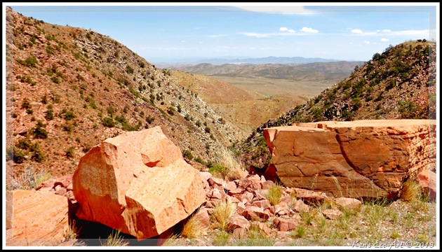
03/18/2016 Trip Notes: While visiting some other locations in the area, I made a brief stop by driving up Aztec Tank Road to once again enjoy the beautiful views visible from this area (Figs. 08 thru 13).Harvey and i made another trip out to Goodsprings Valley to hike up Pauline Mine Road in search of some fossilized coral. Click here for pictures and information on this hike ... Pauline Mine Road - Trip Notes for 03/18/2014.
02/20/2014 Trip Notes: Today I made a trip out to Aztec Tank with the rock-hounds from the Henderson Senior Facility. After hiking nearly two miles out on the Pauline Mine road, I led them up Aztec Tank Road that leads to the old sandstone quarry. Having never been there before, everyone enjoyed the areas' geology and the sweeping views of the surrounding mountains and valleys. Click here for pictures and information on this hike ... Aztec Tank - Trip Notes for 02/20/2014.
08/20/2013 Trip Notes: Before heading home from a ride to the top of Mount Potosi, we decided to drive out to the Aztec Tank area and up Aztec Tank Road (refer to Fig. 02). Contact Mine and an area identified on the map as Aztec Tank. Other than the fact that this area is filled with beautiful Aztec sandstone, the only thing I can guess about the area’s name,“Aztec Tank”, is that it contains a deep wash that may fill up with water during a heavy rain, acting like a reservoir.
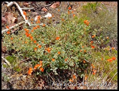
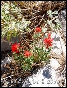
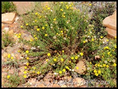
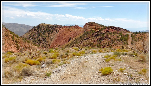
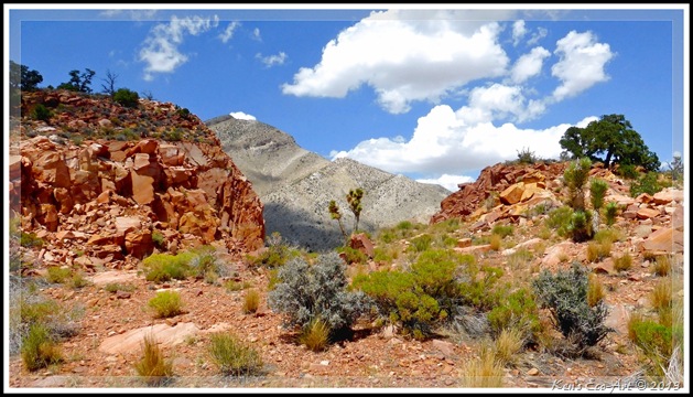
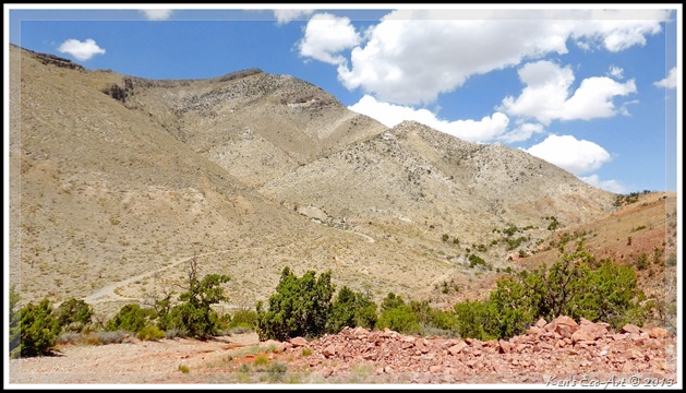
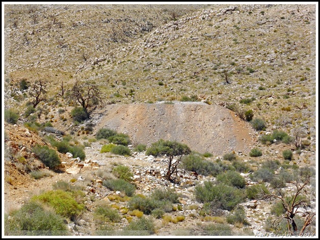
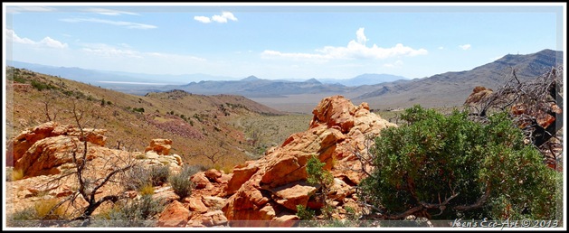
The relatively short drive out to this area provided us not only with colorful scenery and great views of the Potosi Range, but a desert floor that was covered with hundreds of wildflowers, including Globe Mallow Fig. 05), Desert Paintbrush (Fig. 06), and a variety of desert sunflowers (Fig. 07). Once we reached the end of Aztec Tank Road, seen in (Fig. 08), elevation 5,500 feet, we were again witness to some outstanding views. The view in (Fig. 09) is looking south, back towards the town of Goodsprings. Looking north provided distant views of Potosi Mountain (Fig. 10). In hiking around this area it was obvious that someone the Rainbow Quarry had been performing some extensive blasting and quarrying here. Looking towards the northwest from the top of Aztec Tank Road, we located the site of the Contact Mine off in the distance, center of (Fig. 11). Unfortunately, upon leaving this area as we attempted to drive there, the road was blocked with several large boulders, preventing us from getting any closer. As it was getting late, we decided not to hike up to the two tailing sites (Fig. 12). Calling it a day, we began the drive back down Pauline Mine Road, center of (Fig. 13), and headed back to Goodsprings for a cold beer at the Pioneer Saloon. This ended up being a great little side trip.
|
|
|
 |
| (Fig. 08) |
 |
| (Fig. 09) |
 |
| (Fig. 10) |
 |
| (Fig. 11) |
 |
| (Fig. 12) |
 |
| (Fig. 13) |
Contact Mine & Pauline Mine
{Click on an image to enlarge, then use the back button to return to this page}
This page last updated on 06/15/2017
 |
| (Fig. 01) |
 |
| (Fig. 02) |
 |
| (Fig. 03) |
There were two principal workings - a tunnel that extended about 160 feet southwest and a shaft on an incline of about 40-degrees several hundred feet west of the tunnel. From the shaft there are drifts northeast at 90 feet below the top and at the bottom, possibly 300 feet in all. The ore occurred in dolomite breccia recemnted by a reddish dolomite. The ore was largely earthy hydrozincite and calmine, locally associated with galena and oxidized lead minerals. Cuprodescloizite and aurichalcite were also found here and there. Production shipments of this mine between 1912 and 1925 shows that a total of 681 tons of crude ore was removed from this mine, resulting in 1,040 ounces of Silver, 64,979 pounds of Lead and 319,430 pounds of Zinc.
Description of the Pauline Mine: The Pauline lies about a half mile northeast of the Contact mine (refer to Fig. 02). Much less is known about this mine. Only about 250 feet of work had been done here, most of it in a tunnel that extended generally northwest. Some ore had been stoped above the tunnel 75 feet to the southwest. Though there is no official record of shipments from this mine, some material had doubtless been shipped. The dump contains a number of lead, zinc, and copper minerals, but probably the most abundant was cuprodescloizite.
 |
| (Fig. 04) |
 |
| (Fig. 05) |
In addition to the main openings we notice at least two other audits further up the ravine on the southwest side of the hillside. Near the mountaintop directly above the main workings, (seen top center in Fig. 01) there appeared what to be either a man-made cave or a mine adit. Here is what it looked like when I zoomed in on it (Fig. 07). While driving the open Goodsprings Valley, on the way to the sites, we spotted three stands of wild horses, each containing 4-6 (Fig. 08). Even though I have spotted many horses out here several times before, you don't see wild mules as often (Fig. 09). Learn more here ... Mule (Equus mule). After exploring this site we continued hiking up Pauline Road, to the top of the ridgeline to the northeast in search of the Pauline Mine. This turned out to be a vary steep climb with a lot of loose gravel. (con't below)
 |
| (Fig. 06) |
 |
| (Fig. 07) |
 |
| (Fig. 08) |
 |
| (Fig. 09) |
 |
| (Fig. 10) |
 |
| (Fig. 11) |
 |
| (Fig. 12) |
Play a Slide Show
Clicking the picture-link below will open OneDrive in a new window and a folder containing 31 pictures taken on this hike to the Contact and Pauline mines located behind Goodsprings, Nevada. To view the show, click on the first picture in the folder and you will get the following menu bar:
Click the "Play slide show" will play a fullscreen window of the slide show.
La Madre Spring (RRCNCA) - Trip Notes for 03/25/2016
{Click on an image to enlarge, then use the back button to return to this page}
This page last updated on 06/15/2017
 |
| (Fig 01) |
 |
| (Fig. 02) |
 |
| (Fig. 03) |
 |
| (Fig. 04) |
 |
| (Fig.05) |
 |
| (Fig. 06) |
 |
| (Fig. 07) |
 |
| (Fig. 08) |
 |
| (Fig. 09) |
 |
| (Fig. 10) |
 |
| (Fig. 11) |
 |
| (Fig. 12) |
 |
| (Fig. 13) |
 |
| (Fig. 14) |
 |
| (Fig.15) |
Go back to the summary page [La Madre Springs/Dam Hike]
Play a Slide Show
Clicking the picture-link below will open OneDrive in a new window and a folder containing 32 pictures taken on this hike to the La Madre Springs and Dam in Red Rock Canyon. To view the show, click on the first picture in the folder and you will get the following menu bar:
Click the "Play slide show" will play a fullscreen window of the slide show.
Subscribe to:
Posts (Atom)


