 |
| Click to enlarge |

Wednesday
Daytrip - Wee Thump Joshua Tree Wilderness Area
Tuesday
Daytrip - St. Thomas Nevada
 |
| Click to enlarge |
Monday
Daytrip - Ghost Mining Town of Delamar, Nevada
 |
| Click to enlarge |
Daytrip - Yucca Peak Fossil Beds hike at DNWR
 |
| Click to enlarge |
Saturday
St. Thomas - 10/13/2016 Trip Notes
{Click on an image to enlarge, then use the back button to return to this page}
 |
| (Fig. 01) |
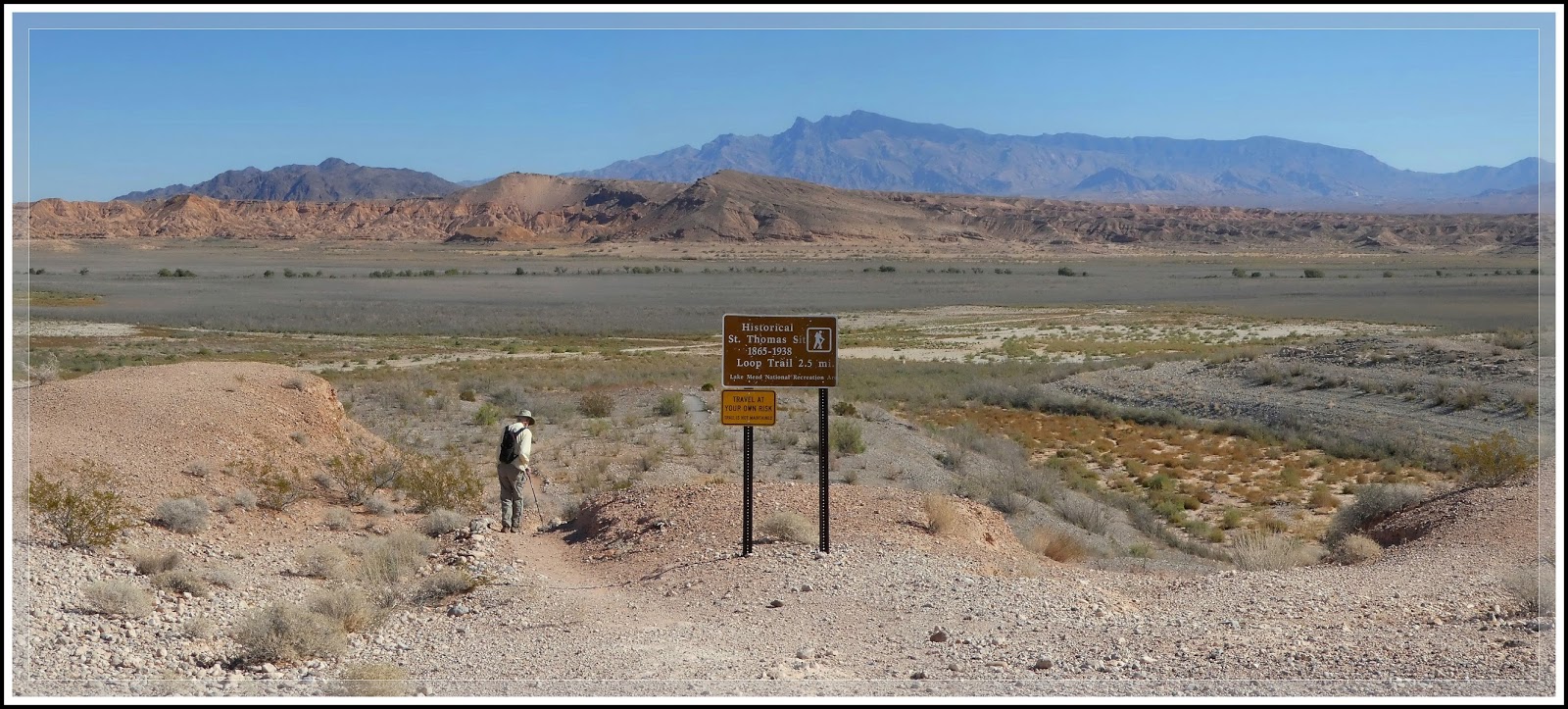
Directions: St. Thomas is located approximately 82 miles NE of Las Vegas. From the Stratosphere Casino head northeast on Las Vegas Blvd about 3 miles and turn right to merge onto US-93/95. Go 12.5 miles and Merge onto NV-564 E/W Lake Mead Pkwy via Exit 61B. Heading east on NV-564 (Lake Mead Blvd) go over the mountains (passing between Frenchman Mountain to the south and Sunrise Mountain to the north) to the park entrance station. Pay the entrance fee ($5 per car or an annual pass), and proceed to the T-intersection with Northshore Road (NV Rt 167) and Lakeshore Road (NV Rt 166). Bear left and drive north on Northshore Road (NV 167) towards Overton, NV. Turn right opposite the Valley of Fire Road onto Old St. Thomas Road and travel 3.3 miles to the parking area and trailhead at the end. The picture in (Fig. 01 above) is of Blake Smith heading out from the parking and trailhead area.
 |
| (Fig. 02) |
 |
| (Fig.03) |
 |
| (Fig. 04) |
 |
| (Fig. 05) |
 |
| (Fig. 06) |
 |
| (Fig. 07) |
 |
| (Fig. 08) |
 |
| (Fig. 09) |
 |
| (Fig. 10) |
 |
| (Fig. 11) |
 |
| (Fig. 12) |
Note: The Union Pacific railroad built a branch down to the valley and used St Thomas as a terminus, between 1910 and 1918. In 1912, the San Pedro, Los Angeles & Salt Lake Railroad built a spur to St. Thomas to haul produce from local farms and ore from the gold and copper mines in the surrounding hills. A large salt mine was located just south of St. Thomas. It was a busy frontier town. The farmers there grew a wide variety of crops, including peaches, melons, grapes, figs, wheat, barley, corn, almonds and asparagus. Then during the First World War the price of copper rose and with thousands of head of stock being freighted from St Thomas to Grand Gulch mine things really got lively. It was at this same time that the Arrowhead Trail was built through the Valley of Fire to St Thomas, which caused the tourist business to grow for the Gentry Hotel.
Wee Thump Joshua Tree Wilderness Area - Summary Page
{Click on an image to enlarge, then use the back button to return to this page}
This page last updated on 06/12/2017
 |
| (Fig. 01) |
 |
| (Fig. 02) |
Directions: From the Stratosphere Casino head northeast on Las Vegas Blvd about 3 miles and bear right to merge onto US-515/93/95 south towards Boulder City. Follow US-93/95 for 17 miles and then merge onto US-95 South (Veterans Memorial Hwy) toward Searchlight/Laughlin/Needles. When you reach Searchlight, about 36 miles, turn right, west, onto NV-164 (known at the Joshua Tree Highway) towards Nipton. The trailhead and the Wee Thump East Road is located on the right (Fig. 02), about 8.2 miles west of Searchlight.
Description: First, it must be noted that the large sign shown in (Fig. 01) that once stood at the entrance to the Trailhead (TR) and the Wee Thump East Road (Fig. 02) has been vandalized by locals and no longer exists. "Wee Thump" is Paiute for "ancient ones."
The Southern Nevada area has been in a drought for the past 15 years. Even though rain and snowfalls fluctuate year to year, on average over the past 16 years water tables throughout the state have been dropping like a rock. As a whole the desert is a harsh environment of mostly sand and rock where the evaporation rate far exceeds precipitation. Even though plants and animals have special adaptions to deal with harsh conditions such as extreme heat, cold and lack of water for long periods, the drought is finally reaching a point where many are near the end of their life cycles. I have evidenced many cacti which can go years without proper watering are beginning to just dry up and die. Wildlife levels, do to a scarcity of adequate plant-life to feed upon, have noticeably fallen over the same period. In spite of all this, there is the ever enduring Joshua tree, that is in fact, not a tree.
It's a tree-like succulent that is actually a member of the agave family. For more information on the Joshua Tree check out the following page ... Joshua Tree (Yucca brevifolia). It is impossible to estimate their age as their trunks are filled with fibers instead of the growth rings found in typical trees. Its primary pollinator is the yucca moth that nurses its large, soccer ball-sized flower with its cream-colored petal. It appears to be a malformed peculiarity with gangling and odd shaped branches that seem to point in no particular direction. It is found in mostly Mojave Desert ecozones.
At first glance, this flat, gently sloped alluvial plain between Searchlight NV and Nipton CA appears rather plain and boring; however, it offers a wide variety of plant life and occasionally, for the patient, glimpses of birds, lizards and other desert animals. Wee Thump Joshua Tree is a relatively small (6,050 acres) wilderness area that was established to protect a forest of dense, old-growth Joshua trees. The wilderness area is relatively flat, sloping gently from west to east at elevations ranging from about 5,000 to 4,100 feet, in a roughly triangular valley (Fig. 02) between the McCullough and Highland ranges and the north shoulder of the New York Mountains, just west of Searchlight, NV. The area lies on the bajada below the South McCullough Mountains. The bajada, composed entirely of outwash materials from the McCullough Mountains, dominates the local geology. Alluvial soils are deep and well sorted, with few rocks of any size in the wilderness area. The soils appear to be coarse-grained decomposed granite, but they are the decomposition products of metamorphic rocks.
There are several places along the highway between Searchlight and Nipton where one can spend hours visiting this and other areas looking for rocks and snapping pictures of Joshua trees, the Prickly Pear Cactus, the Buckhorn Cholla, the Mojave (Banana) Yucca, Blackbrush, the Creosote Bush (Larrea tridentata and a variety of other low-growing desert shrubs. The Joshua trees in this area were some of the largest I've ever seen. The only place on earth in which they live is the Mojave Desert. The area is also known for a diverse community of Mojave desert life, including kit fox, great horned owl, the gilded flicker (which is known to occur in Nevada only at this location) and the federally threatened desert tortoise.
Trip Notes: The purpose of this page is to act as a summary by providing links with pictures and descriptions of my various hiking visits to this spot over the past several years. Obviously, the primary focus here are the Joshua Trees. For more information on the Joshua Tree check out the following page ... Joshua Tree (Yucca brevifolia). The trip notes below provide information and pictured from each of my previous visits.
10/22/2016 Trip Notes: My most recent visit was with my friend Jim Herring, who had never been here before. Because this was my third visit, I didn't take very many pictures. On today's visit we drove about half way into the wilderness, further than I had hiked on my previous visits (Fig. 03). As you can see from (Fig. 04), with Jim standing in front of it, we did encounter some very large trees.
 |
| (Fig. 03) |
 |
| (Fig. 04) |
 |
| (Fig. 05) |
(OPTION 1) Each show is designed to run automatically in place, without leaving the current browser window. If the show is not already running, just click the large "Play" button in the middle of the picture and let it run. (OPTION 2) Running the cursor over the picture being shown will PAUSE the show and bring up a navigation bar at the bottom of the slideshow window with Pause, Forward and Back buttons, allowing you to start, stop or manually forward or back up pictures one at a time. |
Cottonwood Valley Road - 10/29/2016 Trip Notes
{Click on an image to enlarge, then use the back button to return to this page}
This page last updated on 04/14/2018
This page last updated on 04/14/2018
 |
| (Fig. 01) |
Description: This 11 mile, unmaintained dirt road is bounded by the Potosi Mountain Range on the west and the Birdspring Range on the east (Fig. 01). The majority of this narrow road is relatively well maintained, and sometimes travels through several wash areas that can be quite rocky. Along the length of the road it passes several side roads, but the Cottonwood Valley Road is usually obvious, straight ahead. However, a portion of the northern end of the road, especially near Cottonwood Pass, is quite washed out and rough, and definately requires a 4WD vehicle.
10/29/2016 Trip Notes: On this trip, Jim Herring and I rented a jeep and decided to first visit Goodsprings and then out to the large redstone crop out behind the town. We first drove up Pauline Road to the north end of the outcrop and hiked up Aztec Road for a look around. Pauline road was in must worse shape than it was on my previous visit. On the way out we encountered a small band of wild horses on the east side of the road (Figs. 02 & 04). Once we reached Aztec Road, a nice view northwest from the top looked towards the Mt. Potosi Range and the Contact Mine (center of Fig. 05), a place we had visited on a previous trip ... Contact Mine & Pauline Mine. On the way back to the Goodsprings Bypass road to the the intersection of Cottonwood Valley Road, we passed a second band of different horses (Figs. 06 & 07). (notes continued below)
 |
| (Fig. 02) |
 |
| (Fig. 03) |
 |
| (Fig. 04) |
 |
| (Fig. 05) |
 |
| (Fig. 06) |
 |
| (Fig. 07) |
 |
| (Fig. 08) |
 |
| (Fig. 09) |
 |
| (Fig. 10) |
 |
| (Fig. 11) |
Click here to return to the summary page ...
Yucca peak Fossil Beds Hike - 10/04/2016 Trip Notes
{Click on an image to enlarge, then use the back button to return to this page}
This page last updated on 06/15/2017
 |
| (Fig. 01) |
 |
| (Fig. 02) |
 |
| (Fig. 03) |
 |
| (Fig. 04) |
 |
| (Fig. 05) |
 |
| (Fig. 06) |
 |
| (Fig. 07) |
 |
| (Fig. 08) |
 |
| (Fig. 09) |
 |
| (Fig. 10) |
 |
| (Fig. 11) |
 |
| (Fig. 12) |
 |
| (Fig. 13) |
 |
| (Fig. 14) |
 |
| (Fig. 15) |
 |
| (Fig. 16) |
Return to the Yucca Fossil Ridge Summary page ...
St. Thomas Nevada - Summary Page
{Click on any image to view full size, then use the back button on your browser to return to this page}
This page last updated on 04/17/2018
This page last updated on 04/17/2018
|
| (Fig. 01) |
 |
| (Fig. 02) |
Directions: St. Thomas is located approximately 82 miles NE of Las Vegas. From the Stratosphere Casino head northeast on Las Vegas Blvd about 3 miles and turn right to merge onto US-93/95. Go 12.5 miles and Merge onto NV-564 E/W Lake Mead Pkwy via Exit 61B. Heading east on NV-564 (Lake Mead Blvd) go over the mountains (passing between Frenchman Mountain to the south and Sunrise Mountain to the north) to the park entrance station. Pay the entrance fee ($5 per car or an annual pass), and proceed to the T-intersection with Northshore Road (NV Rt 167) and Lakeshore Road (NV Rt 166). Bear left and drive north on Northshore Road (NV 167) towards Overton, NV. Turn right opposite the Valley of Fire Road onto Old St. Thomas Road and travel 3.3 miles to the parking area and trailhead at the end. Though this road was wash out back in May of 2016, it has since been "regraded" and can be reached without a high clearance vehicle.
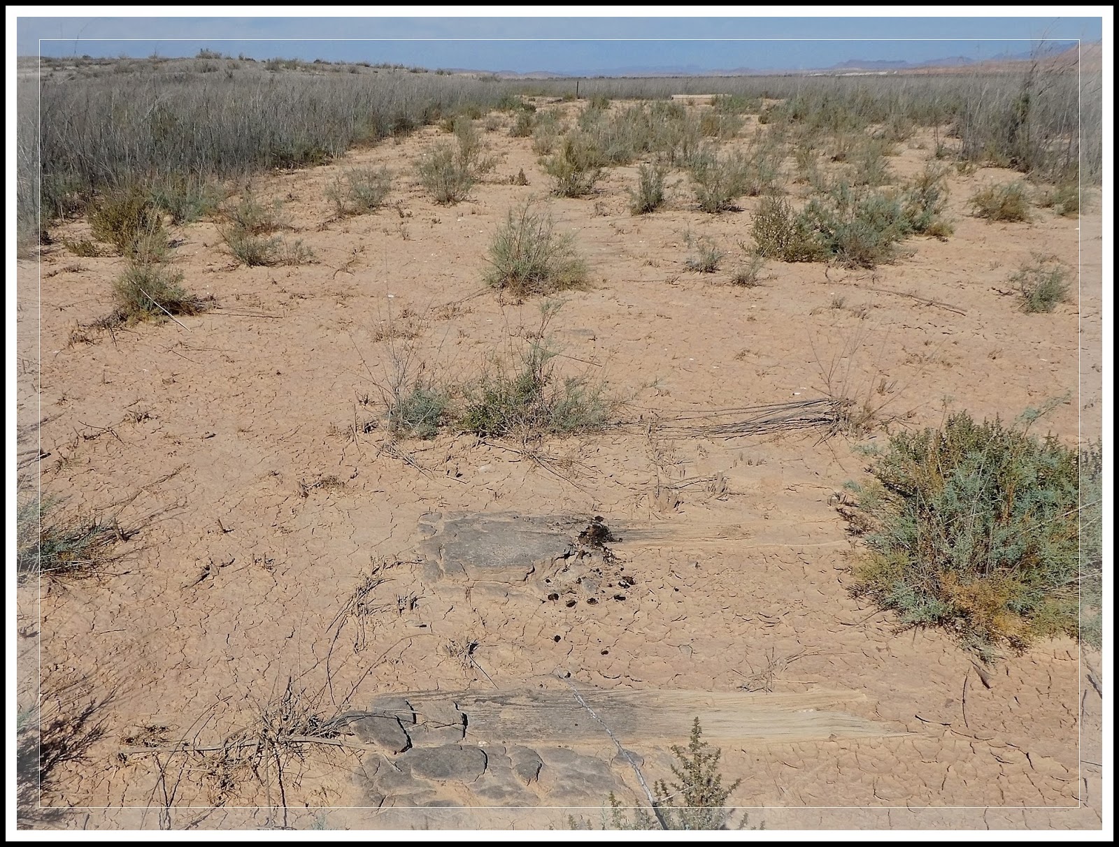
General Description: St. Thomas, Nevada, elevation 1,204 feet, is a ghost town in Clark County, Nevada, in Mopa Valley near where the Muddy River flows into the Colorado River (Fig. 02). I have hiked this location on four occasions. From the parking and trailhead (Fig. 01), it is a moderate 2.5 to 3 mile hike to the shoreline, out and back hike. Do not wander too far off the trail or you may get stuck in the mucky sediment that used to be underwater. In addition, the town site has been over-run with an invasive plant species called Tamarisk. You must be careful not to walk on the stumps of the Tamarisk. These hardy plants are both a nuisance and a potential safety hazard. The branches and leaves can produce cuts and bruising, while the trunks are very hardy and when cut to a stub (Fig. 04) can puncture the soles of your shoes. The is a vault toilet near the trailhead.
St. Thomas was purchased by the US Federal Government and was finally abandoned as the waters of Lake Mead, created by the building of the Hoover Dam, submerged the town. It is now located within the Lake Mead National Recreation Area. The fluctuations of the lake water levels resulting from a series of droughts, St. Thomas has arisen from the depths several times since 1938; in 1945, 1963, and 2012. Today the town is still exposed and visitors can roam the roads and trails that were once a thriving wild west town. The map in (Fig. 03) is a pre-flooding reconstruction of St. Thomas. The path we hiked of our recent 10/13/2016 visit is shown in yellow.
|
| (Fig. 03) |
|
| (Fig.04) |
| 01/16/2014 Trip Notes: This was my third visit to this ghost town with the rock-hounds from Henderson’s Heritage Park Senior Facility. On this visit I was armed with a better map showing the layout for many of the towns more prominent buildings. As a result I was better able to identify more of the exposed foundation remains. Though it is very difficult to be 100% sure about the following foundation/building identifications - I have made them by judging their relationship on the map to various foundations that I am sure of. Click here for pictures and info on today’s visit … St. Thomas 01/16/2014 Trip Notes. |
04/05/2012 Trip Notes: This was my second visit to this town in four months. This three-mile hike provides the perfect opportunity to stroll walk back in time and use your imagination to envision what life was like before the waters of Lake Mead covered this small farming and railroad community; of days when schoolboys climbed the fruit trees and its fields were filled with orchards and grains. Though I had been hopeful that I would be able to capture some budding plants and flowers, it was still too early in the spring. I did however, locate a few major foundations that I had missed on my previous visit here. Click here for pictures and info on today's visit ... St Thomas - 04/05/2012 Trip Notes.
12/15/2011 Trip Notes: This was one of the more interesting places we visited all year. Out of curiosity I decided to do some additional research on the town's history so as to add more meaning to the pictures that I captured on today's hike. Click here for pictures and info on today's visit ... St. Thomas - 12/15/2011 - Trip Notes.
Subscribe to:
Posts (Atom)