{Click on an image to enlarge, then use the back button to return to this page}
This page last updated on 04/13/2017
 |
| (Fig. 01) |
Directions: From the Stratosphere Casino head southwest for 0.3 miles on S. Las Vegas Blvd toward W. Baltimore Ave. Turn right onto W Sahara Ave for 0.7 miles and merge onto I-15 North via the ramp to Salt Lake City. Travel 3.9 miles and take exit 45 for Lake Mead Blvd, then turn right onto NV-147 E/E Lake Mead South Blvd. Travel 13.4 miles, past the base of the Sunrise and Frenchman Mountains, and turn right onto a gravel road. To continue to Lava Butte, go 1.3 miles and turn left and travel 85 feet and turn left again. Go 0.7 miles and turn left and go 0.9 miles. All told you will drive approximately 2.9 miles from the initial turn off to the parking area, which is beneath some power lines. The road will fork on occasion, but has markers that say Lava Butte along the way, take note because if you see a marker for Rainbow Gardens you will know you are off course.
Rainbow Garden Description: This whole area
, located just west of the Lake Mead National Recreation Area near Lava Butte (Fig. 01), a large black volcanic mountain, is generally referred to as The Rainbow Gardens. As seen on the map in (Fig. 02), the area of Rainbow Gardens contains three roads, Black Butte Rd, Rainbow Gardens Rd, and Kodachrome Rd, running north to south and spanning from east to west. The Rainbow Gardens that surrounds Lava Butte is known for its many colorful rock layers which are made up of gypsum, quartz and many other minerals. The Frenchman Mountain-Rainbow Gardens area lies on federal land managed by the Bureau of Land Management (BLM). Until the mid-1990s, the main public uses of the Frenchman Mountain-Rainbow Gardens area were uncontrolled target shooting, illegal dumping, and off-road vehicle use. As the Las Vegas population grew and began to encroach the foot of Frenchman Mountain (Fig. 02), target shooting was no longer permitted in this area. Stricter anti-dumping laws are now much more aggressively enforced, and much of the old trash has been removed during BLM-Boy Scout-volunteer clean-up campaigns. Not least because of an endemic species of bearpaw poppy (Arctomecon sp.), whose habitat is fragile and disappearing, but also to protect geologic resources. Exposed rocks in this region date back more than one billion years, representing every major era of Earth's development. The oldest exposed rocks are to the west in and around Frenchman Mountain, including the 1.8 billion year old Vishnu Schist, the oldest exposed rock in North America. In 2000 the BLM classified the Rainbow Gardens as an "area of critical environmental concern," which carries with it a measure of protection from unrestricted off-road vehicle use and other abuses. Rainbow Gardens and the many surrounding hills have coral and shell fossils from the Paleozoic era along with crystalline gypsum, quartz and many other minerals. The ravines and washes hold many fossils washed down from the surrounding hills. When hiking Rainbow Gardens, look for Pinnacle Butte (also known locally as "Hitchhiker's Butte") and Red Needle. Depending upon the time of year, keep your eyes open for rattlesnakes. Other animals you may encounter wile hiking this area include desert tortoise, lizards, the cotton tale, the burrowing owl, Big Horn Sheep, wild donkeys, coyote, badgers, chip monks and raptors.
Lava Butte Description: The view of Lava Butte in (Fig. 01) was taken from Northshore Drive, just past Lake Las Vegas, looking northwest in the early morning hours shortly after entering the Lake Mead National Recreational Area that boarders the east side of Rainbow Gardens. Composed of Dacite, an igneous volcanic rock, Lava Butte is part of a geologic wonder called Frenchman’s block that may have been a volcanic dome formed over 13 million years ago. Geologists are still arguing about this. It was formed when fresh lava forced itself between the older, adjacent layers when they were horizontal. As with many rocks in the Lake Mead region, tectonic activity has moved this rock tens of miles to the west from where it first spewed from the Earth. The dark outer coating on these iron oxide rocks is desert varnish. The many smaller hills and peaks in the area composed of limestone that are much easier to climb. At a mere 2,871' above sea level, Lava Butte rewards nice summit views of the surrounding mountainous areas, as well as Lake Mead, the City of Las Vegas, and Lake Las Vegas. The most prominent point in the area of Rainbow Gardens, the picture in (Fig. 03) was taken from Lava Butte Road on the approach to the Mountain.
Lava Butte Hiking Notes: There is no real trail on this hike, although from time to time you may see remnants of one. Aim for the saddle on the south side, which will eventually follow a ridge all the way to the top.
Elevation: 2,871 feet.
Difficulty: Hiking Lava Butte itself is a moderate to difficult due to the steepness and some bouldering near the top.
Length: The 1.5 mile R/T hike takes about 2 to 3 hours depending on your physical shape.
Best Time to Hike: The best time to tackle this monster is during the cooler months of late fall and winter. during the cooler months. If tackling this summit during summer, be sure to go in the early morning and late afternoon hours. Unfortunately this is the time that you are more likely to encounter the diamondback rattle snake and the sidewinder. Both snakes are poisonous so one should be on high alert for them while hiking. The area surrounding Lava Butte has many hiking trails and falls under the care of the Bureau of Land Management. These “mini hills” composed of limestone, give you great traction, making it easy to climb to many of the smaller peaks with little difficulty. Bring lots of water and good hiking boots are recommended for hiking the dark, iron oxide covered lava rocks on Lava Butte.
04/10/2017 Trip Notes: On today's visit Jim Herring, Blake Smith and I decided to travel the entire length of Kodachrome Road, the western most road on the map in (Fig. 02). Click here for pictures and a description of this visit ...
Kodachrome Road Drive
12/08/2016 Trip Notes: On today's visit to Lava Butte and the Rainbow Gardens, I followed behind the Rockhounds van from the Henderson's Senior Center. While some of the group attempted to climb Lava Butte (Fig. 03), three of us decided to drive up and hike along Rainbow Gardens Road. As you can see from the map in (Fig. 02), there are four main roads that run through the area of Rainbow Gardens. Lava Butte Road runs past the west side of Lava Butte. Middle Washington Road and the "designated road" Rainbow Garden Road, run through the middle of the area. The road on the west side of the area is Kodachrome Road. These roads all connect on either end, allowing you to make a complete loop of the entire area. Branching northwest off Lava Butte Road, Rainbow Garden Road snakes it was through a colorful pass that cuts between two ridges (Fig. 04). After cutting through the pass leading to Rainbow Garden Road, you are confronted with hills on both sides of the road colored with a variety of reds, oranges and white sandstone, gypsum, quartz and other minerals (Fig. 05). After parking the car, we began our hike up the road that followed a very colorful wash on the right side (Fig. 06). (con't below)
 |
| (Fig. 02) |
 |
| (Fig. 03) |
 |
| (Fig. 04) |
 |
| (Fig. 05) |
 |
| (Fig. 06) |
Notes Continued: Along the way we wandered up a hill on the east side of the road to see if we could see of Lava Butte. The top of Lava Peak is in the very center of (Fig. 07) behind the near ridge line. From here we met with some additional hikers and continued up the road. When we go to the top, Blake, "Buster" and I stopped for some picture taking (Figs. 08-10). From this vantage point, looking to the west, you could see the unique geology on the top of Frenchman Mountain (Fig. 11).
If you click on this image to enlarge it you can see the two towers on the top of Frenchman Mountain on the right. On the opposite side of the road, it is bordered by the very long colorful ridge seen in (Fig. 13). We then continued hiking down the road toward the bottom of the ridge-line seen in (Fig. 08). Eventually we came to the intersection of Rainbow Garden Road and Washington Road (refer to Fig.02). (con't below)
 |
| (Fig. 07) |
 |
| (Fig. 08) |
 |
| (Fig. 09) |
 |
| (Fig. 10) |
 |
| (Fig. 11) |
 |
| (Fig.12) |
 |
| (Fig. 13) |
Notes Continued: At the intersection of Washington Road, which happens to be a wide wash (Fig. 14) that pretty much parallels a portion of Rainbow Garden road, we came upon a wash-out that completely took out a large portion of Rainbow Garden Road (Fig. 15). The result of this flood was a swath about ten feet wide and nearly six feet deep, including large sections of concrete culverts that had been under the road (Fig. 16).
Nearby we found a specimen of fossilized seabed. You can recognize the lapping of water on a shore shore (Fig. 17). Because some had a time that they had to be back at the van, we made a decision to begin our return. Two of the party decided to return via Washington Road. As we hiked back up the road (Fig. 18), about the only vegetation, other than the ever present creosote bushes, we only were able to find very few cactus or plants.
 |
| (Fig. 14) |
 |
| (Fig. 15) |
 |
| (Fig. 16) |
 |
| (Fig. 17) |
 |
| (Fig. 18) |
 |
| (Fig. 19) |
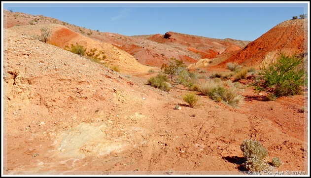
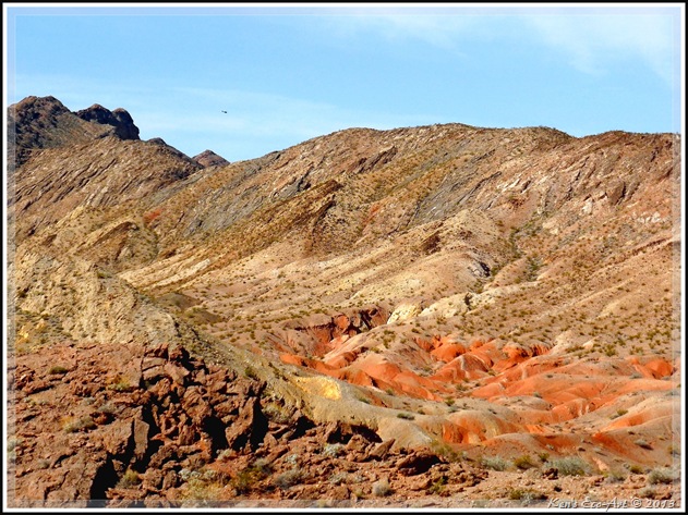
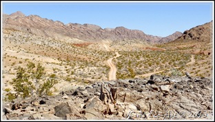
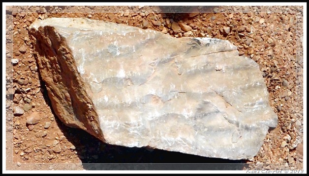
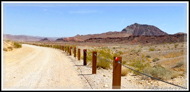
04/24/2013 Trip Notes: As you can see from the map in (Fig. 02) there are three roads that run along the northwest side of Lava Butte; Kodachrome Road to the far west, Rainbow Gardens Road in the middle and Lava Butte Road running along the base of Lava Butte. On today’s visit, Harvey and I entered from Lake Mead Blvd (NV-147) and headed south, driving the full length of Kodachrome Road (approx. 8-miles). The pictures in (Figs. 19 & 20) were taken at a stop about a quarter of a mile in. We got out and hiked to the shaded cliff in the middle of (Fig. 18). The view in (Fig. 20) was taken from the top of this point, looking southwest. About halfway down Kocachrome Road we made another stop to do a little hiking and took the pictures in (Figs. 21 & 22). Climbing to a high point, (Fig. 21) is looking south towards Las Vegas. The view in (Fig. 22) was looking north, back toward the area that we had just covered. Shortly after leaving this spot, I found the rock specimen in (Fig. 23) which appears to be the fossilized edge of a shoreline back when this whole area was covered by water. For the trip back we headed up Rainbow Gardens Road which provided views of Lava Butte to the east (Fig. 24). Having hike part of this road on a previous visit (see below), I didn’t take too many pictures.
 |
| (Fig. 20) |
 |
| (Fig. 21) |
|
 |
| (Fig. 22) |
|
 |
| (Fig. 23) |
|
 |
| (Fig. 24) |
|
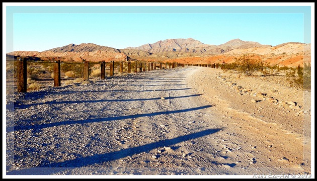
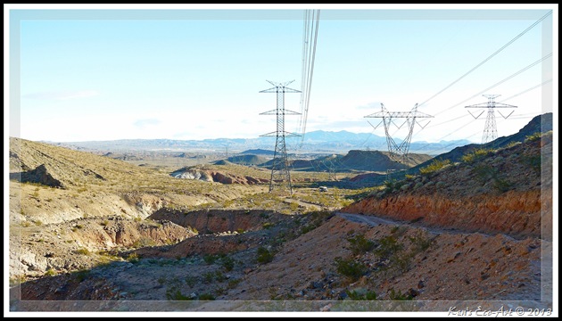
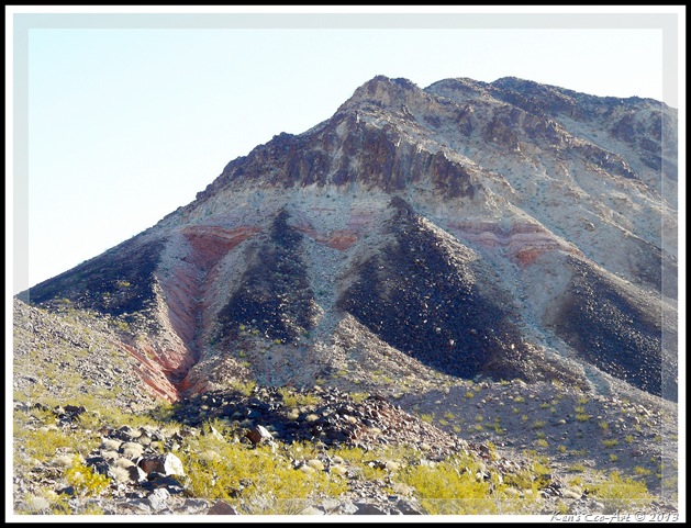
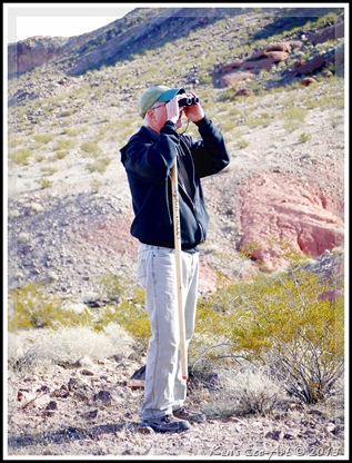
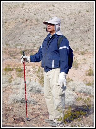
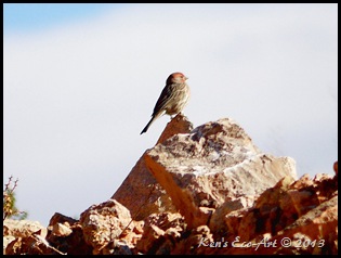
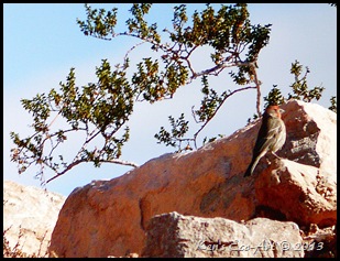
02/02/2012 Trip Notes: Today’s rock hound trip from the Henderson Heritage Park Senior Facility was to Lava Butte and the Rainbow Gardens. Even through the drive in from Lake Mead Blvd (NV-147) was a little rough in spots, we made it to the base of Lava Butte’s northwest face. While the majority of our group hiked the power line rode that ran along the length of the butte and around towards its south face (marked in green on the map), two of our members actually climbed and hiked its entire ridge-line from north to south. Their performance was actually an encouragement for the rest of us to give it a try on our next visit. On our way out from Lava Butte, we took one of roads marked ‘Rainbow Gardens’ (western most green dashed line on the above map), however, it did not lead to the main area that we were looking for. As we ran out of time to explore the other road that led to this area, we were forced to leave it for another trip. The picture below (Fig. 25) was taken at the beginning of the road that winds its way from NV-147 to Lava Butte. A washout in the road caused us to park our van (visible in the center of the picture in (Fig. 26) near the base of the butte’s northern end. We then hiked the power line road up hill for nearly a mile along its west face before it eventually turned and reached the butte’s southern exposure, shown in (Fig. 27). With a view of the Las Vegas valley, I continued on about another three-quarters of a mile before heading back. (Fig. 28) shows Bill, our driver, looking for signs of the last five hikers that had yet to return. On the right in (Fig. 29) is Albert Ramos, another longtime member of our group, taking in some final sights before boarding the van for our return trip. The birds in (Figs. 30 & 31) were captured along the road that we followed around the base of the butte. I believe they are house finches.
|
 |
| (Fig. 25) |
|
 |
| (Fig. 26) |
|
 |
| (Fig. 27) |
|
 |
| (Fig. 28) |
|
 |
| (Fig. 29) |
|
 |
| (Fig. 30) |
|
 |
| (Fig. 31) |
|
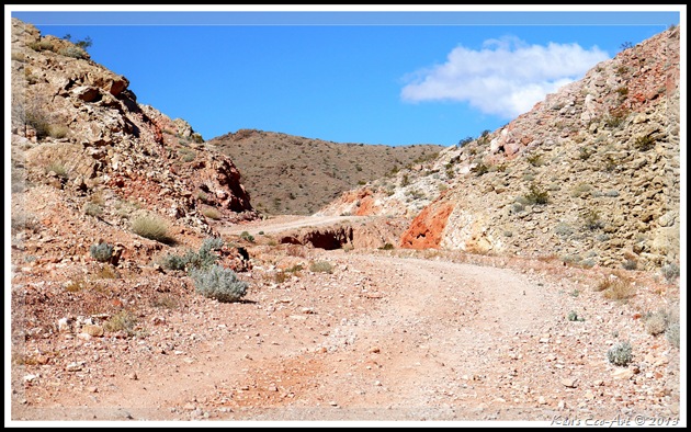
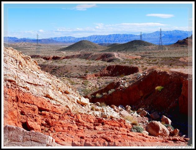
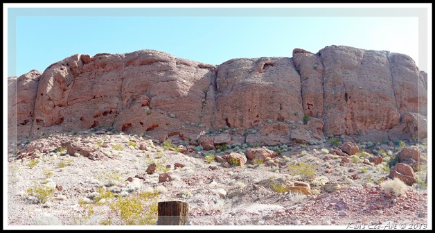
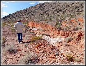
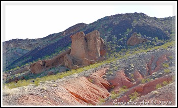
Rainbow Gardens Road: Again, due to a wash out, we had to park our van several miles short of our destination point along this road. The pictures below are some of the views that my hiking partner Blake and I shared while hiking this two mile stretch. The first picture below (Fig. 32) is of a small pass that we hiked thru that led to a wide valley between two long ridges. The next picture (Fig. 33) in this series was taken on our return while standing in the center of the picture below, looking in the opposite direction. If you click this picture to enlarge it, you can see Lake Mead in the upper right-hand corner. The final three pictures (Figs. 34, 35 & 36) were all taken along Rainbow Gardens Road. It is quite easy to see why they call this area Rainbow Gardens.
|
 |
| (Fig. 32) |
|
 |
| (Fig. 33) |
|
 |
| (Fig. 34) |
|
 |
| (Fig. 35) |
|
 |
| (Fig. 36) |
|
Click here to view more pictures from previous visits ....
Lava Butte - Rainbow Gardens


