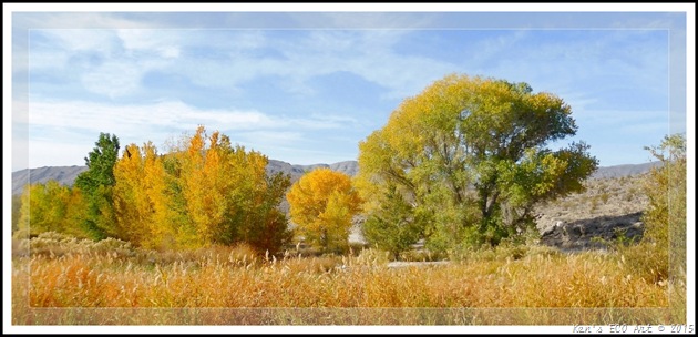
 On 07/10/2015, returning from a daytrip to Pioche, Nevada, I stopped at the Pahranagat National Wildlife Refuge to tour its new visitor center. From the small small two room building that acted as both an office and visitor center on my first visit here in 2012, I was amazed at the size of the new facility and how well done it was. As a result, I updated my previous post on PNWR by adding pictures and making some other cosmetic changes … Pahranagat National Wildlife Refuge. While I was at it, I decided to reorganize and make some improvements to my previous pages on the Black Canyon Petroglyph site that is located within the Pahranagat National Wildlife Refuge … Black Canyon Petroglyphs at PNWR (Summary Page). Even though you may have seen much of this information previously, you might find pleasure in reviewing it again. On 07/10/2015, returning from a daytrip to Pioche, Nevada, I stopped at the Pahranagat National Wildlife Refuge to tour its new visitor center. From the small small two room building that acted as both an office and visitor center on my first visit here in 2012, I was amazed at the size of the new facility and how well done it was. As a result, I updated my previous post on PNWR by adding pictures and making some other cosmetic changes … Pahranagat National Wildlife Refuge. While I was at it, I decided to reorganize and make some improvements to my previous pages on the Black Canyon Petroglyph site that is located within the Pahranagat National Wildlife Refuge … Black Canyon Petroglyphs at PNWR (Summary Page). Even though you may have seen much of this information previously, you might find pleasure in reviewing it again. |
Friday
UPDATED – Pahranagat National Wildlife Refuge & Black Canyon
Sunday
Daytrip - Spring Mountains Visitor Gateway Center
 07/09/2015 - Blake Smith, Bob Croke, Ron Ziance and I decided to drive up to the new Spring Mountains Visitor Gateway Center at Mt. Charleston for a morning hike on the 4.5 mile Escarpment Trail located behind the visitor center. Click here for pictures and a description of our hike of the escarpment trail ... Escarpment Trail at the Spring Mountains Visitor Gateway Center. Because I actually spent a little more time walking around the area taking pictures including some interior shots of the visitor center's gift shop and interpretive display area, I updated my original page on the visitor center. Click here to view this page … Spring Mountains Visitor Gateway Center. One of the most fascinating features inside the visitor center are the etched windows that span the entire length of the building. Created by the local artist, Austine Wood Comarow, these 25 window panels depict pictures and scenes of plants and animals that are indigenous to the Spring Mountains area. When viewed normally, without polarized lenses, they appear as any other normally etched glass. However, when viewed with a polarized lens, they turn into "full-color" scenes. Click the following link to learn more about the artist and her work ... Polarized Light Art by Austine Wood Comarow. 07/09/2015 - Blake Smith, Bob Croke, Ron Ziance and I decided to drive up to the new Spring Mountains Visitor Gateway Center at Mt. Charleston for a morning hike on the 4.5 mile Escarpment Trail located behind the visitor center. Click here for pictures and a description of our hike of the escarpment trail ... Escarpment Trail at the Spring Mountains Visitor Gateway Center. Because I actually spent a little more time walking around the area taking pictures including some interior shots of the visitor center's gift shop and interpretive display area, I updated my original page on the visitor center. Click here to view this page … Spring Mountains Visitor Gateway Center. One of the most fascinating features inside the visitor center are the etched windows that span the entire length of the building. Created by the local artist, Austine Wood Comarow, these 25 window panels depict pictures and scenes of plants and animals that are indigenous to the Spring Mountains area. When viewed normally, without polarized lenses, they appear as any other normally etched glass. However, when viewed with a polarized lens, they turn into "full-color" scenes. Click the following link to learn more about the artist and her work ... Polarized Light Art by Austine Wood Comarow. |
Wednesday
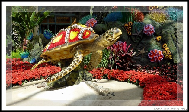
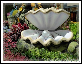
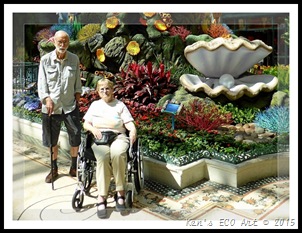
Bellagio’s Conservatory & Botanical Garden – Summer Celebration
{Click on an image to enlarge, then use the back button to return to this page}
Daytrip – Walking Box Ranch
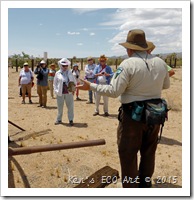 On 06/30/2015 I visited the Walking Box with the rock-hounds from the Henderson Heritage Park Senior Facility. Our rock-hound trip organizer, Linda Groft, set up a tour of the ranch property by the BLM. Click this link for pictures and information regarding today's visit ... Walking Box Ranch Site Tour. For more detailed information on Clara Bow and Rex Bell, and the ranch history, go to my original post on the ranch at … Walking Box Ranch. On 06/30/2015 I visited the Walking Box with the rock-hounds from the Henderson Heritage Park Senior Facility. Our rock-hound trip organizer, Linda Groft, set up a tour of the ranch property by the BLM. Click this link for pictures and information regarding today's visit ... Walking Box Ranch Site Tour. For more detailed information on Clara Bow and Rex Bell, and the ranch history, go to my original post on the ranch at … Walking Box Ranch. |
Pahranagat National Wildlife Refuge - Summary Page
{Click on an image to enlarge, then use the back button to return to this page}
This page last updated on 06/30/2019
| ||||||
| ||||||
| Directions: From Las Vegas, take I-15 north towards Salt Lake City. Travel about 22 miles and turn left onto US-93. Follow US-93 north for about 70 miles. Follow signs to refuge headquarters; the turn will be on your left. | ||||||
| ||||||
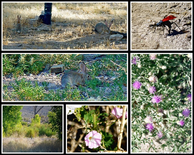
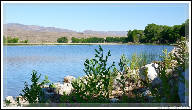
| Area Description: Located at the southern end of the Pahranagat Valley just 90-miles north of Las Vegas, this lush (Fig. 03) 5,300 acre national wildlife refuge stretches about 10 miles in a long narrow strip along the valley floor as it boarders highway US-93 (Fig. 02). It encompasses 2 lakes, a medium sized pond, 2 large marshes, several smaller wetlands and the surrounding desert uplands. Relatively flat, Its elevation ranges from approximately 3,200 feet to 3,378 feet. The name Pahranagat is Paiute and means "a valley of shining waters". This oasis of water and trees in the desert, provides outstanding photographic opportunities not only for wildlife, but desert sunsets, scenic mountains and spring wildflowers. Though visitors are free to roam the area, there isn't much in the way of defined hiking trails. There is the main highway and a few refuge access roads but there aren't any marked and/or maintained hiking trails. It falls within what is known as the Pacific Flyway, making it a high quality wintering and migration habitat for waterfowl and other migratory birds. It often sees peregrine falcons, bald eagles and southwestern willow flycatchers in the air and desert tortoise on the ground (all either threatened or endangered species). More than 230 species of birds have been documented at Pahranagat in the different seasons. As much as bird watching is an obvious activity to enjoy at Pahranagat NWR, fishing is allowed in most areas and hunting (in season) is allowed in some areas, too. What isn't wet is populated with rabbits, squirrels and small rodents. Get up the hill outside the refuge boundaries and you're liable to find mule deer, pronghorn antelope, bobcats, coyotes and mountain lions. | ||||||
| Over the past several years, I have stopped and visited the Pahranagat Valley area no less than ten times in search of various petroglyph sites. Including visits to Black Canyon, this has included no less than five hiking stops at the Pahranagat National Wildlife Refuge. Because these various hikes have resulted in hundreds of pictures, I have created several individual pages to describe them. Three of my visits here were for the specific purpose of taking pictures of the petroglyphs found in Black Canyon on the east side of the refuge opposite the main entrance (Fig. 02). I have placed link that will take you to a summary page containing pictures, descriptions and petroglyph information about the Black Canyon petroglyphs as well as additional links pertaining to my visits to this site. Most of the pictures found on this page are from hiking in and around the refuge headquarters and the upper lake, both located on the west side of the highway. | ||||||
| Black Canyon Petroglyphs: Well-known for its concentration of Pahranagat Representational Style petroglypns, the archaeological significance of Black Canyon was recognized in the 1970's with its listing on the National Register of Historic Places as an archaeological district. In April 2009 the Far Western Anthropological Research Group recorded rock art features at Black Canyon for the purpose of providing data that would serve as the basis for future management, conservation, and interpretation of the district's unique cultural resources. Here is a link to the summary page I created on my three visits to Black Canyon … Black Canyon Petroglyphs (Summary page). | ||||||
| | ||||||
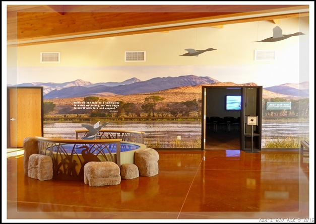
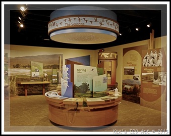
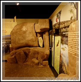
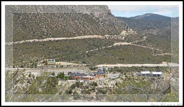
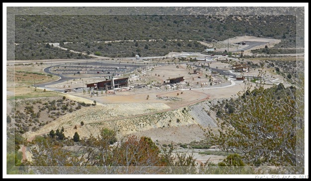
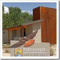
| 06/27/2019 Trip Notes: For this visit, Jim Herring and I visited the Pahranagat National Wildlife Refuge and its Black Canyon Petroglyph Area. In addition, we drove the Old Buckhorne Road, sometimes labeled the Black Canyon Road, to the intersection of Alamo Canyon Road, in search of some petroglyphs. We stopped at the visitor center to gather some info, but it was closed. Click here for pictures and and description of this trip ... Pahranagat National Wildlife Refuge - 06/27/2019 Trip Notes. 07/10/2015 Trip Notes: Returning from a daytrip to Pioche, Nevada, I stopped at the Pahranagat National Wildlife Refuge to tour its new visitor center (Fig. 04). From the small small two room building that acted as both an office and visitor center on my first visit here in 2012, I was amazed at the size of the new facility. Funding for this project came from the Southern Nevada Public Lands Management Act (SNPLMA). Passed in 1998, SNPLMA allows the Bureau of Land Management to sell public land within an urban boundary surrounding Las Vegas, Nevada. Having only been officially open for less than five months, it appeared that they are still working on the outside landscaping, however the interior is fully finished. In the lobby entrance, one wall has a beautiful full-size mural of one of the refuge’s lake areas (Fig. 05). Off the lobby entrance there is also a room where you can watch a movie showcasing the refuge and all its features titled “Pahranagat National Wildlife Refuge”, produced in 2014 by Bristlecone Media. Click here to view … https://vimeo.com/87545027. On the opposite side is a large display area (Figs. 06 & 07) that highlight some of the refuge’s major features. Refuge staff worked closely with Nuwuvi (Southern Paiute) to develop exhibits interpreting the wildlife refuge through multiple perspectives. The building also houses administrative offices for refuge staff. Including the camping area on its Upper Lake (Fig. 02), it is estimated that nearly 35,000 people visit the refuge each year. | ||||||
| ||||||
| ||||||
| ||||||
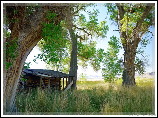
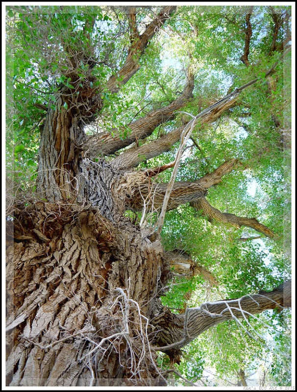
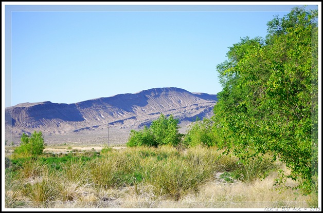
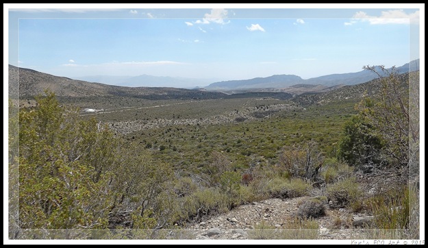
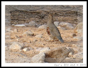
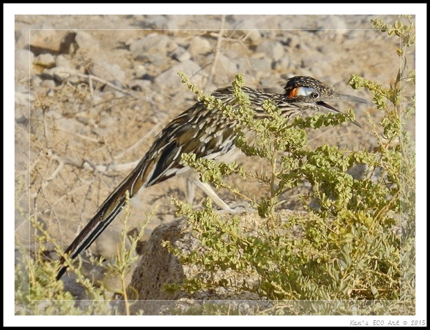
| 06/18/2012 Trip Notes: On the first day of a week-long camping trip with Harvey Smith to Spring Valley State Park, north of Pioche, NV, we made a couple of stops at the Pahranagat National Wildlife Refuge that boarders the western side of US-93. Having driven past the Lower Lake and the meadows surrounding Middle Pond, (refer to (Fig. 02) above) we decided to make a stop at the refuge’s headquarters. We spent nearly an hour walking around this area taking in the scenic views and observing the abundant wildlife. We saw numerous birds, roadrunners, cottontail rabbits, long eared jackrabbits, etc. (Fig. 08). We also toured two old buildings in the process of restoration; one of stone and one a log cabin (Fig. 09) that were surrounded by some of the oldest Cottonwood trees (Figs. 10 & 11) we’ve ever seen. The views in (Figs. 12 & 13) were taken near the rear of the property, looking west towards the surrounding mountain ranges. (scroll down for more) | ||||||
| ||||||
| ||||||
| ||||||
| ||||||
| ||||||
| ||||||
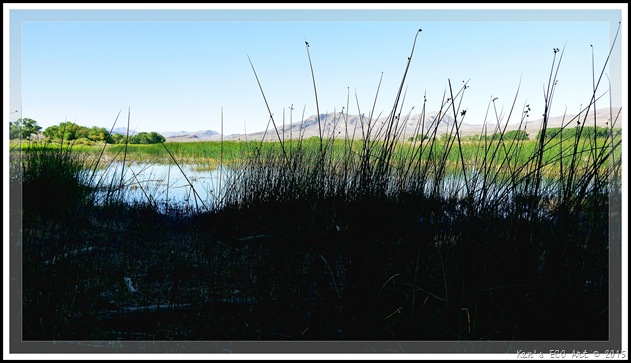
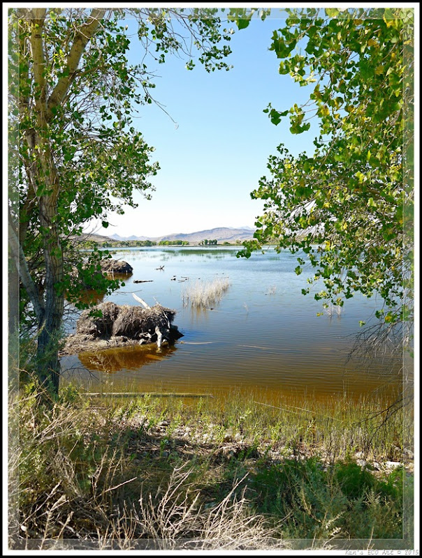
| After hiking around the area surrounding the refuge headquarters, we headed north 0n US-93 and entered the refuge again, driving along the eastern side of the Upper Lake (Fig. 02). The first picture below (Fig. 14) was taken from inside a duck blind located along the lake’s northern shore. As we drove and hiked along the lake’s edge (Figs 15 & 16), taking in the beautiful scenery it provided, we were serenaded by the sounds of birds, ducks and some very deep throated bullfrogs. | ||||||
| ||||||
| ||||||
| ||||||
Escarpment Trail at Spring Mountains Visitor Gateway Center
{Click on an image to enlarge, then use the back button to return to this page}
| |||||||||
| |||||||||
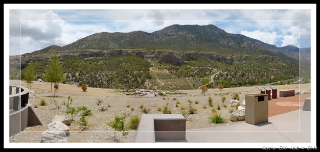
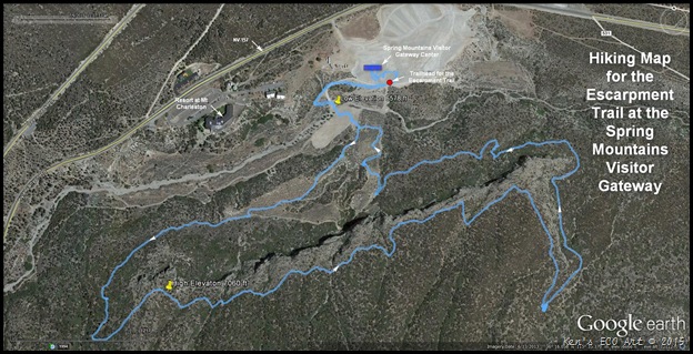
| Trail Description: The picture in (Fig. 01) is a view of the escarpment (the long, precipitous, cliff-like ridge of rock that was formed thousands of years ago as the result of a faulting or fracturing of the earth's crust) that is located behind the Spring Mountains Visitor Gateway center at Mt. Charleston. The length of this loop trail is approximately 4.2 miles in length and runs from a low point of 6,578 feet to a high point of 7,060 feet, giving it a total elevation gain of 482 feet. Refer to the map in (Fig. 02). The lower portions of this trail were once part of a 9-hole golf course, which is the reason some of the trail is “paved”. You can see part of the “paved” section to the right of center in (Fig. 01) as it climbs steeply and heads toward the western edge of the escarpment. | |||||||||
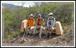
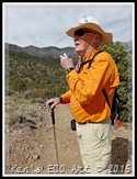
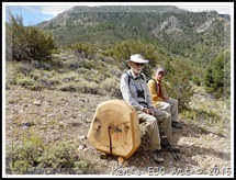
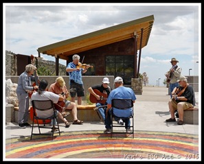
| 07/09/2015 Trip Notes: Blake Smith, Bob Croke, Ron Ziance and I decided to drive up to the new Spring Mountains Visitor Gateway Center at Mt. Charleston for a morning hike on the 4.5 mile Escarpment Trail located behind the visitor center. It was a gorgeous sunny day with the temps 10-15 degrees cooler than the past couple of weeks. As you can see from the picture in (Fig. 01) the top of the escarpment itself runs for more than a mile and a half in length and, with an elevation gain of nearly 500 feet, looks rather intimidating. With all of the elevation gain in the first quarter of the trail, we were all doing a little “huffing and puffing” by the time we reached the high elevation point (Fig. 02). One very nice thing about this trail is that they have spaced about five benches throughout its length to give you a place to rest and take a drink of water. In fact, these unique wooden benches are made from fallen trees and are quite beautiful (Figs. 03, 04, & 05). The good news is that when hiking the trail in this direction, once you reach its high point, the remainder of the hike is downhill. As you near the half-way point of the hike, you are afforded great views of the Resort at Mt. Charleston (Fig. 06) as well as the new visitor center (Fig. 07). As you reach the eastern portion of the escarpment and begin your decent down, there is a nice view looking down Kyle Canyon Road with the Las Vegas Mountain Range in the far distance (Fig. 08). After rounding the eastern most portion of the trail (Fig. 02) you begin hiking along the base of the escarpment as you head back to the starting point (Fig. 09). When we finally reached the visitors center, we were surprised to find a group of bluegrass players that had assembled for an impromptu jam session (Figs. 10 & 11). They were so good that we decided to stick around; grabbed our lunches and sat and listened them for nearly an hour (Fig. 12). | |||||||||
| |||||||||
| |||||||||
| |||||||||
| |||||||||
| |||||||||
| |||||||||
Click here to ...[Return to the Previous Page]
| |||||||||
Sunset Park
{Click on an image to enlarge, then use the back button to return to this page}
This page last updated on 12/27/2017
| ||||||
| ||||||
| ||||||
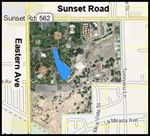
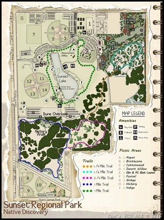
| Park History: Sunset Regional Park is the crown jewel in the County's park system and has served the entire Las Vegas valley since 1967. The land for Sunset Park was acquired in 1967 and contains the last remaining dunes of what once covered most of Paradise Valley. Sunset Park was once home to early ranchers. The Paiute Indian Tribe inhabited the site a thousand years ago and greeted visitors who sought to trade seeds, nuts and turquoise. Water continues to flow under the park and surfaces to provide irrigation to the entire west end of Sunset Park. | ||||||
| ||||||
| ||||||
| ||||||
| ||||||
| ||||||
| ||||||
| ||||||
| ||||||
Subscribe to:
Posts (Atom)

