Showing posts with label Mountain Springs Pass. Show all posts

Sunday

Mountain Springs Saloon (Summary Page)


 {Click on an image to enlarge, then use the back button to return to this page}
This page last updated on 10/13/2017
EFP-P1020429
(Fig. 01)
10/12/2017 Trip Notes: On this date, Harvey Smith, Bob Croke, Jim Herring and I made a quick stop here for some beers after a hike to the Rainbow Spring.

07/28/2013 Trip Notes: The “World Famous” Mountain Springs Saloon (Figs. 01 & 02) is one of only two public buildings in the small community of Mountain Springs located in the pass that crosses over the Spring Mountains. Just 15 minutes west of I-15 and Blue Diamond (Silverton Casino), it is on Highway 160 between Las Vegas and Pahrump. At an elevation of 5,490 feet, the temperature at the bar is nearly 20 degrees cooler than the Vegas. If you’re looking for some mountain views, cooler weather, reasonably priced drinks, live 60’s and 70’s music (weekends), regulation horseshoe pits, good BBQ, and a “biker bar” atmosphere (Fig. 03), this is the place to go. The bands may not be the greatest, nor the food the best, but the relaxed atmosphere is hard to beat. Unfortunately their website is not kept up to date, as we stopped by for an advertised “pig roast” only to be told that it was held the day before. They were however barbequing some brisket (Figs. 05 & 06) off the patio area (Fig. 04) at the rear of the property. Behind the rear patio we were pleasantly surprised to find a beautiful “Water Lilly” pond filled with gold fish (Figs. 07-09). Having been “bikers” in our previous life (176,000 miles on a Goldwing), I enjoyed roaming the parking lot admiring some of the motorcycles (Figs. 10 & 11) in attendance. Even though the weather became cloudy and threatened rain, it still turned out to be a fun afternoon.
                                   
EFP-P1020433
(Fig. 02)
EFP-P1020418
(Fig. 03)
EFP-P1020403
(Fig. 04)
EFP-P1020413
(Fig. 05)
EFP-P1020412
(Fig. 06)
EFP-P1020401
(Fig. 07)
EFP-P1020404
(Fig. 08)
EFP-P1020406
(Fig. 09)
EFP-P1020428
(Fig. 10)
EFP-P1020425
(Fig. 11)


Town of Mountain Springs: Mountain Springs is a small community in Clark County in southern Nevada. It is located in the pass over the Spring Mountains through which Highway 160 connects Las Vegas and Pahrump. Public buildings include a fire house and a saloon. The population is estimated to be near 175. The community was named for the springs that once served as a stop on the Old Spanish Trail. The latitude of Mountain Springs is 36.020N. The longitude is -115.508W. It’s elevation is 5,410 feet.

Click here to [Return to Previous Page]

Friday

Cottonwood Valley Rd - Summary Page

E-P1040698 E-P1040667 E-P1040602-3 E-P1010093 EP-P1040566
{Click on an image to enlarge, then use the back button to return to this page}
This page last updated on 05/28/2020
MAP-T- Cottonwood Valley with Boundaries
(Fig. 01)

Directions Cottonwood Valley Road, a.k.a. Goodsprings Road, is a north-south dirt road that runs between between Highway 160 (the road to Pahrump) and Highway 161 at Goodsprings. As a result it is accessible from either end. For the north end of Cottonwood Valley Road, from Las Vegas drive about 12 miles west on Highway 160 (Pahrump Highway) to the Cottonwood Valley Trailhead on the left, about a mile past the Midnight Trailhead sign. When approaching the south end of Cottonwood Valley Road, from Las Vegas, drive south on Interstate-15 to Jean. At Jean, exit the interstate and turn right onto Highway 161, towards Goodsprings and Sandy Valley. Go about 5,5 miles and turn right onto the Goodsprings Bypass Road. Turn right onto the truck route and follow the pavement around the east side of town. After about 3.2 miles the road forks. Turn right onto the dirt road, which is Cottonwood Valley Road. Continuing on the paved road eventually takes you out to the Rainbow Quarry.

Area Description:
Divided by NV-160 (Fig. 01), Cottonwood Valley is almost ten miles long and nearly a mile wide, with the majority of valley located inside the boundaries of the vast Red Rock National Conservation Area (Fig. 01). This area encompasses a myriad of hiking and biking opportunities. The biking trails here are the best in Los Vegas. There are over 125 miles of interconnecting single-track and an 11 mile NORBA race loop here.  Portions of these trails are thought to have been originally created by the many wild burros in the area. The Wilson Cliff's, located immediately to the west of the trail system, offer amazing views. For a detailed map and more information on the hikes in Cottonwood Valley and along the Wilson Cliffs, go to my reference page Ref - Wilson Cliffs & Cottonwood ValleyIts canyons, most notably being Black Velvet Canyon, provide numerous hiking and rock climbing opportunities. Red Rock Canyon’s Late Night Trailhead offers miles of hiking trails. Located towards the northern end of the valley is the 500-plus acre Spring Mountain Ranch State Park, which also offers more than four miles of hiking trails. On the west side of the southern end of the valley offers various hiking opportunities in the Potosi Mountain range including hikes to the Carol Lumbard Crash site and several old abandoned mines. On the east side there are trails to Bird Spring Peak offering outstanding views of the entire Las Vegas valley. Depending upon where you hike in this valley, you may be retracing the steps of traders and mule train drivers who traveled this area as part of the Old Spanish Trail as far back as the 1830s.
Paragraph divider

Cottonwood Valley Road - 10/29/2016 Trip Notes:  Jim Herring and I rented a jeep and explored the area of the Rainbow Quarries behind Goodsprings and then traveled the length of the Cottonwood Valley Road north to highway 160. Click this link to view pictures and read about this journey.

EFP-P1040497Cottonwood Valley Road & Mines - 02/13/2013 Trip Notes: Harvey Smith and I explored the southern end of Cottonwood Valley Road in search of the Dawn and Ninetynine mines. About 4.7 miles out on the right you will come to the Ninetynine Mine Road (FR-800B). This road starts out heading southwest before turning right and heading northwest towards the base of the tree lined ridges of Mt. Potosi. About a mile and a half up this road it splits. If you head left at the split, the road runs out to the Dawn Mine site; bearing right takes you to Ninetynine Mine site and to the trailhead for the 1930 Carol Lumbard crash site. Exploring the more than half dozen mine shafts of the two mines, the Dawn Mines and the Ninetynine Mine and the surrounding areas including the Ninetynine Cabin at the end of the Ninetynine Mine Road provided us with more than 5 hours of hiking and picture taking. Click this link to view pictures and read about our hike to these two mines.

EFP-P1040635Cottonwood Road - 05/25/2020 & 02/13/2013 Trip Notes - Bird Spring Peak: Birdspring peak is located in a mountain range that runs north-south along the eastern flank of Cottonwood Valley that forms the southwestern margin of the Las Vegas Valley. At an elevation of 5,298 feet, this mountain is little more than a hill compared to some of the nearby Spring Mountains. Driving to the trailhead for this hike leaves a hike of less than a mile with only a 250-300 foot elevation gain. The peak provides some outstanding views of Cottonwood Valley and the Las Vegas Valley.


04/21/2011 Trip Notes:  Again I visited this location with the rock hounds from the Heritage Park Senior Facility. Because we usually make several stops along NV-160, it is always difficult coming up with a single descriptive title for the day’s hikes. We usually stop at a couple of well known areas, each unique in its own way. First, we stopped at the trailhead for the Old Spanish Trail. Next we drove up the road to the Boy Scout Camp road which leads up a valley on the western side of Potosi Mountain. Finally on the way back we stopped at the Late Night Trailhead, part of the Red Rock Canyon National Park area. The pass itself is at the summit of a ridge of the Spring Mountains between the Mount Charleston area and the rest of the Mojave Desert and is located near the border of the Humboldt-Toiyabe National Forest and Red Rock Canyon National Conservation Area. The pass connects the Pahrump Valley with the Las Vegas Valley, and it is traversed by SR-160. Click each of the links below to view pictures and learn more about each of these areas.
   
E-P1040656Mount Potosi: At an altitude of more than 7,500 feet, this area provide some very nice mountain areas that were covered in a variety of juniper trees and mountain scrub. There were great views of the western facing cliffs of the Potosi Mountains and well as views down towards the Pahrump valley. Unfortunately, this was only one of three planned stops for the day, we really didn’t have enough time to do any real hiking. Click the link above to view pictures and read more about our stop here.


E-P1040698Late Night Trailhead at Red Rock Canyon: With easy access from Highway 160, aka Blue Diamond Road, this stop provides accessibility to a large network of trails throughout Cottonwoood Valley and the surrounding hills and mountains. The trails have been there for years but just recently a paved parking area, restrooms, and stone welcome sign have been installed at the Late Night Trailhead, which is located on the north side of SR-160, five miles west of the intersection with SR-159.


E-P1040602-3Re: Old Spanish Trail: The Old Spanish Trail was designated by Congress as a National Historic Trail in December 2002. The trail is jointly administered by the BLM and the National Park Service, working in partnership with other federal, state, and local government agencies, as well as private landowners. Explored, in part, by Spanish explorers as early as the late 1500s, this historical trade route has often been called the most arduous pack mule caravan route in the history of America. The trail saw extensive use by pack trains from about 1830 until the mid-1850s. For more info and pictures, click the link above.

Thursday

Mount Potosi Canyon Road at Mountain Springs Pass - Summary Page

{Click on any image to view full size, then use the back button on your browser to return to this page}
This page last updated on 02/10/2019
E-P1040645

Destination: Mount Potosi at Mountain Springs Pass
Distance from Point of Origin: 36 miles.
Estimated (One Way) Travel Time: 55 minutes.
Directions: From the Stratosphere Casino, head southwest on South Las Vegas Blvd go 1.7 miles and turn right onto Spring Mountain Rd. Go .7 miles and turn left to merge onto I-15 South. Travel 5.5 miles and take exit 33 to merge onto NV-160 W/Blue Diamond Rd/SR-160 (aka Pahrump Highway) west toward Pahrump. Heading west on NV-160 go past SR-159 (West Charleston Blvd)  the turn to Red Rock Canyon. Continue following highway 160 toward the mountains and Mountain Pass for abut 10 miles. As the road starts to ascend toward the Pass on the northern flanks of Potosi Mountain, look for a dirt road on the left (south) side of NV-160 that is signed for the Boy Scout camp located within. Follow the graded dirt road south for a couple of miles, past the Boy Scout camp and a few houses here and there, ignoring the smaller dirt roads branching off. This two mile stretch of property is owned by the Boy Scout Camp and there are no trespassing signs on every other tree on both sides of the road as well as two large signs at their property lines. It has been reported that there is a very good chance that you could be or will be chased away. Stay on the main dirt road until you see a small parking area (maybe 2 cars) on the right.

General Description: With an elevation of around 8,500 feet above sea level, Potosi Mountain, or Mount Potosi as it's generally referred to, is the last large mountain stemming from the southern end of Nevada’s Spring Mountain range. When viewed from Las Vegas, its presence to the southwest is striking. Its northeast face is a maze of complex ridges and rugged cliffs. Once one reaches the parking area, the rugged west-side cliffs of Potosi Mountain are to the east. There is another impressive unnamed peak is to the west. Climbing up to the west in this area you are presented with a variety of views in every direction.
Special Attraction or Points of Interest: Near the top of Potosi Mountain (on the eastern ridge) you will find what’s left of the remains of the TWA plane that crashed on January 16th, 1942, that killed 22 people including Carole Lombard. At the very top are a series of broadcast transmitters. Today the mountain is a major FM broadcast transmitter site for Las Vegas. It is home to 7 full power FM stations, along with 1 FM Translator. The stations are KNPR 88.9, KCNV 89.7, KOMP 92.3, KPLV 93.1, and KXPT 97.1 all licensed to Las Vegas, KFRH 104.3 licensed to North Las Vegas, and KXTE 107.5, licensed to Pahrump, Nevada. A translator, K276BL, also operates from up here on 103.1, simulcasting KSOS 90.5 from Las Vegas. KXTE was the first tenant to broadcast from the top of the mountain and the first station in the United States to transmit in HD Digital.
Primary Activity: Hiking.
Secondary Activities: Rock-hounding, Photographing and Birding.

Elevation: 8,500 feet at the top of the mountain.
Best Time To Visit: Available for hiking year round, the best time to make this hike would be in the cooler months of the Fall, Winter and Spring. Though there is some snow in the winter months, it is usually not very deep.
Difficulty: Moderate to difficult. Hiking to the top of Potosi Mountain can be quite grueling.
Facilities: None.
Estimated Round-trip Time: 3-4 hours for just walking around and taking pictures. To actually im the mountain would be and all day affair.

01/08/2014 Trip Notes: I visited this area again with two of my hiking friends, Harvey Smith and Robert Croke, in search of the Potosi Mine site. Click here to view pictures and read information about this hike ... Potosi Mine - Mt. Potosi Canyon Road.

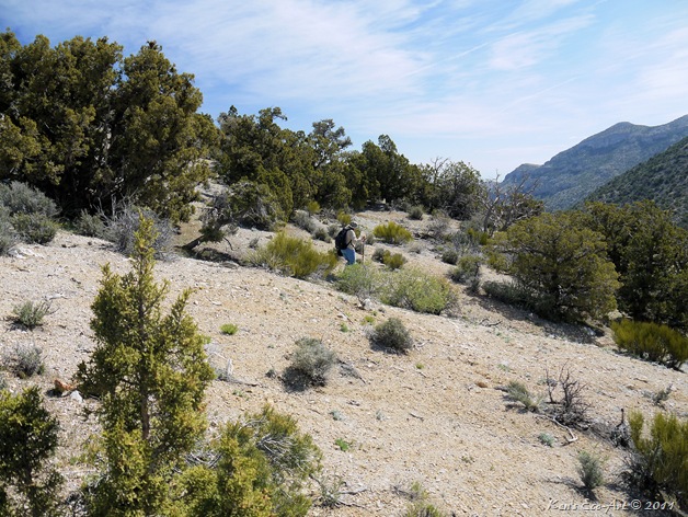
04/21/2011 Trip Notes: I first visited the Spring Mountain Pass and the west side of Potosi Mountain on  with the rock hounds from the Heritage Park Senior Facility. We did not attempt to climb the mountain on our visit, but rather just hiked the general area looking for rocks and taking scenic pictures. I'm not really sure if there are any 'trails' up the mountain from this side. When attempting to climb the mountain, most people climb it from trails on its eastern ridges. We were afforded some beautiful scenic views though.

E-P1040643 Stitch
E-P1040683 E-P1040686

Heading west and upward from the parking area, you are presented with a relatively easy climb up some wash-like, rocky terrain similar to that above.  However, reaching the top provides you with the some lovely southerly views like the ones above and below.


E-P1040656
E-P1040684

The shot above is the view looking toward of the northwest side of the Mt. Potosi range. Below are some more pictures of members of our group. The reflection in the middle is a self portrait of myself taken in one of the windows of our van.

E-P1040694 E-P1040696-2  E-P1040687