Showing posts with label Laughlin. Show all posts

Tuesday

Labyrinths in Laughlin NV


(Fig.01)

What is a Labyrinth?
 
A labyrinth is a meandering path, often unicursal, with a singular path leading to a center. You begin a labyrinth walk at the entrance and proceed along the path. Lines define the path and often maintain a consistent width, even around the turns. A left- or right-handed labyrinth is determined by the direction of the first turn after entering the labyrinth. Neither is better than the other—it is totally up to personal preference of the builder. Figure 2 shows Jim at the center after walking one of the labyrinths.

(Fig. 02)

Laughlin's Labyrinths Description
:
Just outside the town of Laughlin, tucked away in the desert are a series of labyrinths meant to inspire serenity. Created by Wes Dufek, the Laughlin Labyrinths were designed to help lost souls find their peaceful center. There are nine labyrinths, each within a quarter mile radius of each other and ranging from 25 to 55 feet. Recently, a 36-foot and 7-circuit square labyrinth has been added to the site. The Laughlin Labyrinths and surrounding desert scenery create a calming experience for those who take the time to walk the mazes. Labyrinths appear in many cultures around the world, with documented benefits connected to reduced blood pressure, chronic pain alleviation, and insomnia relief.

Dufek built these labyrinths painstakingly, rock by rock. “For the very first one, I took a milk crate, filled it with rock, carried it to the site, and dumped it,” he recalls. “And that is literally how I built the first one. Just buckets of rock, and then when we had all the rock, we started arranging them.” It took Dufek three and a half months to construct the first labyrinth. Each of the labyrinths at Laughlin are different shapes (Fig. 03) and patterns, inspired by separate concepts. All of the labyrinths are meant to encourage tranquility and inner dialogue. In their twists and turns, they encourage visitors to accept the unpredictability of daily life with ease. They are free to visit and open at all times.

(Fig. 03)
09/12/2019 Visit Notes: Here is a short PBS Video of the Laughlin's Labyrinths, Click here to check it out ... Video of the Laughlin Labyrinths. The segment starts at 2.23 minutes into the video. Though they are interesting, overall neither of us were impressed with the area. In the main area there are five labyrinths of varying size and shape. If you walk to the top of the ridge to the right, you can get to view all of them (Fig. 04). In the distance you can see another ridge several hundred yards away with three more. We were not excited enough to hike to there. Picture (Fig. 05) is of a square one. Jim was not feeling any more "peaceful" of changed after walking one. We can no say, been there and done that.

(Fig. 04)
(Fig. 05)

Wednesday

Hiko Spring Hike - Trip Notes for 01/31/2017


 {Click on an image to enlarge, then use the back button to return to this page}
This page last updated on 02/09/2017


(Fig. 01)
01/31/2017 Trip Notes: On January 31st Jim Herring, Ron Ziance, Bob Croke and myself drove to visit Hiko Spring and Grapevine Canyon, located just north of Laughlin NV. For the first time in months, it was a beautiful sunny day near 70 with almost no wind. Though Jim had never been to this site before, Bob, Ron and I visited it a year ago. Besides giving Jim the opportunity to view the great petroglyphs found at this site, we were curious to compare what we found on our visit of a year ago (Fig. 01). As we hiked the wash, it was obvious that there was nowhere the number of spots of surface water that we encountered a year ago, as evidenced by the picture in (Fig. 02). Bob did a great job of making the comparison picture in Figure 02.

Once we reached the site, we spent considerable time scouring the area and the cliff sides looking for "not-so-obvious" petroglyphs. In addition to the obvious on the lower level, you can see from the blue arrows in (Figs. 04 & 04), the petroglyphs go right up the cliff to the top edges. Although almost all of the glyph symbols found at the site are very abstract in nature, there are a couple of examples of zoomorphs such as the sheep in (Fig. 05). As we continued hiking down the wash, Jim spotted what looked like a pictograph on the side of a cliff (center of Fig. 06)). The picture in (Fig. 07) is a close up of the image. It appears to be two warriors facing each other. The one on the left appears to have a waist band and a loin cloth. To me these images certainly don't look old. They are in too good of shape to be as old as the surrounding petroglyphs. I have no real explanation. For more pictures of rock art found on this site, click on the following link ... Trip Notes for 02/02/2016 - Hiko Spring. By the time we got back to the car we had hiked nearly 3.25 miles. We found a shady spot to have a picnic lunch and then drove to view the pictographs at Grapevine Canyon, a site that neither Jim nor Ron had ever been to. Click here for information and pictograph pictures of my previous visits to Grapevine Canyon ... Grapevine Canyon Hikes - Inside The Bridge Canyon Wilderness Area. We then followed the eleven mile dirt Christmas Pass Road back to US-95. Offering some stunning desert mountain views, this rough dirt road runs through both the Bridge Canyon Wilderness Area and the Spirit Mountain Wilderness Area, home to Spirit Mountain (elevation 5,639 feet). This area its surrounding canyons are considered sacred grounds for the Yuman speaking tribes of the lower Colorado River. Click here for some pictures of Christmas Pass Road ... Christmas Tree Pass. All-in-all, it was just another great day of hiking and fellowship in the Nevada desert. We thank Jim for being the driver for today's trip.
                         
(Fig. 02)
(Fig. 03)
(Fig. 04)
(Fig. 05)
(Fig. 06)
(Fig. 07)

Monday

Hiko (Lower) Spring Site (Summary Page)

             
 {Click on an image to enlarge, then use the back button to return to this page}
This page last updated on 10/11/2017
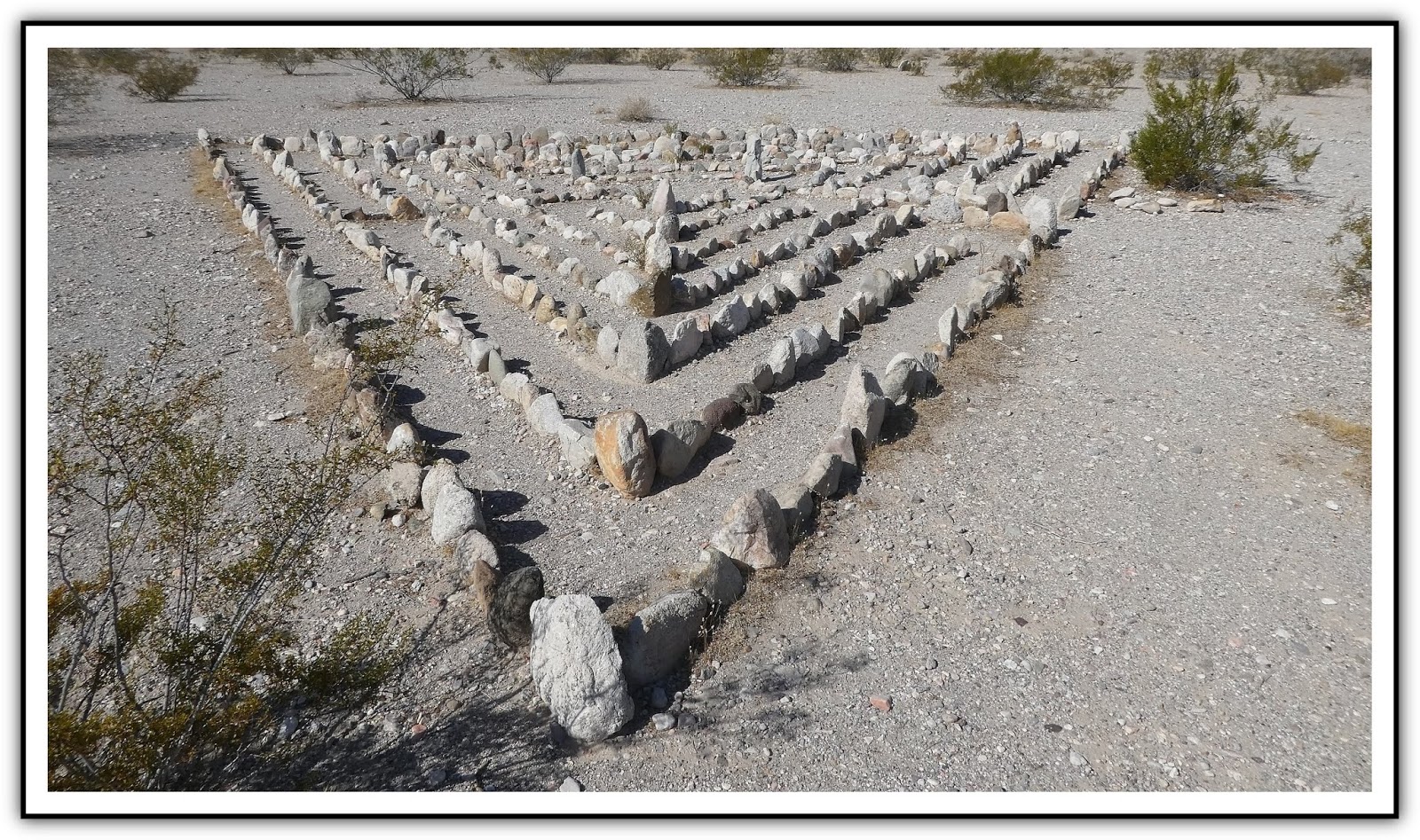
(Fig. 01)


Here are a few simple guidelines you can follow that will help to preserve these unique and fragile cultural resources that are part of our heritage. Guidelines for Preserving Rock Art. If you would like to learn more about the Nevada Site Stewardship Program, go to my page ... Nevada Site Stewardship Program (NSSP).


Directions: From the Stratosphere Casino head northeast on Las Vegas Blvd about 3 miles and turn right onto I-515/US-93/US-95 south towards Boulder City. Follow US-93/95 for 17 miles and then merge right onto US-95 South (Veterans Memorial Hwy) toward Searchlight/ Laughlin/Needles and travel for 55.5 miles. Turn left onto NV-163 (Laughlin Hwy) east. Drive.About 8 miles from the US-95 turnoff you will see a Laughlin sign in the desert off to your right. Just beyond this there is a fairly open area where a lot of people go four wheeling. Traveling about two miles beyond this area the road runs straight downhill. At the bottom of this stretch, SLOW DOWN. Just before the guard rails where the road makes a sharp left turn, there is an unmarked exit to the right that turns into a dirt 4WD road. There is also a white cross just in front of the guard rail.

Hike Description: Hiking from where we parked the car, you come to a concrete foundation slab on the north side of the wash. Just a few hundred feet beyond the slab you come to the 'upper' spring petroglyphs. This first group consists of several boulders on the side of a small hill just east of the concrete foundation slab. (refer to the pictures on the previous page). The elevation here is about 1,933 feet.

01/31/2017 Trip Notes: On January 31st Jim Herring, Ron Ziance, Bob Croke and myself made yet another trip to Hiko Spring. For the first time in months, it was a beautiful sunny day near 70 with almost no wind. Though Jim had never been to this site before, Bob, Ron and I visited it a year ago. Besides giving Jim the opportunity to view the great petroglyphs found at this site, we were curious to compare what we found on our visit of a year ago. Click here for pictures and description of this hike ... Hiko Spring Hike - Trip Notes for 01/31/2017.

02/02/2016 Trip Notes: Even though I had heard that a heavy rain had cleared much the dense growth, reeds and bushes that had been clogging the Hiko wash, I was amazed at how much the topography this area had been changed since my last visit. The pictures found in the collage (Fig. 02), show the difference between today (the top two pics) and my visit in 2013 (bottom three pics). The area where we entered the wash on today's visit wasn't even possible back in 2013. Walking down the middle of the wash, there were many large clumps of reeds that had been uprooted and jammed against the sides of the washes' rocks and canyon walls (Fig. 01). As we hiked down the wash, we came upon nearly a half dozen areas (Fig. 03) where flowing water percolated up through the sand, only to disappear back beneath the surface, usually less than a hundred feet later. We can only assume that the water originates from the spring near the beginning of the hike. In addition to the green slime around these water areas, there were several green grassy areas located nearby (Fig. 04). (con't below)

(Fig. 02)
(Fig. 03)
(Fig. 04)
Notes Continued:   In the lower end of the wash a grouping of boulders contain dozens of individual petroglyph elements (Fig. 05). Of the more than 40-50 individual elements, most of these elements were of a very abstract design (Figs. 06 & 07).  I was only able to discern three zoomorphs (possibly bighorn sheep) and maybe two anthroporphs (human-like figures) (Fig. 08). After examining this area we continued to walk down the wash. A few hundred yards further down we encountered another small grouping on the side of a hillside (Figs. 09 & 10). From here we continued to hike some more in the hopes of maybe coming to the end of the wash. Unfortunately, as the wash started to fill with more and more big boulders (Fig. 11), it also started to head downhill much steeper than previously (Fig. 12), and still be getting nowhere near the end. As we later determined we would still have had to continue more than a mile of tough hiking in order to reach the end of the canyon/wash.  

(Fig. 05)
(Fig. 06)
(Fig. 07)
(Fig. 08)
(Fig. 09)
(Fig. 10)
(Fig. 11)
(Fig. 12)

Return to previous Hiko Spring (Upper) Hike

Friday

Hiko Spring (Upper) Hike

 {Click on an image to enlarge, then use the back button to return to this page}
EFP-P1040599
(Fig. 01)
image
(Fig. 02)
Directions: From the Stratosphere Casino head northeast on Las Vegas Blvd about 3 miles and turn right onto I-515/US-93/US-95 south towards Boulder City. Follow US-93/95 for 17 miles and then merge right onto US-95 South (Veterans Memorial Hwy) toward Searchlight/ Laughlin/Needles and travel for 55.5 miles. Turn left onto NV-163 (Laughlin Hwy) east. Drive.About 8 miles from the US-95 turnoff you will see a Laughlin sign in the desert off to your right. Just beyond this there is a fairly open area where a lot of people go four wheeling. Traveling about two miles beyond this area the road runs straight downhill. At the bottom of this stretch, SLOW DOWN (Fig. 02). Just before the guard rails where the road makes a sharp left turn, there is an unmarked exit to the right that turns into a dirt 4WD road (Fig. 01). There is also a white cross just in front of the guard rail.
                                       
Description: Hiko Springs is located a short distance off of Hwy 163 (Fig. 02) not far from the Grapevine Canyon site and the city of Laughlin, Nevada. The amazing thing is that there is very little information to be found about this site on the Internet; especially considering the number of Petroglyphs that can be found here. Unless you have a 4WD vehicle, I would advise parking just off the highway (Fig. 01) and walking the .8 of a mile to the site. The Hiko Springs site here (not to be confused with the Hiko Springs in Lincoln County) seems to have essentially, many of the same rock art designs as the site found in Grapevine Canyon, located only 4 miles to the north. The petroglyphs here are also pecked into vertical cliff of granitic rock covered with a dark patina called desert varnish. Because the formation of desert varnish is a very slow process, it suggests that these etchings are quite old.

02/02/2016 Trip Notes:  On January 24th I received an email from Kenneth Todd, a resident of Golden Valley Arizona, that hiked Hiko Spring  after finding this page on the Internet. He noted that a severe flow of water from a big storm, subsequent to my 2013 visit here, had washed away much of the heavy growth of the invasive shrubs and vegetation that had previously clogged the wash, making hiking down the wash much easier. He then indicated that by hiking about 1.2 miles past the cement foundation, he discovered a series of petroglyph panels on the wall above a flat rock on the right side of the wash. I decided to try it out for myself. Click here for petroglyph pictures and a description of this hike ... Hiko Spring (Lower) Hike.
                     
10/31/2013 Trip Notes: For today’s visit, I met up with the Rock-hounds from Henderson’s Senior Facility, who made a stop here before continuing on to Grapevine Canyon. Even though it was cool, it was sunny without the clouds and winds I had experience earlier in the week. The majority of the petroglyphs here are on the cliffs (Figs. 03-09) east of the foundations and along the saddle you have to scramble over to get to the other side of the spring. By no means do they end here. You can spot several more (Fig. 10) after climbing over the saddle past the spring. Though nowhere as prolific as those down the road at Grapevine Canyon, there are enough here to peak the interest of the average desert explorer. From something I found on the Internet, I’m inclined to believe that you can find even more by hiking another half mile further into the canyon (Fig. 11). Unfortunately, Blake and I hiked down the wash too far to the left and got buried up to our shoulders in some very high reeds (Figs. 12 & 13). Though we were unable to find any visible signs of water, the amount of vegetation here suggests that it must not be too far under ground. I hope to hike further down this canyon wash on our next visit.
                     
EFP-P1040580
(Fig. 03)
EFP-P1040581-2
(Fig. 04)
EFP-P1040578
(Fig. 05)
EP-P1040593
(Fig. 06)
EP-P1040579
(Fig. 07)
EP-P1040583
(Fig. 08)
EP-P1040585
(Fig. 09)
EFP-P1040587
(Fig. 10)
EFP-P1040649
(Fig. 11)
EP-P1040645
(Fig. 12)
EP-P1040643
(Fig. 13)
10/27/2013 Trip Notes: Because I knew I would be hiking here in a few more days with the rock-hounds from the Henderson Senior Facility, I decided to try and locate this site and perform some basic exploration of the area. Because the weather on today’s visit was very cold, overcast and windy I did not stay long. After a couple of passes, I was finally able to find the unmarked turn-off (Fig. 01). From the road, there are two or three 4WD roads (Fig. 14) that run parallel with the wash that runs down to the area of the spring at the opening of the canyon. About halfway to the canyon opening I found the remnants of a fence, as seen in the triptych in (Fig. 15), that appeared to have spanned the entire width of the wash as one time. I have no idea as to why this was placed here, except for the purpose to denote a property line or claim, which may have been connected to the pipes and foundations (Figs. 16 & 17) that I discovered at the bottom of a cliff, left (north) of the spring and canyon entrance. The smaller foundation (Fig. 17) looked as though it may have surrounded a shallow well of some type. Because the area surrounding the spring where the wash goes through the canyon opening was so overgrown with trees, weeds and bushes, mostly Bearclaw (Fig. 18), you have to scramble over the small saddle to the left in order to access the remainder of the use trail that continues to run down through the canyon.
                             
EFP-P1040574
(Fig. 14)
Fence
(Fig. 15)
EFP-P1040577
(Fig. 16)
EFP-P1040592
(Fig. 17)
EFP-P1040594
(Fig. 18)

Davis Dam - Laughlin, NV

{Click on an image to enlarge, then use the back button to return to this page}
This page last updated on 11/21/2017
EFP-P1040620
(Fig. 01)
Directions - Davis Dam
                           
Description: Davis Dam is situated in Pyramid Canyon (Fig. 01), 67 miles downstream from Hoover Dam, about 10 miles north of where the Arizona, California and Nevada boarders meet and approximately 2 miles upstream from Laughlin, Nevada and Bullhead City, Arizona. The dam itself was named after Arthur Powell Davis, a once Director of Reclamation and nephew of John Wesley Powell who explored the region in the late 1800s.
                    
The Davis Dam Project was authorized April 26, 1941, and a contract for the construction of the dam and its associated structures was awarded in June 1942. However, work was halted after the War Production Board revoked priority ratings needed to obtain the necessary materials for construction. Work resumed in 1946, and the dam and power plant (Fig. 06) were completed in 1953 at a total cost of approximately $67 million dollars. It is a rock-fill embankment with a concrete spillway, gravity structure, intake structure and power plant.. Once completed, the body of water running through Black Canyon behind the dam was named Lake Mohave. Lake Mohave, has a total storage capacity of 1,818,300 acre-feet,

With a structural height of 200 feet and a base width of 1,400 feet, the earth filled dam itself contains 3,642,000 cubic yards of rock and earth. About 600,000 cubic yards of concrete and 23 million pounds of reinforcing steel were placed in the spillway, power plant, and other structures. The crest (top) of the dam had a width of 50 feet and a length of 1,600 feet. The spillway structure, seen on the right of the picture in (Fig. 06) has a crest elevation of 597 feet. Its three fixed-wheel regulating gates, each 50x50 feet, can handle 214,000 cubic feet of water per second. The tops of the five Francis turbines, as seen from the crest of the dam in (Fig. 07), each have a heated capacity of 48,000 kilowatts. Each turbine produces 62,200 horsepower and can discharge 6,200 cubic feet of water per second.

The Davis Dam Power Plant is located on the Arizona side of the dam. The hydroelectric plant generates between 1 and 2 terawatt-hours of electricity annually. This energy is used in the Southwest to turn the wheels of industry and pump water from wells to irrigate farmlands and water livestock. The primary purpose of Davis Dam is to re-regulate Hoover Dam releases to meet downstream needs, including the annual delivery of 1.5 million acre-feet of water to Mexico. This is in accordance with the 1944 water treaty with Mexico. Lake Mohave also provides recreation and habitat for fish and wildlife. Additionally the lake captures and delays the discharge of flash floods from side washes below Hoover Dam.
Paragraph divider
                    
11/15/2017 Trip Notes:  Today I accompanied Jim Herrington on a trip to Laughlin and the Davis Dam. As this was his first visit to the area, before heading into Laughlin, we hiked around the dam to gather a few pictures. From the Heritage Greenway Park (Fig. 10 below) we hiked up the road that runs along the left side of the dam. From the park this walk climbs nearly 200 feet to the top of the dam. Looking south from the top of the dam, you get a good view of the river as it runs down to the town of Laughlin (Fig. 1A). Looking north, you get to look up the Mojave Lake (Fig. 1B). As you walk more than a thousand feet across the top of the dam you come to a bridge (Fig. 1C) that crosses over the channel that funnels the lake into the backside of the dam (Fig. 1D). The dam has a regular hourly schedule for releasing water downstream. Notice the water being released in picture (Fig. 1A0. Releases average about 7,000 cubic feet per second (cfs) each day, but the current release pattern will change this coming December. Presently, releases from Davis Dam average about 9,200 cfs (2 generating units) between 10:00 a.m. and 10:00 p.m. Mountain Standard Time, and 4,600 cfs (1 unit) in the evening and early morning hours.


(Fig. 1A)
(Fig. 1B)
(Fig. 1C)
(Fig. 1D)

12/19/2013 Trip Notes: Today’s visit to the Davis Dam and the Colorado River Heritage Greenway Park and Trails was with the rock-hounds from the Henderson Heritage Park’s Senior Facility. Information and pictures from this trip are divided between this page and my post for the Colorado River Heritage Park & Trails. The sunrise in (Fig. 02) was taken in the parking lot of the Heritage Park’s Senior Facility as we were boarding the van for our early morning ride to Laughlin and the Davis Dam. After taking the road leading down to the dam, we reached the picnic area referred to as the “North Reach” of the Greenway Park & Trails system. The majority of the group decided to hike to the top of the dam and across to the Arizona side of Lake Mojave. Some hiked the trail that led south along the river; and some of us hiked the trails that led up to the mountain ridge overlooking the dam, as seen behind the park's picnic area in (Fig. 10 - bottom). (Fig. 03) is a view from the Overlook Trail looking east towards the Arizona side of the river. (Fig. 04) is a view looking west towards the Spirit Mountain Range. Once we reached the top of this trail, we were afforded great views (Fig. 05) overlooking the dam and Lake Mojave.
                  
EFP-P1050577
(Fig. 02)
EFP-P1050582
(Fig. 03)
EFP-P1050587-P1050588
(Fig. 04)
EFP-P1050591-P1050593
(Fig. 05)
Paragraph divider

10/31/2013 Trip Notes: I stopped here today to capture some pictures after a morning of hiking just up the road to Hiko Spring and Grapevine Canyon. Though I have been here before, the weather on previous visits did not provide very good picture taking opportunities. As the road that crosses the top of the dam is closed to all vehicular traffic, I spent some time hiking to the crest of the dam. Standing near the middle of the dam, the view in (Fig. 08) is looking north toward Lake Mojave. The picture in (Fig. 09) is looking east along the 1,600 foot length of the dam’s crest towards the Arizona shoreline. (Fig. 07) is a view from the top of the dam looking southeast towards Bullhead City. The final picture (Fig. 10) shows “North Reach”, the northern portion of the Colorado River Heritage Greenway Park and Trails. (Be sure to click to enlarge so you can read the inserted text notes) 
                        
EFP-P1040626
(Fig. 06)
EFP-P1040696-P1040698
(Fig. 07)
EFP-P1040689-P1040692
(Fig. 08)
EFP-P1040686-P1040688
(Fig. 09)
EFP-P1040699-P1040703-2
(Fig. 10)